Parking Muritzen - Schmalzscharte (Muritzen - Mur source - Schmalzscharte)
Starting point: Parking Muritzen (1542 m)
| Lat/Lon: | 47,13324°N 13,40293°E |
| |
Name of path: Muritzen - Mur source - Schmalzscharte
Time of walking: 3 h 45 min
Difficulty: easy marked way
Altitude difference: 902 m
Altitude difference po putu: 902 m
Map:
Recommended equipment (summer):
Recommended equipment (winter): ice axe, crampons
Views: 400
 | 1 person likes this post |
Access to the starting point:
a) Drive through the Karavanke Tunnel into Austria, then continue along the Thuringian Highway to Salzburg. After leaving the Katschbergtunnel, you will enter the Austrian state of Salzburg. At the first exit from the St. Michael im Lungau tunnel, exit the motorway, pay the toll and continue to the first junction. Turn left towards Zederhaus and Muhr. Shortly afterwards, there is a larger junction where you turn left again towards Muhr. From here, continue through Muhr until you reach the end of the main asphalt road, 23 km long, which ends at the Muritzen parking lot, at the end of the parking lot there is a barrier.
b) From Styria or Carinthia, first drive to Dravograd and then via Border crossing Vič to Austria, where you follow signs for Klagenfurt and then on to Villach and then on to Belzec. Continue on the motorway through Tur, which takes you to Salzburg. After leaving the Katschbergtunnel, we enter the Austrian state of Salzburg. At the first exit from the St. Michael im Lungau tunnel, exit the motorway, pay the toll and continue to the first junction. Turn left towards Zederhaus and Muhr. Shortly afterwards, there is a larger junction where you turn left again towards Muhr. From here, continue through Muhr until you reach the end of the main asphalt road, 23 km long, which ends at the Muritzen parking lot, at the end of the parking lot there is a barrier.
Path description:
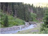
The start is from the parking lot next to the river Mura. At the end of the parking lot, cross the bridge and follow the dirt road. Already a stone's throw away, you reach the first crossroads, where you keep right towards Sticklerhütte. A gently ascending dirt road leads past the Muritzen Chapel and on past the mountain pasture Zalussenalm to the Sticklerhütte hut. In front of the hut there is a crossroads where you turn left to the hut and the path to Weißeck leads off to the right. Ahead of the hut, a path leads through pastures to the beginning of the Upper Mura Valley, where the Mura winds like a snake. The gently rising path runs along the Mura and crosses several streams originating in the western mountains. Some of the streams have to be crossed very carefully at high water levels, as there is almost nowhere to step in some places. After about an hour's walk, you reach a crossroads where you keep straight on in the direction of the Schmalzscharte notch. The sign Schmalzscharte 1:30 is a bit misleading, because the normal walk to the top takes almost 2 hours. After half an hour you reach the source of the Mura River, which is at 1898 m.
From the source onwards, the well-marked path begins to climb steeply. It follows rugged terrain full of large rocks and boulders. From here you can already see the destination and the bivouac below. Just below the summit, the snow likes to linger until summer, where you sometimes need crampons, as there is often ice under the snow. By the time we reach the Albert-Biwak bivouac at 2420 m, we are practically at the finish line. Above it is the Schmalzscharte 2444 m notch, which offers a view of the northern slopes of Großer Hafner and the summit of the Kölnbreinspitze. Below us, the Unterer Schwarzse lake, which is often frozen over until the beginning of summer, is a sight to behold.
Muritzen parking lot - Sticklerhütte 50 min; Sticklerhütte - source of the Jura 1:15; source of the Jura - Schmalzscharte 1:40

Pictures:
 1
1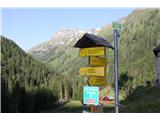 2
2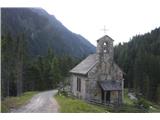 3
3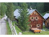 4
4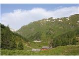 5
5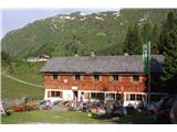 6
6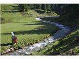 7
7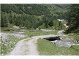 8
8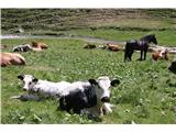 9
9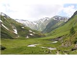 10
10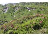 11
11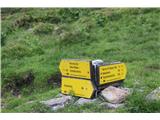 12
12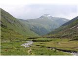 13
13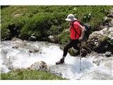 14
14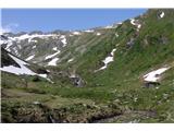 15
15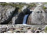 16
16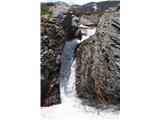 17
17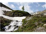 18
18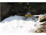 19
19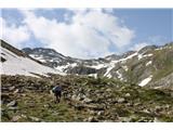 20
20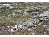 21
21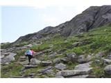 22
22 23
23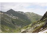 24
24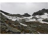 25
25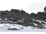 26
26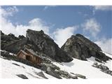 27
27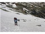 28
28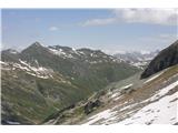 29
29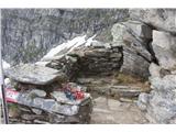 30
30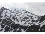 31
31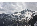 32
32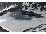 33
33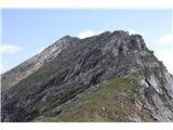 34
34
Discussion about the trail Parking Muritzen - Schmalzscharte (Muritzen - Mur source - Schmalzscharte)