Parking Erichhütte - Hoher Kopf (Königsjodler)
Starting point: Parking Erichhütte (1339 m)
| Lat/Lon: | 47,39164°N 13,04879°E |
| |
Name of path: Königsjodler
Time of walking: 7 h
Difficulty: extremely difficult marked way
Ferata: D
Altitude difference: 1536 m
Altitude difference po putu: 1800 m
Map:
Recommended equipment (summer): helmet, self belay set
Recommended equipment (winter): helmet, self belay set, ice axe, crampons
Views: 4.115
 | 2 people like this post |
Access to the starting point:
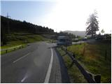
Drive through the Karavanke Tunnel into Austria, then continue along the Turkish Autobahn. We continue through the Katschberg Tunnel and later the Thuringian Tunnel / Tauerntunnel, and follow the motorway to Salzburg (aka Solnograd) only as far as the exit for Bischofshofen, from where we continue on the four-lane road to the aforementioned town. From Bischofshofen, follow the signs for Höchkonig and Dienten am Höchkonig. The road starts to climb and leads to the Dientner sattel. From the saddle, continue for another 100 metres along the road, which begins to descend, and then you will see a parking area on the right-hand side of the road where you park.
Path description:
From the parking lot, follow the signs "Erichhütte 30 min" to the mountain road, which is closed to traffic. The macadam road we are climbing leads us along pastures with a beautiful view of the High Tauern and the nearby peaks above the Erichhütte hut. The path then leads us through a short lane of forest where we also cross a small stream. The path continues along the pasture again until it reaches the Erichhütte hut on the mountain pasture Schönbergalm.
From the hut, continue to the right, following the signs "Königsjodler Klettersteig, Hochkönig", and start to climb gently up the grassy slopes to the north-east. The path soon leads to a crossroads where you continue left towards Hochkönig and the path to the right leads to the summit of Taghaube (2159 m).
The trail then climbs for a while along the rare dwarf pines, and then along a slightly steeper grassy slope to another crossroads. A protected climbing route to the right leads to Granlspitz (2307 m), and we continue left towards the Hochscharte notch.
Here the path turns slightly to the left and leads from the grassy slopes to steeper rocky slopes, which are initially traversed to the north. After crossing, the path turns to the right and climbs up to the Hochscharte notch. The path is quite rough at this part and a short ladder is helpful, but the path is not particularly difficult here. Continue left on the notch and after a short climb you are back at the crossroads. To the right, the slightly easier route No 432 branches off, leading to the Birgkarscharte ridge and on to Hochkönig or Hoher Kopf. We continue to the left and the path quickly leads to the entrance to the Köngsjodler protected climbing route.
Before entering the climbing section, equip yourself with a helmet and self-belay gear, and it is recommended to wear climbing gloves.
In the initial part of the route, the path climbs steeply along a ropeway towards the ridge to a tower called the Flower Tower. The path then follows a slightly exposed ridge and then climbs steeply. The ridge then gives way to the left side and you cross a steep wall towards a narrow notch (difficulty C/D). Cross the narrow notch using a rope to the other side and then climb steeply towards the Teufels Turm Tower (difficulty C). From the tower, you then descend steeply (difficulty C/D) and cross the notch below you on a suspension bridge. The bridge is made of three cables, one of which you walk on and the other two are used for holding and self-belaying. There is a short traverse of steep walls and a steep descent with a few scrambles to help (difficulty C). After the descent, the path leads to a slightly less exposed and unprotected part of the route. After a short climb, the route is secured again and there is a climb up a still slightly less sharp ridge, which leads to the next tower (difficulty B/C). There is a short descent and then, with the help of just one rope (Flying Fox), which is led to the next tower, we cross the notch below us. If you do not have the right equipment for such a crossing, you can also continue along the route that descends into the notch. It is recommended to use a double pulley with a rope to cross the notch. With some care, it can also be crossed with an additional umbilical. On the other side of the notch, there is another slightly less steep climb along the sheave. The route soon leads back to an exposed ridge (Teufels Hörndl). After a few short ascents and descents (difficulty C), there is a slightly steeper climb up to a sharp, extremely exposed ridge (difficulty C/D). There are also a few crampons to help you climb up. There is a short climb up the ridge, followed by a descent into the stubble. A slightly less steep path then leads to a crossroads where an emergency exit is possible down to the right. The path to be followed is technically less difficult, but the steepness and the sparsely measured fixed safety gear require some caution.
At the crossroads where we are about halfway up the protected climbing route, we continue straight ahead and climb up the less steep unprotected slope, which leads us to one of the more difficult parts of the route. There is a fairly long, mostly vertical climb (difficulty D) to the next tower, called Kummetstein. There is also a risk of falling rocks on this part of the route. Just below the top of the tower, there is also a registration box along the way. There is another short descent along the ridge from which we have increasingly beautiful views, especially towards the summit of Hochkönig. The path leads to the next stub and the ridge retreats to the left. Another very steep climb (difficulty D) follows, with a few staples to help us. When we reach the ridge again, the route becomes slightly less difficult for a while (difficulty A/B). There is one last steeper climb (difficulty C/D), and then the route becomes progressively less difficult and leads us to the top of Hoher Kopf where the protected climbing route ends. At the top, there is also a fine view north towards the glacier and the other mountains of the Berchtesgaden Alps, which are located on the German side of the border. The route described is extremely challenging and is only suitable for experienced mountaineers with self-control and sufficient strength in their arms. The Königsjodler route is the longest protected climbing route in the state of Salzburg (SalzburgerLand), so it is necessary to be in good condition.
Descend to the right towards the Birgkarscharte stub and then down the 432 route. Great care is needed when descending as the path is very crumbly and rather poorly protected. The climb then ascends gently towards the Hochscharte where the Königsjodler route starts. From there, descend past the Erichhütte hut back to the starting point.

Pictures:
 1
1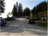 2
2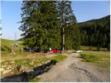 3
3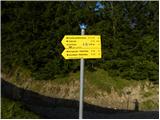 4
4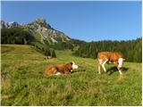 5
5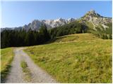 6
6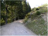 7
7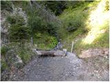 8
8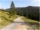 9
9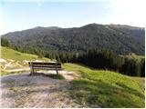 10
10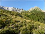 11
11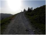 12
12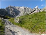 13
13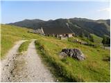 14
14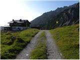 15
15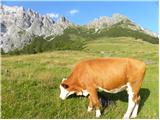 16
16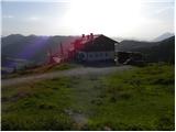 17
17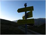 18
18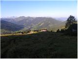 19
19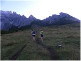 20
20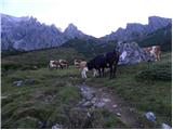 21
21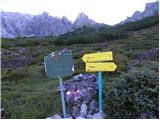 22
22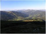 23
23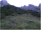 24
24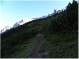 25
25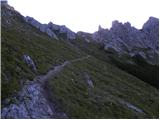 26
26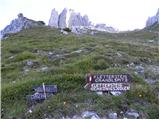 27
27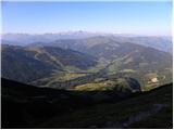 28
28 29
29 30
30 31
31 32
32 33
33 34
34 35
35 36
36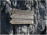 37
37 38
38 39
39 40
40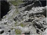 41
41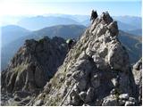 42
42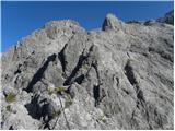 43
43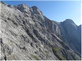 44
44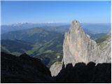 45
45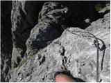 46
46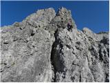 47
47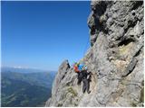 48
48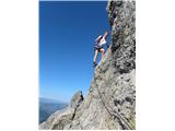 49
49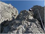 50
50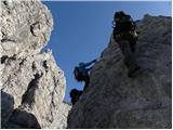 51
51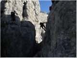 52
52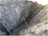 53
53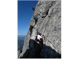 54
54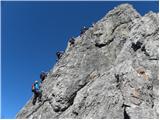 55
55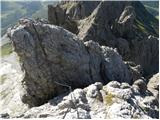 56
56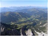 57
57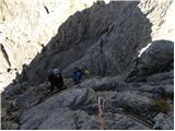 58
58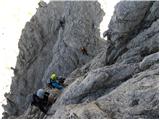 59
59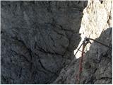 60
60 61
61 62
62 63
63 64
64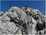 65
65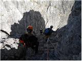 66
66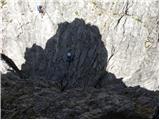 67
67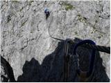 68
68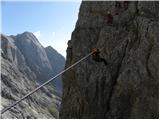 69
69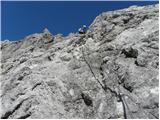 70
70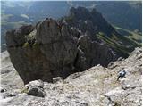 71
71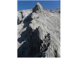 72
72 73
73 74
74 75
75 76
76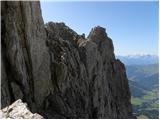 77
77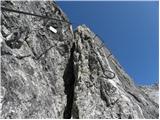 78
78 79
79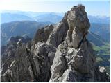 80
80 81
81 82
82 83
83 84
84 85
85 86
86 87
87 88
88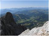 89
89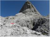 90
90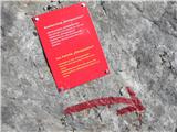 91
91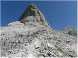 92
92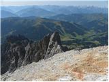 93
93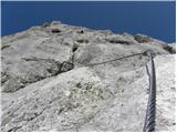 94
94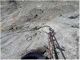 95
95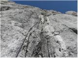 96
96 97
97 98
98 99
99 100
100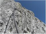 101
101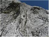 102
102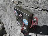 103
103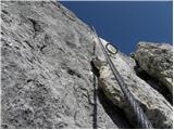 104
104 105
105 106
106 107
107 108
108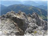 109
109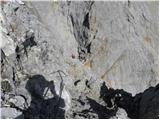 110
110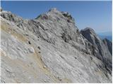 111
111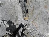 112
112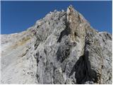 113
113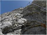 114
114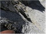 115
115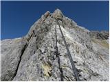 116
116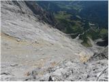 117
117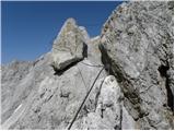 118
118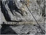 119
119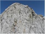 120
120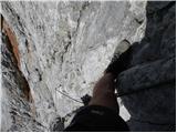 121
121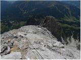 122
122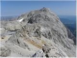 123
123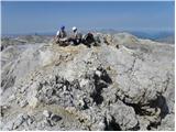 124
124 125
125 126
126
Discussion about the trail Parking Erichhütte - Hoher Kopf (Königsjodler)
|
| medo*7. 09. 2011 |
Bil pred kratkim gor: http://www.hribi.net/trenutnerazmere.asp?aut=1&gorovjeid=10005&id=2723 Lepa in naporna tura, ki jo je zato najbolje opraviti v dveh dneh, ker je skupaj z vožnjo velik zalogaj. Mi smo prespali na vrhu Hochkoniga v koči Matras-Hause in sestopili na Arthurhause. Zaradi zasedenosti koče je treba pravočasno rezervirat in imeti več avtov za povezavo do izhodišča ali prehoditi do tja še dodatne tri ure.
|
|
|