Palafavera - Monte Civetta (Via Ferrata Alleghesi)
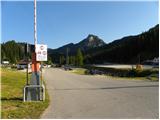
Starting point: Palafavera (1507 m)
| Lat/Lon: | 46,40196°N 12,10119°E |
| |
Name of path: Via Ferrata Alleghesi
Time of walking: 6 h 30 min
Difficulty: extremely difficult marked way
Ferata: C
Altitude difference: 1713 m
Altitude difference po putu: 1720 m
Map: Tabacco 15 1:25.000
Recommended equipment (summer): helmet, self belay set
Recommended equipment (winter): helmet, self belay set, ice axe, crampons
Views: 16.550
 | 4 people like this post |
Access to the starting point:
Via Border crossing Rateče, take the road to Trbiž / Tarvisio, where you take the motorway towards Udine. Leave the motorway at the exit for Tolmezzo and follow the road to the above-mentioned place. From Tolmezzo, continue in the direction of Ampezzo and the Passo della Mauria mountain pass. The road then begins to descend and leads into the Cadore valley, where you turn left towards Cortina d'Ampezzo. Follow the signs for Cortina d'Ampezzo to Venas di Cadore. Shortly before the end of the town, turn left towards Forno di Zoldo. The road then leads over the Cibiana Pass into the Val di Zoldo valley, where it continues to the right towards the Staulanza Pass. Follow the ascending road to Palafavera, where you park in the large parking lot next to the Rifugio Palafavera hut. The parking lot is on the left side of the road next to the ski resort.
Path description:
From the parking area of the Rifugio Palafavera hut, continue south and then turn right onto the dirt road after the signs "Rifugio Coldai, Forcella D'Alleghe". After a few metres, the road leads to a junction where you turn right along a dirt road which is closed to traffic. The road then climbs up and alongside the ski slope, and as it climbs there are beautiful views, especially towards the Monte Pelmo peak and Civetta. Later, the road leads to the western side of the summit of Col Marino della Travesera. Here, the road, which is quite sloping, follows the ski slope and then leads to the mountain pasture Malga Pioda at the saddle of Forcella D'Alleghe.
At mountain pasture where there is a crossroads, continue left on the footpath following the signs "Rif. A. Sonnino al Coldai". Initially still very wide, the path begins to climb slowly in long switchbacks towards the slopes of the summit of Cima di Coldai. The path then turns left and crosses the slopes to the south in an ascending direction to pass under the funicular. Here the path turns right and then climbs steeply up the slope below the cable car. When you reach the top station of the cargo cableway, the path becomes gentle and quickly leads to the hut.
A little beyond the hut where there is a crossroads, continue to the left following the signs "Sent. Tivan, Ferr. Alleghesi", and straight ahead the path leads to Lago Coldai. The trail continues for some time, crossing relatively steep slopes to the south, and in a short part the cable car is helpful. This path then leads to the saddle below the Schinal del Bech. At the saddle where there is a crossroads, continue to the right where a large inscription on a rock directs you to 'Ferrata Alleghesi'. The path then turns slightly to the left and soon we are in front of the entrance to the climbing part of the route.
The protected route called Via Ferrata Alleghesi climbs moderately at first along a steel cable, and then soon follows a vertical climb on crampons and ladders. The trail then follows a steep, well-protected gully, with occasional short switchbacks to the left and right. Higher up, the path leads to a more difficult part, where, with the help of a number of staples, you climb over a slightly overhanging chimney. As we continue to climb along the cliff, the views to the north start to open up. The path then turns left and crosses the slopes below the summit of Punta Civetta. Later, the path resumes a slightly steeper ascent and continues southwards. The last part of the climb follows the ridge to the viewpoint at the summit.
Descend via the via normale, which leads along the eastern slopes of the mountain, past the Torrani hut and then back towards the Coldai hut. The slopes are a shade less steep, but the slippery sand makes it necessary to take care even on this route.

Pictures:
 1
1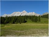 2
2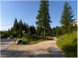 3
3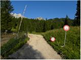 4
4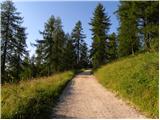 5
5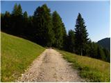 6
6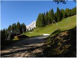 7
7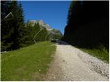 8
8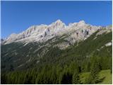 9
9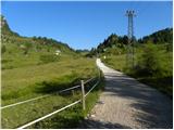 10
10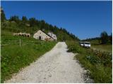 11
11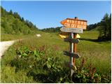 12
12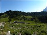 13
13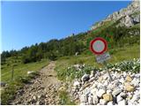 14
14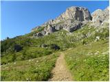 15
15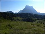 16
16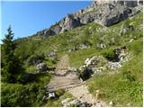 17
17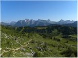 18
18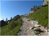 19
19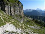 20
20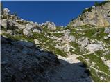 21
21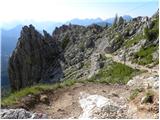 22
22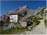 23
23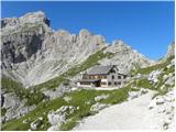 24
24 25
25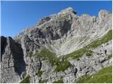 26
26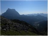 27
27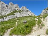 28
28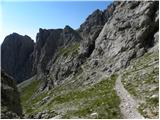 29
29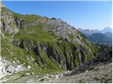 30
30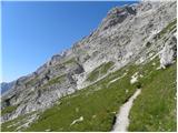 31
31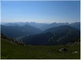 32
32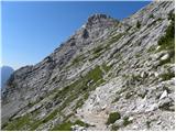 33
33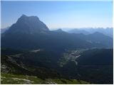 34
34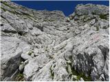 35
35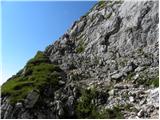 36
36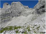 37
37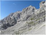 38
38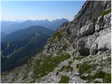 39
39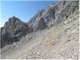 40
40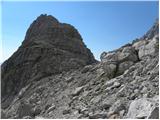 41
41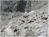 42
42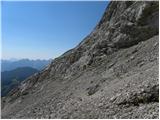 43
43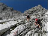 44
44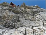 45
45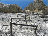 46
46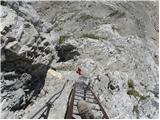 47
47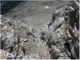 48
48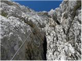 49
49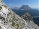 50
50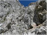 51
51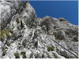 52
52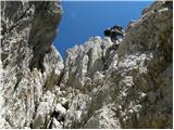 53
53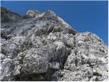 54
54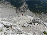 55
55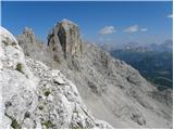 56
56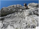 57
57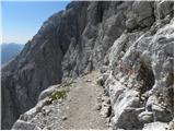 58
58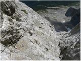 59
59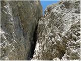 60
60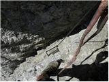 61
61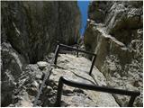 62
62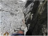 63
63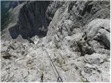 64
64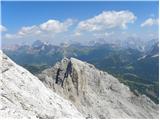 65
65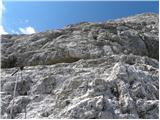 66
66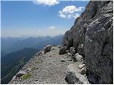 67
67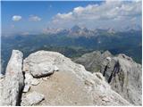 68
68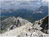 69
69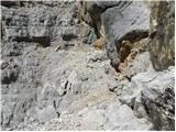 70
70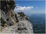 71
71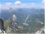 72
72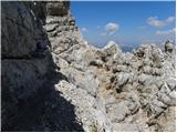 73
73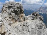 74
74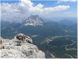 75
75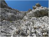 76
76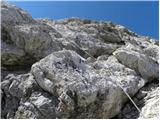 77
77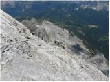 78
78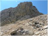 79
79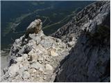 80
80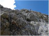 81
81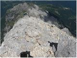 82
82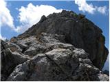 83
83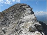 84
84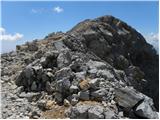 85
85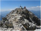 86
86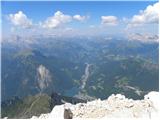 87
87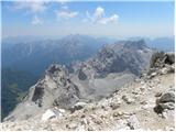 88
88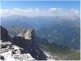 89
89
Discussion about the trail Palafavera - Monte Civetta (Via Ferrata Alleghesi)
|
| malimiha16. 01. 2018 |
Zdravo zanima me tezavnost poti. Se lahko primerja s katero potjo v Sloveniji? Hvala in lp
|
|
|
|
| jax16. 01. 2018 |
Težavnost je zelo zmerna, nič kaj bistveno težja od kakih Vrbanovih špic. Je dolga in naporna, ampak se je res ni treba bat, samo zato, ker je pač v Dolomitih pa prideš na 3200.
|
|
|
|
| jax16. 01. 2018 |
Aja, pa še to: v resnici je bolj naravno izhodišče na planini Grava na južni strani. Sicer nimaš na izhodišču koče, zato pa prideš bliže gori, dostopa je manj, sestop pa mnogo bolj direkten. Pa še s Tissijevo ferato lahko kombiniraš, če ti samo ta še ni dovolj ...
|
|
|
|
| mirank16. 01. 2018 |
Zavarovanih poti take dolžine in s tem povezane zahtevnosti pri nas ni-pa saj tudi tako visokih gora nimamo. Tudi jaz mislim, da je casera Grava zagotovo najprimernejše izhodišče. Sestop po ferati Tissi me še vedno privlači, ma me odbija nadaljevanje izpod nav ferate-od Forcelle delle Sasse do izhodišča. Za dobro uhojene kar polna kapa v enem dnevu!
|
|
|
|
| malimiha17. 01. 2018 |
Ok hvala vama za vse informacije
|
|
|
|
| VanSims18. 01. 2018 |
Ne bi se ravno strinjal da ni bistveno težja od Vrbanovih špic. Je ipak razlika. Tudi po značaju nista primerljivi.
Za nekega izkušenega feratista pa seveda ni problem. Običajna srednje težka. Nekoliko težja od recimo tiste na stol iz Avstrijske strani. Tudi po karakterju recimo primerljiva a vsaj še za polovico daljša.
Bil letos poleti.
|
|
|
|
| ANDREJA1236. 03. 2024 21:58:53 |
Kakšna je v primerjavi s Cjajnikom iz AUT strani? Je tudi kaj spusta po ferati, če greš Via normale?Cjajnik je tudi kot izjemno zahtevna, vendar ima tudi dele poti D. S Cjajnika v smeri grebena se tudi krajši del spustiš dol.
|
|
|
|
| VanSims7. 03. 2024 10:42:16 |
Ferata Cjajnik je dosti težja od Alleghesija, tudi če pred vrhom izbereš lažjo varianto (in se izogneš Dju). Je pa krajša.
Nekaj zavarovanih delov imaš na Via normale, seveda pa nikjer takega brutalnega spusta, kot je v Cjajnikovo škrbino (v smeri grebena).
|
|
|
|
| mirank7. 03. 2024 14:23:53 |
In kot že večkrat bom priporočil izhodišče s planine Grava. Od tam je tura komot izvedljiva v enem dnevu ob normalni kondiciji se razume  . Mi smo jo s skupino 14 planincev začeli sicer v temi a smo tudi zaključili ob 14h pa nismo bili prav hitri.
|
|
|