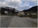
Starting point: Otlica (815 m)
| Lat/Lon: | 45,927°N 13,9098°E |
| |
Time of walking: 1 h 20 min
Difficulty: easy marked way
Altitude difference: 187 m
Altitude difference po putu: 230 m
Map: Goriška - izletniška karta 1:50.000
Recommended equipment (summer):
Recommended equipment (winter):
Views: 39.063
 | 1 person likes this post |
Access to the starting point:
a) From central Slovenia, first drive to Logatec and then continue towards Idrija. At Kalce near Logatec, turn left towards Colo, then continue along the winding road towards Colo. Turn right at Colo and then left after 100 m in the direction of Predmeja. Continue along the road, which is sometimes a little narrower and also partly winding, to Otlica, where at the Church of the Guardian Angels turn left towards the Otlice Window. Park about 50 metres further on in the cemetery parking lot.
b) Drive to Idrija, and from there continue to Logatec. In Godovič, leave the main road towards Logatec and continue driving to the right in the direction of Črni Vrho, Cola and Ajdovščina. Follow the road to Colo, where signs for Predmeja point you to the right. Continue along the road, which is sometimes a little narrower and also partly winding, to Otlica, where you turn left at the Church of the Guardian Angels towards the Otliška Window. Park about 50 metres further on in the cemetery parking lot.
c) From the expressway Razdrto - Nova Gorica take the exit Ajdovščina and follow the road towards the village Lokavec (Lokavac can be reached from the centre of Ajdovščina, or from the old road Ajdovščina - Nova Gorica, where you turn right at the place Cesta). From Lokavac, continue driving along the ascending winding road in the direction of Predmeja. When the road levels out a bit, you will come to a crossroads, where you continue to the right towards Predmeja and Colo. Follow the road towards Col on Otlica, where you turn right at the Church of the Holy Guardian Angels towards the nearby cemetery. Park in the cemetery parking lot.
Path description:
From the parking lot, continue along the right-hand side of the cemetery along the narrow asphalt road towards the Otliška window. Walk along the road for a short distance as the signs for Otliško okno direct you left onto a grassy cart track, which crosses lane bushes a little further on, and then you quickly arrive at a grazing fence in the vicinity of a nearby house. Here, continue right onto the wider cart track, which takes a few steps to reach a marked crossroads.
From the crossroads continue left (Predmeja and Čaven on the right) and follow the path a few 10 metres to the left of the edge of the Gora plateau. After a short, steep descent, we reach the edge of the plateau, where the path from the source of the Hubl joins from the right.
Here, continue slightly to the left and climb up to where a short path branches off to the left to a stone snail (the snail is the idea and work of architect Damjan Popelar, whose artistic work seeks to link nature and culture).
Continue straight on (left stone snail 2 minutes) and after a further 10 steps you will reach the information boards above the Otlis window.
From the signs, continue to the right and descend to the nearby window, which offers a beautiful view.
From the window, continue along the path towards Sinje vrh. The path ahead quickly emerges from the forest and leads us to the viewing slopes, along which we climb along the edge of the cliffs in a south-easterly direction. After about 10 minutes' walk from the window, the path splits into two parts. At the point where the pasture fence makes a sharp left turn, leave the wide path and turn right onto a less well-marked path which, after a five-minute climb, leads to Navrše.
From the top, the path descends to a small saddle, where it rejoins the path that bypasses Navrše. The path continues through the lane of a forest and leads us a little further to a pleasant lookout point where we join the path across the Old Baba. Here, by the electricity pylons, the markings for Sinji vrh direct us left to cart track, which climbs gently at first and then gradually descends. When the path climbs again, get on the road where you continue left upwards (to the right the road ends at the last house in the village). After walking along the road for a few minutes, you come to a crossroads where you continue right and then right again after a few metres. The road, which continues to climb slightly higher, leads us to another crossroads, where we again continue to the right. There is a 700 m walk along the road to the Sinji vrh guesthouse. Here the road ends and we continue along an unmarked path towards Sinji vrh, which we reach after three minutes. Orientation in the last part is not difficult.

Pictures:
 1
1 2
2 3
3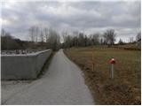 4
4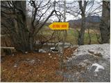 5
5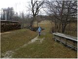 6
6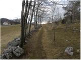 7
7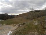 8
8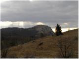 9
9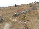 10
10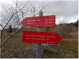 11
11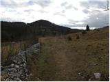 12
12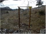 13
13 14
14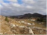 15
15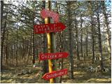 16
16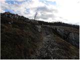 17
17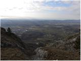 18
18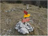 19
19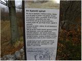 20
20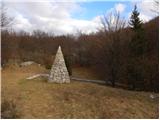 21
21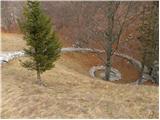 22
22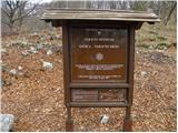 23
23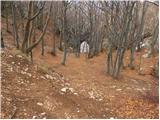 24
24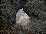 25
25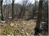 26
26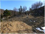 27
27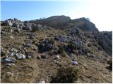 28
28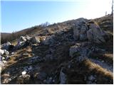 29
29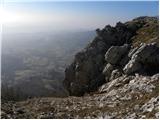 30
30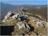 31
31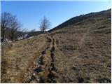 32
32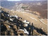 33
33 34
34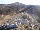 35
35 36
36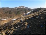 37
37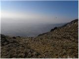 38
38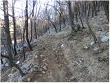 39
39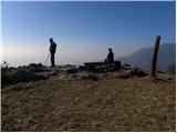 40
40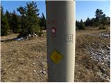 41
41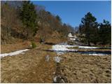 42
42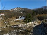 43
43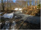 44
44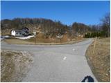 45
45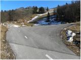 46
46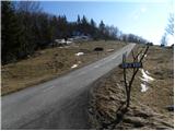 47
47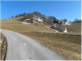 48
48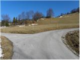 49
49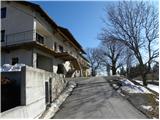 50
50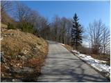 51
51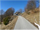 52
52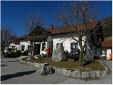 53
53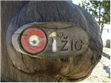 54
54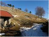 55
55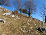 56
56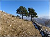 57
57 58
58 59
59 60
60
Discussion about the trail Otlica - Sinji vrh
|
| mako4419. 01. 2013 |
Lepa tura, prelepe fotke...srečno še dalj na poteh in nasploh!
|
|
|
|
| Parkeljc27. 04. 2013 |
Pot sem prehodil 25.4.2013 in moram reči, da je naveden čas krepko navit  . Spet sem se zanašal na to, da bom na vrhu pol prej kot je navedeno, a žal sem se uštel. Točnega časa niti ne morem navesti, ker ne vem točno kdaj sem štartal, a do vrha sem porabil tam okoli 1 ure in 30 min. Ker se mi je pot zdela daljša kot je navedeno, sem nazajgrede sledil času in hodil 1 uro in 15 min. Dejstvo je, da ne hodim počasi, no, tečem pa tudi ne, razen nazajgrede, ampak šele ko sem prišel nazaj do Otlice sem pogledal kje je Sinji vrh in če bi že na štartu vedel kam se podajam in za koliko časa, je vprašanje, če bi sploh šel. Ta dan sem imel že eno turo za seboj in moram poudariti, da je Sinji vrh iz Otlice zelooooo daleč. Vem, da je čas hoje zelo relativen, a tale je kar precej preteran  . Sicer pa zelo zanimiva pot, še posebej mora biti zanimiva tista, ki poteka "Po robu" od Predmeje in nato proti "Angelski poti", ki je polna zanimivosti in prelepih razgledov na Vipavsko dolino in tudi naprej do morja. A ta je lahko že celodnevna tura. Domačija na Sinjem vrhu in okolica zelo lepo urejena, čista, oskrbnica prijazna.. Pokrajina je res krasna, kot zanimivost pa naj navedem, da se tu in tam pojavi kakšna novogradnja, ki bi se skladala prej s kakšno okolico Ljubljane, ne pa ... Denar je pač sveta vladar  .. To je pač samo moje mnenje 
|
|
|
|
| Parkeljc29. 04. 2013 |
No, veseli me, da ste/si ponastavil "tajming"
|
|
|
|
| mvidmar3@amis.net2. 03. 2015 |
milan kot otrok sem se tu podil moral sem iti z trebuhom za kruhom najprej študij potem zaposlitev dolga leta od domačega kraja vračal sem se ampak premalo v meni je vedno hrepenelo da se vrnem nazaj v domači kraj in sedaj je tudi ta trenutek prišel res lepi moji domači kraji najlepši kraj na svetu 
|
|
|
|
| owlic28. 03. 2015 |
imam samo eno grajo za napisat. In to je ko prideš ves vesel do sinjega vrha, da si daš žig v dnevnik planinskih poti in ugotoviš da je neprepoznaven (uničen)in se ne da razbrati kaj je na tistem žigu...
|
|
|
|
| rades23. 04. 2016 |
Res je, da je žig pred kočom (penzionom) slabši, ampak se da razbrati. V penzionu se tudi lahko dobije klasična štempiljka SPP (nefiksirana).
|
|
|
|
| marinka6715. 08. 2016 |
Žig pred kočo je še vedno slab in komaj viden, noter pa res ne greš sitnarit, ker predvidevaš, da je tisti zunaj edini. Tudi mi smo hodili 1,40 min, prekrasna pot, le zadnjih 20 min klepanja po asfaltu je mukotrpnih. Vendar na vrhu smo bili poplačani s čudovitimi razgledi.
|
|
|
|
| modrook121. 10. 2016 |
danes smo prehodili to pot.pot je odlično markirana, primerna za male otroke. škoda le da je žig tako slab, neprepoznaven.lep planinski pozdrav iz posavja.
|
|
|
|
| domek23. 07. 2019 |
Par dni nazaj smo tudi mi prehodili tole pot. Sicer smo do cilja potrebovali več časa, kot piše v opisu. Čudoviti kraji s prekrasnimi razgledi. Je pa pred penzionom nov žig.
|
|
|
|
| Tajka6710. 06. 2023 18:50:16 |
Danes še na Sinjem vrhu po tej poti. Napotili so me trije domačini, ki sem jih srečala na Golakih. Pogled skozi Otliško okno je res čudovit. Sama pot sicer označena, v zadnjem delu pa kar veliko hoje po asfaltu. Pohodnikov skoraj ni bilo, najbrž zaradi vremena, ki je ves čas grozilo z nevihto.
|
|
|