Starting point: Ortnek (540 m)
| Lat/Lon: | 45,7941°N 14,6788°E |
| |
Time of walking: 2 h 30 min
Difficulty: easy marked way
Altitude difference: 424 m
Altitude difference po putu: 475 m
Map:
Recommended equipment (summer):
Recommended equipment (winter): ice axe, crampons
Views: 2.031
 | 1 person likes this post |
Access to the starting point:
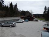
a) From Ljubljana, drive towards Kočevje, but only as far as Ortnek. In this settlement, just after the Vinija Café, the road to Sv. Gregor turns off to the right. Just after the crossroads, park in a suitable place on the roadside. The parking space in front of the café is reserved for guests.
b) From Ribnica or Sodražica, drive to Žlebič and from there continue in the direction of Ljubljana, but only as far as Ortnek. In the village, the road to Sv. Gregor turns left in front of the Vinija restaurant. Just before the crossroads, park in a suitable parking space on the side of the road (a suitable parking space is on the opposite side of the road). The parking space in front of the café is reserved for guests.
Path description:
From the crossroads by the Vinija Café, first cross the main road carefully, then walk for a few 10 steps in the direction of Ribnica. When you reach the crossroads where the road to Velike Poljane and Grmada branches off to the left, leave the main road and continue along the local road. After a further 10 metres, cross a small stream and at a small crossroads turn right towards the hamlet of Dule. It does not take long to walk towards the hamlet, as the signs for Grmada, before the nearby house, lead to the left on a slightly steeper macadam road, along which we continue our ascent. After a few minutes, the forest through which we are walking ends and we see the church and the village of Veliki Poljane in front of us.
Shortly before the church, we turn onto an asphalt road and start climbing through the village. At a few crossroads, follow the signs to Grmada, and then the village ends and beautiful views open up, reaching all the way to Julian Alps with Triglav as the highest peak. When the road turns into a small valley, we reach a place where a marked footpath to Grmada branches off to the left, and we continue along the asphalt road for another 10 steps to a place where a macadam road branches off to the right, leading east to south-east. We continue along the above-mentioned road, which initially leads us through meadows, then after a slight descent into the forest, where we see signs indicating that we are entering a bear area. The sign is located just at a small crossroads, where you continue straight ahead on the left-hand road, which begins to climb gently through the forest. After a few minutes, the marked path from the top of Grmada joins us on the left.
From the crossroads, continue the cross-climb through the forest for some time, then arrive at a slightly larger crossroads, where you continue straight in the direction of Sv. Anna (you can take the road sharp left to reach Kompolje or Rapljeva). There are a few more minutes of gentle to moderate climbing, and then the trail begins to descend behind an unmarked pass between the peaks Tisovec (931 m) and Špičnik (926 m). A descent of a few minutes follows, and then the signs for Sv. Anna direct us left onto a slightly less good road, which begins to climb steeply (the wider road we leave leads towards Ribnica). Walk along the ascending road for a few minutes, and then the signs lead us slightly more to the right onto a marked footpath which continues through the forest. After a few minutes, when the path has completely flattened out, you will reach cart track and follow it to the left, where you walk along the edge of a small valley where, in spring, the hellebores grow. Somewhere in the middle of the valley, the relatively well-marked path turns right and passes onto the slopes of the Sten Sv. Anna peak. Climb relatively steeply to the right for a few minutes, and then the signs for Sv. Ana with cart track direct you sharp left onto a slightly steeper footpath. A relatively steep climb follows, and then after a few minutes the path lays down and in a few further steps leads us to a place where a short path branches off to the left, leading to a nearby viewpoint.
From the viewpoint, we return to the aforementioned crossroads, and from there we continue in the direction of Sv. Ana. A short crossing follows, and then a path from Struge joins us from the left, and a few steps further on, a path branches off to the right to the top of Sten Sv. Anna (directly Koča pri sv. Ani na Mali gori).
From the crossroads, it is a one-minute walk to the summit, where the geodesic tower is located.
Description and pictures refer to the situation in 2015 (April).

Pictures:
 1
1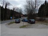 2
2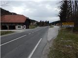 3
3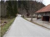 4
4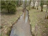 5
5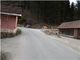 6
6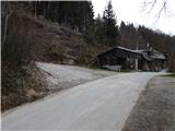 7
7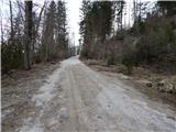 8
8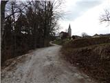 9
9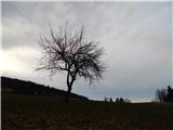 10
10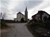 11
11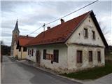 12
12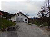 13
13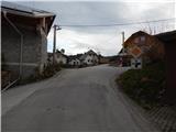 14
14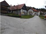 15
15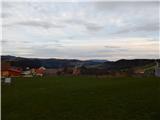 16
16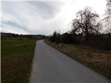 17
17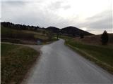 18
18 19
19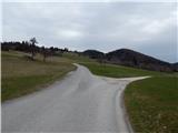 20
20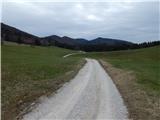 21
21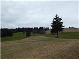 22
22 23
23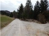 24
24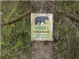 25
25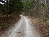 26
26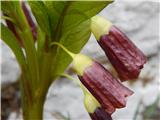 27
27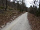 28
28 29
29 30
30 31
31 32
32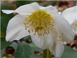 33
33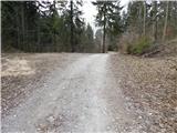 34
34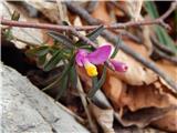 35
35 36
36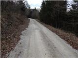 37
37 38
38 39
39 40
40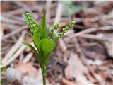 41
41 42
42 43
43 44
44 45
45 46
46 47
47 48
48 49
49 50
50 51
51 52
52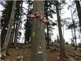 53
53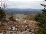 54
54 55
55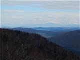 56
56 57
57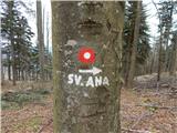 58
58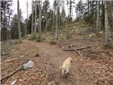 59
59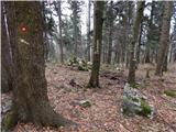 60
60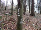 61
61 62
62 63
63 64
64
Discussion about the trail Ortnek - Stene svete Ane