Oplotnica - Dom na Osankarici (via Sveti Trije Kralji)
Starting point: Oplotnica (370 m)
| Lat/Lon: | 46,38692°N 15,44683°E |
| |
Name of path: via Sveti Trije Kralji
Time of walking: 3 h 35 min
Difficulty: easy marked way
Altitude difference: 823 m
Altitude difference po putu: 990 m
Map: Pohorje 1:50.000
Recommended equipment (summer):
Recommended equipment (winter): ice axe, crampons
Views: 183
 | 1 person likes this post |
Access to the starting point:
a) From the motorway Ljubljana - Maribor take the exit Slovenske Konjice, then follow the signs for Slovenske Konjice. From the roundabout after the OMV petrol station, take the first exit to the right towards Slovenska Bistrica, and from Slovenska Bistrica take the road to the left to Oplotnica and Osankarici. Turn towards Oplotnica and follow the road to the centre of the town, where you can park in one of the several car parks in the settlement.
b) From the motorway Maribor - Ljubljana, take the exit Slovenska Bistrica - South, then follow the signs for Slovenske Konjice. Shortly after Slovenska Bistrica, turn right towards Oplotnica, then drive to the centre of Oplotnica, where you can park in one of several car parks in the village.
Path description:
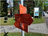
From the centre of the village, follow the path towards Osankarice, Černý jezero and Treh Kraljev, first walking along the pavement past the Mercator shop, the Pohorski Bataljona Oplotnica primary school to the Salama pizzeria, where you turn left and then immediately right, passing the pizzeria on your right.
The way forward begins to climb visibly on a narrower asphalt road, which leads us past occasional houses, and when we arrive in the Lačna Gora settlement, we also have a beautiful view of Oplotnica and the surrounding hills.
Higher up, at the cross, the signs for the Black Lake direct us to the right, where we pass the last house, after which we continue our ascent on the dirt road, soon turning left into the woods on a marked footpath. Climb steeply through the woods, cross the dirt road you have recently left, and then climb moderately to reach the Church of Sts.
At the church, return to the road and continue north. The road quickly turns into the cart track, which leads you first through the forest and then across a grassy viewpoint, where you descend a little.
When you reach the asphalt road in the village Kebelj, cross it crosswise to the right, then go left towards the Black Lake, passing the nearby house on your right. After a few minutes of a scenic climb over a grassy slope, when you reach the end of the asphalt road, there is a trail on your right, starting at the cemetery in the village of Kebelj.
Continue straight ahead on the marked cart track, which turns right before entering the forest and continues along the edge of the forest, and from the above-mentioned cart track, signs direct you to the left onto the narrower cart track, which continues through the forest. Follow the markings through the forest, and when the path turns slightly to the right, after a short crossing, another path from the village of Kebelj joins us from the right.
Go left here and you will quickly reach the ruins of Kebelj Castle.
Go around the ruins on the left and follow the signs to the nearby asphalt road, where you go straight up. Just a little further on, the asphalt road turns right, and the path to Osankarica (the Kebelj Transversal Route) branches off to the left. Leave the asphalt road just a little further on, where the signs for the Black Lake direct you to the left into the forest. There is a short climb through the forest, and then past numerous rubbish bins we reach a nearby homestead (there is also a warning for a vicious dog from the opposite direction). At the homestead, the road becomes asphalt and we quickly return to the slightly wider asphalt road, which we continue our climb on. After a few minutes, the signs direct us left onto the grassy cart track, which we climb along the edge of the forest, and higher up, we pass a house and rejoin the asphalt road, which leads us to the next marked crossroads.
Continue to the right in the direction of Treh Kraljev and Črni jezero (on the left Črno jezero - the path past Kos) and follow the road to the crossroads near the NOB monument.
From the crossroads go right towards the driveway, and at the sign for the cul-de-sac go left onto the marked footpath which continues through the woods. It takes about 20 minutes to climb through the forest, following the signs, and then you reach a road, which you follow for about 10 steps to the right, where you reach the Hotel Jakec, above which is the Church of St. Three Kings.
From the Church of the Three Kings, continue in the direction of the Black Lake and the Urška Trail and quickly reach the nearby ski slope, which you continue along for a short distance and then cross (when the ski slope is open, the ski run and the ski lift cross higher up - above the ski lift and the ski slope). The way forward takes us past the ARSO weather station, and we continue to follow the markings, and after a few minutes on the connecting ski slope we arrive at another ski slope, which we also cross (up Veliki vrh, next to the ski slope). Then we cross the ski lift and another ski slope, and then the trail comes into the forest, where after a few minutes of further walking we arrive at a cross, next to which stands the Urška Trail teaching board. The way forward descends slowly and leads us to a marked crossroads, where we choose the left path (straight Šumik and Ruška koča), where we continue in the direction of Osankarice and Črnega jezera. Continue to descend gently to moderately and follow the markings. When the descent ends, you will reach a crossroads near Černý jezero.
Continue straight on (left Oplotnica - the path past Kos) and in a few steps you will reach the lake.
Follow the path in the direction of Osankarica, bypassing the lake on the right, and after crossing a small stream, the path enters the forest and continues along a wood-paved path. The path initially continues without major changes in elevation, but after a while it begins to visibly descend. Follow the paved path, which is a slip hazard in wet conditions, all the way to the parking lot near Dom na Osankarici. From the parking lot, cross the road and climb up to Dom na Osankarici, which burnt down in 2021.
Oplotnica - St. Mohor 0:45, St. Mohor - Hare's Castle 0:40, Hare's Castle - St. Trije Kralji 1:20, St. Three Kings - Black Lake 0:50, Black Lake - Osankarica 0:15.
Description and figures refer to the situation in April 2022.

Pictures:
 1
1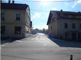 2
2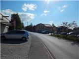 3
3 4
4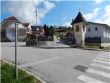 5
5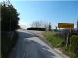 6
6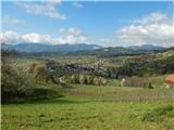 7
7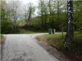 8
8 9
9 10
10 11
11 12
12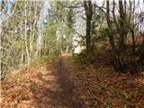 13
13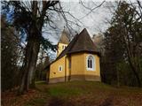 14
14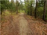 15
15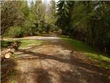 16
16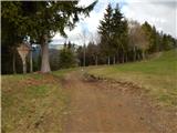 17
17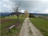 18
18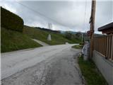 19
19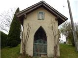 20
20 21
21 22
22 23
23 24
24 25
25 26
26 27
27 28
28 29
29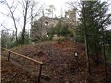 30
30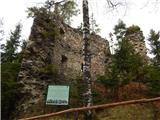 31
31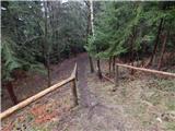 32
32 33
33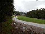 34
34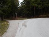 35
35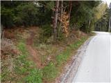 36
36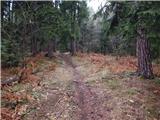 37
37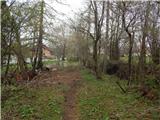 38
38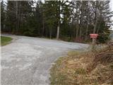 39
39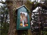 40
40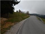 41
41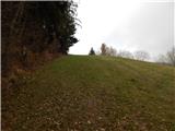 42
42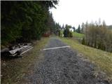 43
43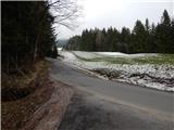 44
44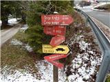 45
45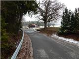 46
46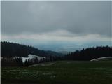 47
47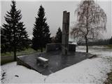 48
48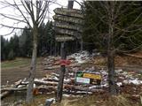 49
49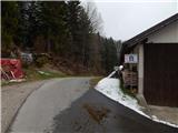 50
50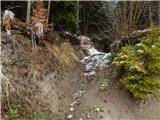 51
51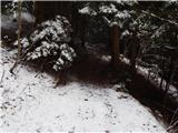 52
52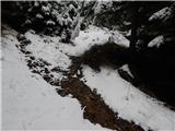 53
53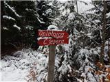 54
54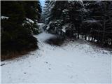 55
55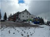 56
56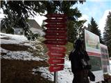 57
57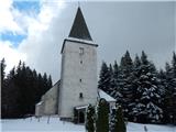 58
58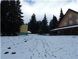 59
59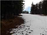 60
60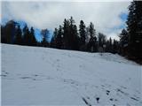 61
61 62
62 63
63 64
64 65
65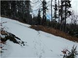 66
66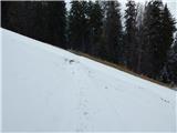 67
67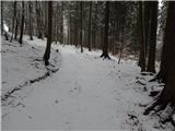 68
68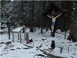 69
69 70
70 71
71 72
72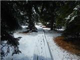 73
73 74
74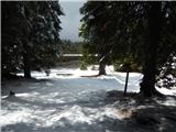 75
75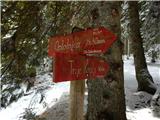 76
76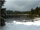 77
77 78
78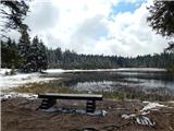 79
79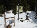 80
80 81
81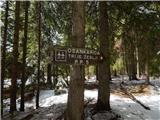 82
82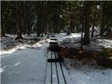 83
83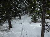 84
84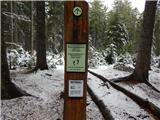 85
85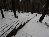 86
86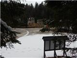 87
87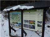 88
88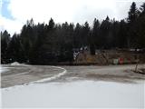 89
89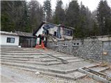 90
90
Discussion about the trail Oplotnica - Dom na Osankarici (via Sveti Trije Kralji)