Nemilje - Sveti Križ above Selca (via Prevoje)
Starting point: Nemilje (510 m)
| Lat/Lon: | 46,2553°N 14,2249°E |
| |
Name of path: via Prevoje
Time of walking: 2 h 25 min
Difficulty: easy unmarked way
Altitude difference: 350 m
Altitude difference po putu: 420 m
Map: Škofjeloško in Cerkljansko hribovje 1:50.000
Recommended equipment (summer):
Recommended equipment (winter): ice axe, crampons
Views: 226
 | 1 person likes this post |
Access to the starting point:
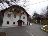
a) Drive to Kranj, then follow the signs for Besnica (the turn-off from the old Ljubljana - Kranj road is before the bridge over the Sava River, or after the bridge if you are coming from Kranja). Continue through Spodnja, Zgornja Besnica and Njivica. A little further on, you arrive in Nemilje, where the route described above starts at the Raspoka Inn. There are no parking places for mountaineers at the starting point, so park in a suitable place somewhere nearby.
b) From Železniki, drive to Dražgoše, then continue towards Kropa, crossing the slopes of Jelovica, then arriving at a crossroads where the road to Kranj branches off sharply to the right (the turn-off for Kranj is only from the opposite direction). Here, continue sharp right (if the turn is too sharp, there is a turning point about 50 metres further on), then descend to Podblica and further to the settlement Nemilje, where the route described above starts at the Raspoka Inn. There are no parking places for mountaineers at the starting point, so park in a suitable place somewhere nearby.
Path description:
From the inn, take the side road that continues west (Selca and Topolje on the left, Dražgoše and Jamnik on the right). After a short climb, the road turns left and leads to a few more houses, and before the last house, take a slight right onto cart track, which climbs across a meadow into the forest. Through the forest, cross the slopes of Bekrej (585 m), and on the other side of the summit reach a wooded ridge, along which the path continues. There are a few small forks where you continue straight ahead, and a little higher up you go right from an indistinct ridge, where after a short traverse you reach another cart track, and continue climbing along it. There is some moderate climbing and a few switchbacks where you follow the wider cart track, reaching the Prevoje pass, where you reach the marked Dražgoše - St. Mohor route and continue right (St. Mohor on the left).
The way forward initially climbs cart track, then along the mountain path, and at Koblarjev hrib the climb ends transitively. There follows some easy walking to the nearby chapel, where the path from Podblice joins us from the right.
The way ahead leads us along cart track, which climbs gently to moderately. At a slightly higher altitude, the path exits the forest onto a hay meadow and then returns to the forest behind a small hut, which can be seen on the right-hand side. After a few minutes of ascent through the forest, you reach another hayfield, where the path leads along its left edge. A little higher up, the path turns left and leads us past the abandoned Lobnikar farm to an asphalt road, which we follow to the left, quickly reaching the church of St Jedert. From the church, we continue along the asphalt road, and at a nearby crossroads, we continue straight on in the direction of Dražgoš. The way forward leads us past two NOB memorials with beautiful views, and then we arrive in Dražgoše, where we turn left, onto a side road, behind the house in front of which the chapel is located. The way ahead takes us past a few houses, and then we arrive on the slopes of Slemena, where, before a strip of woods to the left, cart track branches off, leading to the transmitters, and we continue for a few more 10 metres along the asphalt road, turning left at the middle of a left-hand bend. The way forward leads us along the cart track lookout, which leads us along the ridge to Sleme in a few minutes.
From the top, continue to the nearby transmitters, where the aforementioned cart track joins from the left. Continue straight ahead, following the path into the forest, which begins to descend gently to moderately. A little lower down, the path goes from the ridge to a slope, and a few steps further on, out of the forest onto an older clearing, now mainly a grassy slope with some reforestation in the upper part. A little further on, you reach an asphalt road, and continue climbing along it to a marked fork. Continue along the forest track (right private asphalt road), which leads to the top of a rise, where you leave the forest. From the point where you leave the forest, it is only a short walk of 10 steps to the Church of the Holy Cross.
Nemilje - St Jedert 1:35, St Jedert - Sleme 0:30, Sleme - St Križ 0:20.

Pictures:
 1
1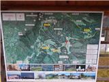 2
2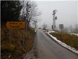 3
3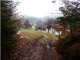 4
4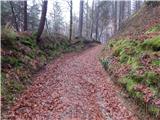 5
5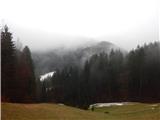 6
6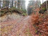 7
7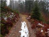 8
8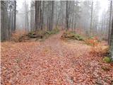 9
9 10
10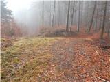 11
11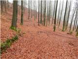 12
12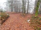 13
13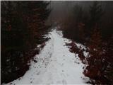 14
14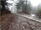 15
15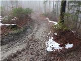 16
16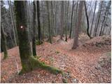 17
17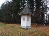 18
18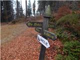 19
19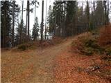 20
20 21
21 22
22 23
23 24
24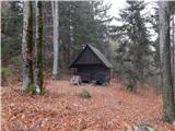 25
25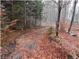 26
26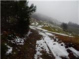 27
27 28
28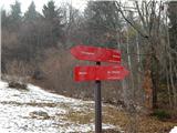 29
29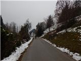 30
30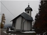 31
31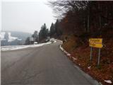 32
32 33
33 34
34 35
35 36
36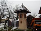 37
37 38
38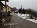 39
39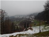 40
40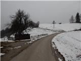 41
41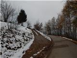 42
42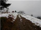 43
43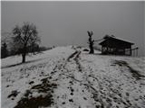 44
44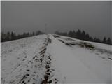 45
45 46
46 47
47 48
48 49
49 50
50 51
51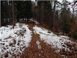 52
52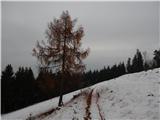 53
53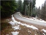 54
54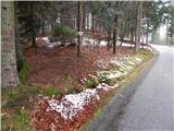 55
55 56
56 57
57 58
58 59
59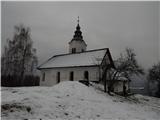 60
60 61
61
Discussion about the trail Nemilje - Sveti Križ above Selca (via Prevoje)