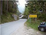
Starting point: Mojstrana (675 m)
| Lat/Lon: | 46,4552°N 13,9321°E |
| |
Time of walking: 4 h 15 min
Difficulty: easy marked way
Altitude difference: 1402 m
Altitude difference po putu: 1402 m
Map: TNP 1:50.000
Recommended equipment (summer):
Recommended equipment (winter): ice axe, crampons
Views: 107.743
 | 12 people like this post |
Access to the starting point:
Leave the Gorenjska motorway at the Hrušica exit and follow the road towards Kranjska Gora. Just before the village of Dovje, the road branches off to the left and leads to Mojstrana (Vrata, Kot and Krma). Follow the road in the direction of the Vrata valley for a short distance, as you will soon see the mountain signs for Vrtaška mountain pasture along the road. Park in the parking lot along the road a few metres further on.
Path description:
From the parking lot, walk down the road a few metres, where a signpost directs you to a wide footpath. The path climbs moderately at first and in a few minutes leads to a crossroads, where you continue straight ahead (to the right, the path leads to the Grančišče lookout point).
Shortly afterwards, the path crosses a short muddy part of the path, then turns left and climbs steeply. The path ahead is steep and runs through the forest. After an hour and a half of walking, the steepness subsides and the path turns to avalanche slopes. Then we cross a wide artificial ledge guarded by a fence (the fence is for the belaying cattle), which opens up to a beautiful view of the surrounding peaks. The path then returns to the forest for a while and climbs steeply again. A little higher up, the steepness eases, a pasture fence is crossed and within a few more minutes of walking you reach Vrtaška planina, where you see a shepherd's hut on the right, equipped with an emergency bivouac in the attic of the house.
The path continues across the meadow and then turns sharp left into the forest. The path through the forest climbs moderately and after 20 minutes of walking from mountain pasture leads to a larger clearing which we only cross. The path then returns to the forest, which is becoming increasingly sparse. The path, which is then relatively zložna us after a while leads to a nice vantage point from which we open a beautiful view.
There follows a short descent and then some crossing with a slight ascent to a large grassy slope below Vrtaški vrh, where we join the unmarked path from the Peričnik waterfall.
The path then turns slightly to the right and continues to climb gently across the meadow. A little higher up, the path changes from grassy slopes to the dwarf pines strip and begins to climb steeply. From the moderately steep path, surrounded by a belt of rare larch forest, a view opens up towards Slemeen (2077 m). The otherwise marked path gradually begins to disappear, but in fine weather orientation is not difficult. The path then climbs steeply again and leads us to a ridge where we see Špik and Kukova spica in front of us. Continue left (right Drobeče Sleme) and follow the ridge trail, which after 10 minutes of further walking leads to a scenic peak. Mojstrana - Vrtaška planina 2:00, Vrtaška planina - Sleme 2:15.

Pictures:
 1
1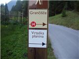 2
2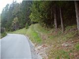 3
3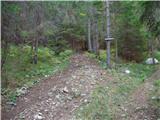 4
4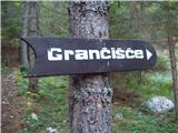 5
5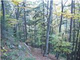 6
6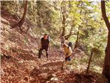 7
7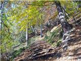 8
8 9
9 10
10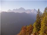 11
11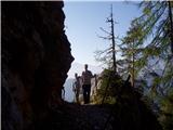 12
12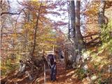 13
13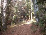 14
14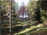 15
15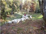 16
16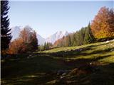 17
17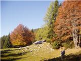 18
18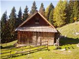 19
19 20
20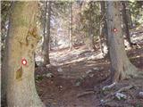 21
21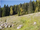 22
22 23
23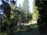 24
24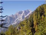 25
25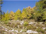 26
26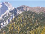 27
27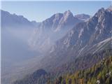 28
28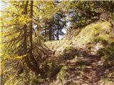 29
29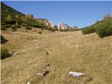 30
30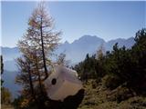 31
31 32
32 33
33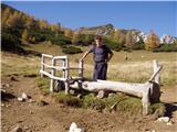 34
34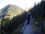 35
35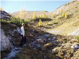 36
36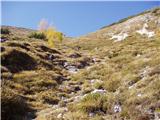 37
37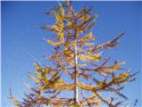 38
38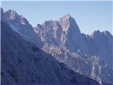 39
39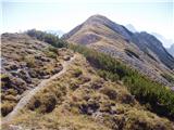 40
40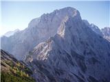 41
41 42
42
Discussion about the trail Mojstrana - Sleme
Show older messages
|
| andrejjerina3. 08. 2009 |
Danes pogled skozi okno ni obetal obiska visokogorja, zato sem se odločil za eno izmed bližnjih in hitrejših vzponov. "Strma je pot v nebo, strma zelo,..." Tole pesmico sem si žvižgal, ko sem se vzpenjal proti Vrtaški planini. Lepa in prijetna pot, vendar do Vrtaške planine zelo strma!Od nje naprej je pot zelo prijetna, le pri sestopu moraš biti previden, da ne zaviješ proti Čerlovcu. LP Andrej
|
|
|
|
| Kriška3. 08. 2009 |
Hm, zame 2077 m že predstavlja visokogorje. Pa tudi 4 ure in pol hoje v eno smer bi meni predstavljalo že kar dober "zalogaj"   .
|
|
|
|
| viharnik3. 08. 2009 |
Po starih vodnikih se višavje nad 1500m,šteje že za visokogorje.Tudi nad to višino lahko zasneži v vsakem letnem času.Kar lepo turo si opravil pred poslabšanjem.
|
|
|
|
| grahelj24. 05. 2010 |
ali je kdo pred kratkim hodil po tej poti? Je pot že kopna?
|
|
|
|
| knap422724. 05. 2010 |
Do njivic je kopna, naprej pa je snega še kar nekaj, ki se občasno predira. Pot na Vrtaški vrh je kopna, povzpni se nanj (10 min), z njega imaš pa tudi lep pogled na nadaljno pot proti Slemenu in tako lahko sam oceniš razmere.
|
|
|
|
| ruševec5. 07. 2010 |
V soboto smo se podali na Sleme po markirani poti. Leon, čas 4.30 smo dejansko porabili, res pa je, da smo si ogledali praktično vsako cvetočo rastlino, ves razgled, vse fotografirali, skratka počasna turistična hoja. Sestop smo opravili v 3 urah. Pot odsvetujem ljudem z malo kondicije in takim, ki jim je smisel kislo mleko ali pivo v koči. Kajti na tej poti se ne da dobiti ničesar. Odvisen si od tistega kar imaš v nahrbtniku.
|
|
|
|
| hribuc858. 07. 2010 |
Včeraj bil na Slemenu. Mislim, da je markiran čas nekoliko pretiran. Res mam še mlajše noge, pot sem prehodil v 2,5 ure vključno z več manjšimi pivskimi postanki in malo daljšim pogovorom s pastirjem pod Vrtaško planino. Če se zmerno hodi, se več kot 3 ure nima kaj delat. Pa brez zamere ljubitelji cvetja. Res ga je na pretek, jaz sem si ga ogledal na povratku nazaj.
Glede poti: da se it direktno s parkirišča pri opisu poti. Pot je izrazita, drevesa pa so označena (ne z markacijami). Pa veliko užitkov vsem lačnim strmin in lepot visokogorskih planin.
Srečno.
|
|
|
|
| EUGEN8. 07. 2010 |
Zakaj je pomemben čas hoje?
Saj hoja v hribe ni nobeno tekmovanje,temveč užitek in soočenje z naravo in samim sabo.
To je moje mišlenje, vsak ima svoje užitke.
l.p.
|
|
|
|
| hribuc858. 07. 2010 |
EUGEN maš popolnoma prav. Sam če si odvisn od voznih redov (vlak, avtobus, ...) je dobr da veš ustrezne markirane čase, da si lahko splaniraš turo.
|
|
|
|
| klavdipo19. 09. 2010 |
Je na tem vrhu poleg vpisne knjige tudi žig?
|
|
|
|
| chackk28. 10. 2010 |
Kakšna je pot zdajle? Koliko cm snega približno je zdajle, če mi kdo za povedat?
|
|
|
|
| dj1211. 11. 2010 |
Ali je mogoče kdo hodil te dni po sneženju na Sleme ? Je precej snega ? LP
|
|
|
|
| alesh7411. 11. 2010 |
Snega je več kot pol metra......
|
|
|
|
| karlin26. 01. 2011 |
Je bil kdo v zadnjem času na Slemenu, kakšne so razmere, koliko je snega?
Hvala!
|
|
|
|
| kr neki9. 05. 2011 |
Koliko je še snega na tej poti?
Hvala.
|
|
|
|
| ZZ10. 05. 2011 |
na Slemenu sem bil dober mesec nazaj, pa je bilo nekaj snega le nad cca. 1800 m
|
|
|
|
| JORDAN23. 05. 2011 |
V soboto 21.5.2011 sva prehodila to pot,snega je nekaj od 1800 m naprej.Pot je res kar strma in na začetku kar 1,5 ure grizeš kolena.Skoraj pa ne morem verjeti,da po tej poti gor spravijo krave,kaj šele nazaj v dolino.
|
|
|
|
| mošt25. 08. 2011 |
Včeraj bila na vrhu. Res, kje pridejo krave tu gor? Včeraj jih ni bilo videti ne slišati zvoncev. Na planini je suša, na Njivicah je napajališče izsušeno. Očitno so morale v dolino, a po poti kjer sem jaz hodila ni bilo njihovih markacij. Dan je bil čudovit, a na vrhu ni bilo za zdržat. Doživela sem invazijo letečih mravelj, ki so nadležno lezle povsod in ščipale. Vrnitev v dolino je bila hitra, saj po taki strmini počasi res ne morem.
|
|
|
|
| Laščan15. 10. 2011 |
Jutri nameravamo iti na Sleme, pa me zanima če kdo ve, ali je gori kaj snega? Hvala in lp!
|
|
|
|
| viharnik15. 10. 2011 |
Pred dnevom je bilo v vršnjem delu vidnega še nekaj snega.Tam so trave z pomrznjenim snegom in previdnost ne bo odveč.
|
|
|
|
| ninooos15. 10. 2011 |
Snega je videti le za vzorec, gamaše niso potrebne , kot je omenil že viharnik pa je potrebna previdnost zaradi zmrzali.
|
|
|
|
| Suriljana1. 05. 2012 |
Živjo! Ali kdo ve, kakšne so kaj trenutne razmere na Slemenu?
|
|
|
|
| heinz1. 05. 2012 |
sneg (zagotovo še nekaj naslednjih dni)
|
|
|
|
| 5Xum19. 05. 2012 |
Snega praktično ni več. Pot le kakšne dvakrat preči manjše snežišče, a res nič večjega.
|
|
|
|
| michael6616. 08. 2012 |
A je mogoče na Vrtaški planini kakšen studenec??
|
|
|
|
| Majdag30. 08. 2012 |
...Naj vas ne zavede na prvi sliki parkirišče. Avto je že obrnjen iz smeri Peričnik v smer Mojstrana
|
|
|
|
| ninooos30. 08. 2012 |
Ne, studenca ni (na vsej dolžini poti, ne le na Vrtaški pl.)
|
|
|
|
| ljubitelj gora8. 10. 2012 |
Plaz Črlovec v smeri Kukove špice, višje ko je razpotje grem desno (na bukvi je oznaka kuk-grem desno), pot je neoznačena, je pa rdeča pika in črta, pot gre malo gor, malo dol....kasneje pa poteka vzolž in se po cca 1 ure hoje priključi markirani poti, nato pa še na vrh Slemena...povratek po isti poti. Priporočam.
|
|
|
|
| dino14. 07. 2013 |
Krasna pot za nabiranje kondicije. Na Vrtaški planini se razen toplega piva,radlerja in žganja ne dobi nič, zatorej vse s seboj! Vode ob poti razen na snežiščih ni !
|
|
|
|
| johanh21. 10. 2013 |
Ali mogoče kdo ve v kakšnem stanju pa je steza Peričnik - Sleme
|
|
|
|
| damijanp27. 10. 2013 |
Začetni del poti je res kar strm, ampak kasneje razgledi odtehtajo vložen trud, še posebej na tako čudovit jesenski dan, kot je bil v soboto. Slike so na povezavi: Sleme in Vrtaški vrh
|
|
|
|
| katja8710. 06. 2014 |
Včeraj smo naredili lepo turo: Mojstrana - Vrtaška planina - Njivice - Sleme - Drobeče Sleme - Vrtaški vrh - Vrtaška planina - Mojstrana. Na poti je sneg le od Njivic dalje proti Slemenu, vendar se da čisto vredu hodit in ne predstavlja nobene težave. Greben med Slemenom in Drobečim Slemenom pa je kopen. Imeli smo se super in uživali v prekrasnih razgledih  Slike iz pohoda si lahko ogledate na spletni strani Planinskega društva Matica Murska Sobota: http://www.mojalbum.com/pdmaticams/20140609-sleme-drobece-sleme-in-vrtaski-vrh/izhodisce-v-mojstrani/21764638
|
|
|
|
| navdušena5. 09. 2017 |
Pot je vzorno urejena, je pa nekoliko strma. Danes opazovala snega na Triglavu. Hodila od parkirišča do vrha 3.15. Vrtaška planina že sameva.
|
|
|
|
| sasgittariusvz6. 10. 2017 |
Kakvo je stanje na putu? Ima li snjega?
GPX možda tko?
|
|
|
|
| tango20. 10. 2017 |
Idealne razmere, a družbo na vrhu nama je delala le planinska kavka. Zlati jesenski razgledi, toplo pa bolj kot poleti.
|
|
|
|
| spet_jaz3. 11. 2017 |
Teden dni nazaj je bilo vreme odlično, le pihalo je na vrhu. A se je dalo skriti pred vetrom na vzhodno stran vrha. Fotografije in malenkost opisa pa na povezavi.
|
|
|
|
| Jusk6. 09. 2019 |
Včeraj prehodil to pot,na Slemenu sem bil prvič,sem si pa že lani ko sem bil na Vrtaškem vrhu rekel da nekoč pa tja gor treba je bilo izkoristit lepo popoldne po šihtu,pot je večinoma kar strma,ampak razgled na vrhu poplača ves napor
|
|
|
|
| golica22. 09. 2019 |
je te dni bil kdo na Slemenu,se macesni že kaj barvajo? hvala
|
|
|
|
| lepenatka22. 09. 2019 |
Bo treba še malo počakat.
|
|
|
|
| golica25. 09. 2019 |
včeraj bili na Slemenu, macesni bodo čez dobrih 10 dni,ker se že kr lepo barvajo
|
|
|
|
| Enka29. 09. 2019 |
Z izhodišča se ni treba vračati po cesti, saj gre direktno nasproti dela parkirišča, ki je na sl. 1, v gozd markirana pešpot, ki se nekoliko višje priključi na opisano pot. Sicer pa lepa, razgibana pot, gozd trenutno pol gob vseh vrst, razgledov pa danes ni bilo...bo treba ponoviti.
|
|
|
|
| lakkon3. 10. 2019 |
Pozdravljeni!
Zna biti ob petkih malce po 11. uri v tem opisu navedeno parkirišče na koncu Mojstrane polno?
Predvidevam, da je prva alternativa (brezplačno?) parkirišče ob Slovenskem planinskem muzeju?
Kam pa, če je še to zasedeno? A kje prav v Mojstrani ali morda višje ob cesti (dovoljeno?) v Vrata?
Hvala za pomoč.
|
|
|
|
| Enka4. 10. 2019 |
To parkirišče je lepo urejeno in precej veliko, v nedeljo je bilo povsem prazno (obiskovalci ferate parkirajo tik pod njo, tam bolj pri muzeju). Sicer ne vem, kako je med tednom, ampak kakšnega posebnega razloga, da bi bilo (pre)polno, si skoraj ne predstavljam.
|
|
|
|
| michael664. 10. 2019 |
V mojem primeru je bilo še prostora z parkiranje,tako ob odhodu kot pri prihodu. In to vedno.
|
|
|
|
| Jusk4. 10. 2019 |
Tudi jaz še nisem doživel da bi bilo to parkirišče polno,vedno je prostor
|
|
|
|
| J.P.20. 09. 2020 |
Strm začetek, izjemno lepa pot. Parkirišče je danes bilo polno ob 13 uri, zjutraj pa prazno. Lp
|
|
|
|
| gorjanc18. 10. 2020 |
Živjo. Ima kdo svežo informacijo kakšne so snežne razmere na poti? Je pot shojena v delih, kjer je sneg? Hvala
|
|
|
|
| vetrnica23. 04. 2021 10:09:34 |
Živjo, Je bil kdo v zadnjih dneh na Vrtaškem slemenu? Kakšne so razmere? Hvala
|
|
|
|
| Jusk23. 04. 2021 20:13:05 |
Če ti to kaj pomaga,v sredo sem šel do Vrtaške planine,do planine je kopno,na planini pa še kar dosti snega.. je pa bilo že shojeno naprej. Lp
|
|
|
|
| ljubitelj gora31. 10. 2021 00:21:30 |
S parkirišča se ni treba nič spustit, ker je začetek poti že nasprot parkirišča. Prehodil 30.10.2021, k sreči suha pot, ampak strmina 1-2 uri je kar. Potem so vedno lepši razgledi. Višje se macesni že otresajo.
|
|
|
|
| ljubitelj gora13. 03. 2022 22:13:05 |
Parkirišče ima rozasto tablo, vrjetno plačilo parkirnine preko aplikacije. Cesta v dolino na dan 13.3. ima kak km naprej, pri hišah zaporo, tako da do peričnika ne gre.
|
|
|
|
| natasacraine16. 04. 2022 15:31:16 |
HOj, je bil kdo v zadnjem času? Je zimska oprema še potrebna?
Hvala,
N.
|
|
|
|
| Kafetarca1. 05. 2022 14:52:51 |
Kaaaaj parking tu spodaj je za plačat po novem?!
|
|
|
|
| julika1. 05. 2022 16:35:46 |
Tako je, z aplikacijo EasyPark ali prek smsa. Prav tako je plačljivo parkirišče pri muzeju.
|
|
|
|
| babica 517. 10. 2022 17:54:05 |
Sicer je že dolgo nazaj klavdipo spreševal(a), ali je žig na vrhu Slemena. JE, pa blazinca tudi.
|
|
|
|
| BorStenar19. 11. 2022 18:45:37 |
HEJ
je kaj tehničnih težav na poti? in ali je možno turo združiti z Vrtaškim Vrhom?
V enem dnevu?
LP in hvala
|
|
|
|
| Enka19. 11. 2022 22:35:00 |
V kopnem tehničnih težav ni. Možno je vključiti Vrtaški vrh, seveda. Lepo krožno pot čez lahko narediš.
|
|
|
|
| BorStenar20. 11. 2022 12:32:56 |
Hvala za informacijo, Enka.
LP
|
|
|
|
| natasacraine26. 04. 2023 11:17:21 |
Hojla, a kdo ve, je pot kopna oz kakšne so snežne razmere na poti? Hvala,
|
|
|
|
| urošk26. 07. 2023 10:25:00 |
Je bil kdo na Slemenu po nedavnih neurjih? Je pot prehodna?
|
|
|
|
| jbs26. 07. 2023 10:58:34 |
V nedeljo je bilo vse lepo prehodno.
|
|
|
|
| Lisica18. 08. 2023 14:38:21 |
Tako lep vrh, pa tako malo obiskan. Veliko vpisanih v knjigi je tujcev. Ob poti še Vrtaški vrh tudi zelo sameva. Pot b.p. - samo nekje v spodnjem delu v gozdu se zna sčasoma porušit ena napokana skala ob poti.
|
|
|
|
| Vršac199126. 05. 2024 14:51:50 |
Na vrh se poleg opisanih da priti še po eni stezi, težko sledljivi, strmi in mestoma za zdrs nevarni lovski poti od starega železniškega mosta 5km naprej od Mojstrane. Po njej sem se vzpel včeraj, bil sem edini na Vrtaškem slemenu, po tej stezi pa morda prvi letos. Tale blog iz leta 2017 lepo opiše pot: https://tomazsarc.blogspot.com/2017/09/votlo-sleme-992017.html Od takrat so poletna neurja 2023 podrla kup dreves pri lovski koči na 1200m. Pot je do tam lepo sledljiva, čez drevesa se s težavo in trmo prebijem, pot preči v levo in je na drugi strani na najnižjem delu podrtega drevja. Spustim se v grapo, kjer se je na pot treba skobacati levo od balvana z rdečo piko prek zoprnega travnega skoka. Najbrž bi bilo lažje iti po enem kraku Y grape dol in po drugem nazaj gor, ter levo po gozdu nadaljevati. Pot se večinoma le sluti, včasih se izgubi, vidne so sledi gamsov in drugih živali. Pobočje je velikokrat izjemno strmo, treba se je vleči za veje in travo. Nad 1700m se je potrebno prebijati med ruševjem, ki je od leta 2017 še malo bolj zraslo čez pot. Se pa vsaj ne da več zgubiti. Priporočljivo le za izkušene, zdrs na več mestih bi bil usoden. Pot je skoraj v celoti kopna, zimska oprema ni potrebna. Tudi pot iz mojstrane je razen nekaj zaplat pod vrhom kopna, zimska oprema ni potrebna.
|
|
|