Maria Waldrast - Serles (western approach from Maria Waldrast)
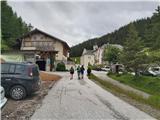
Starting point: Maria Waldrast (1638 m)
| Lat/Lon: | 47,13159°N 11,40445°E |
| |
Name of path: western approach from Maria Waldrast
Time of walking: 3 h 30 min
Difficulty: partly demanding marked way
Altitude difference: 1079 m
Altitude difference po putu: 1079 m
Map: Innsbruck und Umgebung, 31/5 1:50.000; Outdooractive Stubai Wanderkarte
Recommended equipment (summer): helmet
Recommended equipment (winter): ice axe, crampons
Views: 435
 | 1 person likes this post |
Access to the starting point:
From Ljubljana, take the motorway past Salzburg towards Munich. At the Dreieck Inntal multi-level junction, take the A93 towards Innsbruck/Kufstein/Brenner. On your return to Austria, continue to the Innsbruck-Mitte exit. Here, do not turn towards Innsbruck, but continue on the A13 motorway towards the Brenner Pass. Continue on the motorway until Matrei am Brenner, where you take exit 19-Matrei. Then take the B182 and follow it to the village of Mützens, where, with the help of reliable signs, you will find a narrower road which, after crossing a barrier (the toll is €6 for a car), will lead you within a few kilometres to a parking area near the inn and the monastery church.
The alternative is to drive through northern Itali: in this case, from central Slovenia, take the A2 motorway to one of the border crossings with Austria and continue to Lienz. Here you continue on the 100 road and pass the Prato alla Drava crossing into Itali. In Itali, follow the SS49 all the way to the junction with the A22 motorway in the direction of the Brenner Pass. After the pass, continue in the direction of Innsbruck to exit 19-Matrei at Matrei am Brenner. From there, continue along the route described above.
Path description:
From the parking lot of Maria Waldrast, the highest pilgrimage station in Austria, follow the signs for Serles along the path that turns left into the forest just after the church. Passing through grazing areas, follow the path which soon crosses a scree ravine in the eastern wall of Serles. Further on, an excellently marked path leads us through increasingly sparse high mountain forest, which is replaced by dwarf pines higher up, and twice more we cross the outcrops of the steep ravines that emerge from the rocky slopes above us. After a good hour's walk from the starting point, we reach the open grassy slopes in the heart of the Serles group, with a fine view of the southern part of the mountain range, where Lämpermahdspitze and Peilspitze are the first. The trail, which crosses a moderately steep slope in a series of switchbacks, is followed as far as the Serlesjöchl Pass, where the Marie Waldrast trail joins the longer alternative approach trail from Kampl in the Stubai Valley.
At the saddle, a further route opens up; head right towards the north-facing Serles and within a few minutes you will reach the first fixed safety gear on the route. Using a metal ladder and ropes, climb over a rocky ledge (partly difficult), then continue on the path, which crosses the moderately steep slopes of the Serles in switchbacks. Shortly after the first steel cables, cross the last protected area on the trail, and then follow a moderately steep but easy trail along the top slope of the mountain for a longer distance. Just below the summit ridge, the trail turns sharply right to the west and leads surely over a rocky threshold onto the vast summit plateau of Serlesa. From here, it's only a short walk to the highest point with its large cross and spectacular views.
It is worth noting that the high mountain trails in Tyrol are marked with blue (easy), red (medium) and black (difficult/very difficult) markings. Although the described route on Serles is marked with black circles and faces a short easy climbing route, I consider it to be comparable to Slovenian partially difficult routes without obvious exposed spots and higher technical difficulty.

Pictures:
 1
1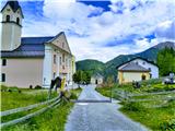 2
2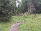 3
3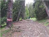 4
4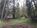 5
5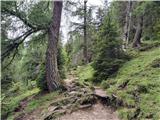 6
6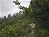 7
7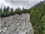 8
8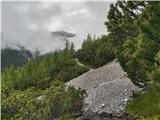 9
9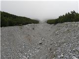 10
10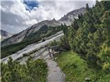 11
11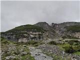 12
12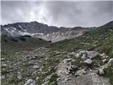 13
13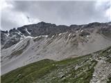 14
14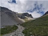 15
15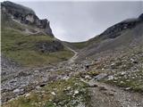 16
16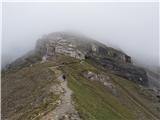 17
17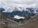 18
18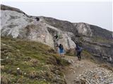 19
19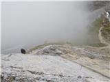 20
20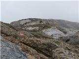 21
21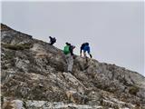 22
22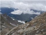 23
23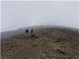 24
24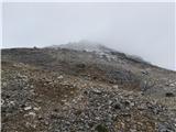 25
25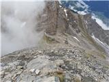 26
26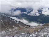 27
27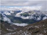 28
28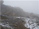 29
29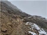 30
30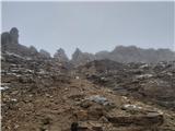 31
31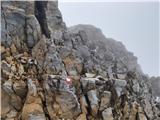 32
32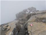 33
33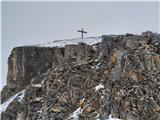 34
34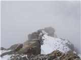 35
35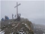 36
36
Discussion about the trail Maria Waldrast - Serles (western approach from Maria Waldrast)