Malga Ciapela - Punta Penia (Marmolada)
Starting point: Malga Ciapela (1559 m)
| Lat/Lon: | 46,42196°N 11,89277°E |
| |
Time of walking: 6 h 10 min
Difficulty: very difficult marked way, partly demanding unmarked way
Altitude difference: 1784 m
Altitude difference po putu: 1800 m
Map: Tabacco 06 1:25.000
Recommended equipment (summer): helmet, self belay set
Recommended equipment (winter): helmet, self belay set, ice axe, crampons
Views: 4.726
 | 3 people like this post |
Access to the starting point:
a) First, drive to Cortina d'Ampezzo (you can get here via Border crossing Rateče or Predel to Trbiž / Tarvisio and then take the motorway towards Udine to the Tolmezzo exit. From Tolmezzo, follow the road towards Ampezzo and the Passo della Mauria mountain pass. The road then descends and leads to a crossroads where you turn left (possibly right) towards Cortina d'Ampezzo. At all subsequent junctions, follow the signs for Cortina d'Ampezzo and then follow the signs for the Passo di Falzarego Alpine Pass. In the first part of the ascent towards the Falzarego Pass, you will reach a crossroads where the signs for Passo di Giau (2233 m) and Marmolado point to the left. After the Giau Pass, the road starts to descend and we follow it through the settlements in the lower part towards Marmolada or Passo di Fedaia. We then follow the road towards the Passo di Fedaia to a crossroads just before the bottom station of the gondola. Here, turn left onto the narrow asphalted road towards mountain pasture Malga Ciapela. The road then leads past the bivouac and the Malga Ciapela tourist farm. Just after the farm, the asphalted road ends. Here we park in one of the roadside car parks.
b) Access from Primorska: Take the motorway towards Padua, but only as far as the motorway junction, where you continue towards Veneto and Belluno. Near Belluno the motorway ends and we follow the road towards Belluno, where we turn right at a major junction towards Agordo. From there, follow the frequent signs for Marmolada or Passo di Fedaia. Follow the road towards Passo di Fedaia to a crossroads just before the bottom station of the gondola. Here, turn left onto the narrow asphalted road towards mountain pasture Malga Ciapela. The road then leads past the bivouac and the Malga Ciapela tourist farm. Just after the farm, the asphalted road ends. Here we park in one of the roadside car parks.
Path description:
From the parking lot, turn onto the macadam road, which is closed to traffic. First cross the bridge and then the road will lead you to a marked crossroads.
A footpath branches off to the left towards the Passo di Forca Rossa saddle, and we continue to the right on the dirt road, which climbs steeply. Soon we come to another crossroads. This time we head right into the forest on the footpath towards mountain pasture Malga Ombretta and the Falier hut. Further along the road and later on the mulatier, a second slightly sloping path leads to the same mountain pasture.
From the crossroads, the footpath begins to climb steeply and occasionally a fine view of the nearby peaks opens up from the path. The path then turns slightly to the right and crosses a steep slope as it ascends. The path is not difficult in this part as it is protected by a fence, and there are also steps to help us. The slope becomes less steep again and the path opens up to a view of a small dam along the way. The path continues to climb through the forest and later crosses the mulatier. The path becomes slightly more level and soon leads us out of the forest to the lookout mountain pasture Malga Ombretta where there is also a small hut.
From the hut, follow the path westwards through the pastures. The path then turns slightly to the right, following the right side of the valley. The path then leads through a short lane of woods and there is only a short climb to the Rifugio Failer hut, which is situated below the slopes of the summit of Cima Obretta.
From the hut, continue along route 610 towards the Passo Ombretta saddle. From the hut, the path ascends along the mulatier mainly through dwarf pines to the north. As you get a little closer to the Marmolada walls, dwarf pines ends and the trail turns to the left. The increasingly scenic route then climbs westwards and runs on terrain partly covered with grass. The grassy slopes later turn to scree and the path continues to climb gently westwards for some time. In the last part of the ascent towards the Passo Ombretta saddle, the path turns right and starts to climb steeply on scree up to the aforementioned saddle, where there is also a crossroads.
At the saddle, turn right onto the unmarked path. From the saddle, first climb up towards the Marmolada escarpment and then you will see a track crossing the steep scree to the west. Bear left on the path and you will see some old markings. The path is not maintained and in some parts the scree is very steep, so some caution is needed. After crossing the scree, join the marked path which leads past the Rifugio Contrin hut. The more difficult part can be avoided by descending from the Passo Ombretta saddle about 100 metres to the west side and then turning right onto an easier unmarked path. Alternatively, follow the marked trail down to a marked crossroads at 2400 metres and then turn right towards the Forcella Marmolada notch. In this case you will descend 300 metres. After crossing the trail to join the trail past the Rifugio Contrin hut, continue to the right and climb the steep scree that leads us under the wall where the climbing part of the trail is entered.
In the initial part, the climbing route climbs steeply up the right side of the ravine, helped by a number of scrambles. A relatively short initial climb leads to the Forcella Marmolada notch, where the path from Lago di Fedaia joins from the left.
At the notch, continue to the right and start climbing up the steep slope with the aid of crampons. The path then turns slightly to the right and briefly follows the ridge, where the view of the south side opens up again. The path then retreats slightly to the left and then climbs for some time along a ropeway on a number of staples and wedges. This path leads us back to the well protected ridge, which we then climb eastwards. In the last part, the path becomes less steep and a short traverse of a sloping snowfield ensues. If the snowfield is frostbitten, it is advisable to use a snowshoe and snowshoes, despite the fact that it is sloping.
There is a short, easy climb up to the shelter, where the path over the glacier joins from the left. From here, it's just a few steps of easy walking to the highest peak in the Dolomites.

Pictures:
 1
1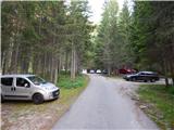 2
2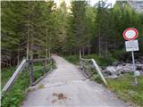 3
3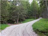 4
4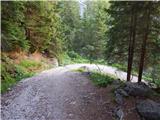 5
5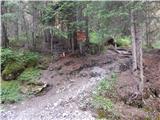 6
6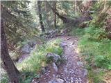 7
7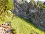 8
8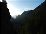 9
9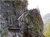 10
10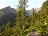 11
11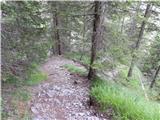 12
12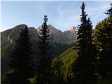 13
13 14
14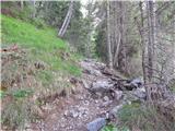 15
15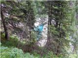 16
16 17
17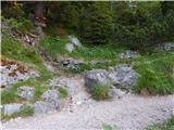 18
18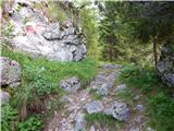 19
19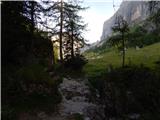 20
20 21
21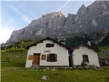 22
22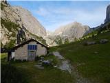 23
23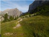 24
24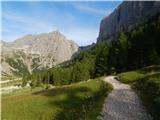 25
25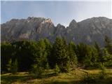 26
26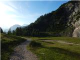 27
27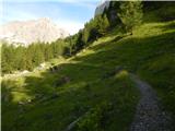 28
28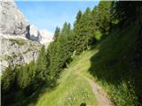 29
29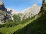 30
30 31
31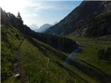 32
32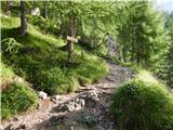 33
33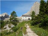 34
34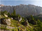 35
35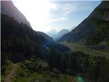 36
36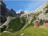 37
37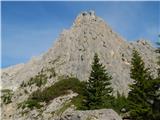 38
38 39
39 40
40 41
41 42
42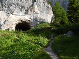 43
43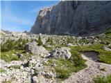 44
44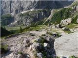 45
45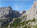 46
46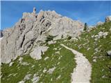 47
47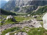 48
48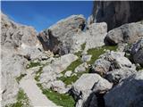 49
49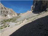 50
50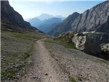 51
51 52
52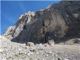 53
53 54
54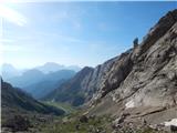 55
55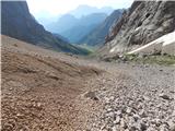 56
56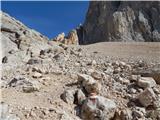 57
57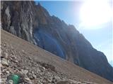 58
58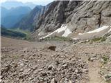 59
59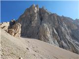 60
60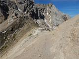 61
61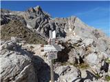 62
62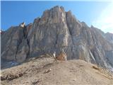 63
63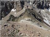 64
64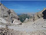 65
65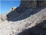 66
66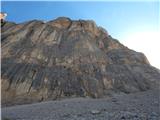 67
67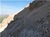 68
68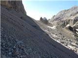 69
69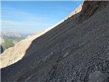 70
70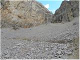 71
71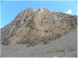 72
72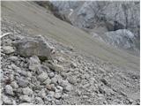 73
73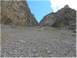 74
74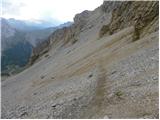 75
75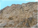 76
76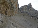 77
77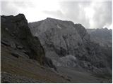 78
78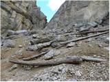 79
79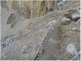 80
80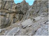 81
81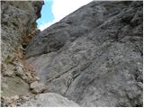 82
82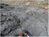 83
83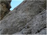 84
84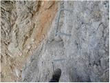 85
85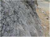 86
86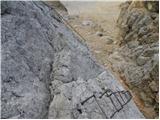 87
87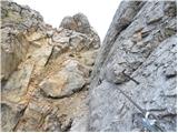 88
88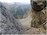 89
89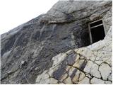 90
90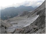 91
91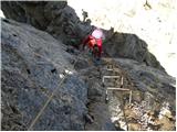 92
92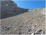 93
93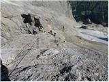 94
94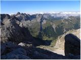 95
95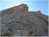 96
96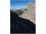 97
97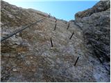 98
98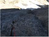 99
99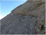 100
100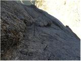 101
101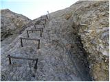 102
102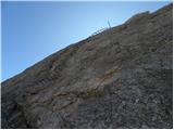 103
103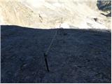 104
104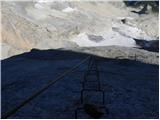 105
105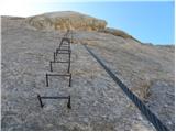 106
106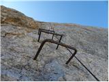 107
107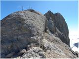 108
108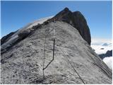 109
109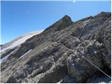 110
110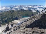 111
111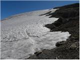 112
112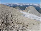 113
113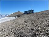 114
114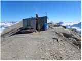 115
115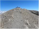 116
116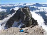 117
117 118
118
Discussion about the trail Malga Ciapela - Punta Penia (Marmolada)
|
| pinkapolonka28. 08. 2017 |
Pozdravljeni,
V soboto 26.8.2017 smo s hčerko in možem opravili opisano pot. Zgornji opis je sicer zelo dober, vendar smo imeli nekaj težav pri iskanju neoznačene poti od Passo Ombretta naprej. Usmerili smo se na desno neoznačeno pot, prvo možnost, ki jo predlaga avtor zgornjega opisa. Pot je od začetka dobro vidna, vidne so tudi stare označbe. Že proti koncu pa pot izgine, mislim da so jo odnesli hudourniki, ki so za seboj pustili globoke grabne. Poskušali smo prečiti grabne in še vedno nadaljevati prečno po meliščih, vendar smo se v končni fazi morali spustiti na pot, ki jo avtor omenja kot drugo možnost. Zato bi svetovala vsem, da se že na Passo Ombretta spustite 100m ter poiščete neoznačeno pot desno. Ta je še dokaj dobra in po njej melišča lahko prečimo brez težav. Po tej poti smo se mi vračali.
LP Barbara
|
|
|