Loke - Koča na Čemšeniški planini (via Krvavica)
Starting point: Loke (400 m)
| Lat/Lon: | 46,2072°N 14,9913°E |
| |
Name of path: via Krvavica
Time of walking: 3 h 30 min
Difficulty: partly demanding marked way
Altitude difference: 720 m
Altitude difference po putu: 950 m
Map: Posavsko hribovje - zahodni del 1:50.000
Recommended equipment (summer): helmet
Recommended equipment (winter): helmet, ice axe, crampons
Views: 5.474
 | 1 person likes this post |
Access to the starting point:
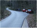
a) From the Ljubljana - Maribor motorway, take the Vransko exit and continue along the parallel old road towards Celje. Drive along the main road for a few kilometres, then signs for Tabor and Ojstriška vas point you to the right. Continue through Ojstriška vas to Tabor, and from there continue towards the village of Loke. In Loke you will come to a crossroads where you continue straight on (left Zajčeva koča) and follow the road to the next crossroads, which is after the village of Loke. Here, continue straight ahead (slightly left) in the direction of "Presedle" and follow the road to a parking area on the right side of the road, at which you will see mountain signs for Krvavica.
b) From the motorway Maribor - Ljubljana, take the exit Šentrupert and then continue along the parallel old road towards Trojany. Follow the main road for a few kilometres and then follow the signs for Tabor and Ojstriška vas to the left. Continue through Ojstriška vas to Tabor, and from there continue towards the village of Loke. In Loke you will come to a crossroads where you continue straight on (left Zajčeva koča) and follow the road to the next crossroads, which is after the village of Loke. Here, continue straight ahead (slightly left) in the direction of "Presedle" and follow the road to a parking area on the right side of the road, at which you will see mountain signs for Krvavica.
Path description:
From the parking lot, cross the road and follow the marked path towards Krvavica. The trail goes into the forest from the very beginning and starts to climb quite steeply. Higher up, the steepness eases a little and the path turns sharp left at a signpost (walk along the path for rare bird species nesting). The path then starts to climb steeply again and after a few minutes of further walking leads to an unmarked side ridge where it turns to the right. We continue to climb through the forest on a path that leads us higher up to a very steep slope. The steepness eases for a short time as the path leads us along an exposed and often muddy shelf. A steep climb follows up a grassy slope overgrown with sparse forest. At the top of this steep section, which is a slip hazard in wet conditions, the path leads to a natural window through which a protected mountain path is routed. With the help of crampons and a rope, we climb to the top of the window, followed by another 10 steps of walking on a steep grassy slope. The steepness then gives way and the path, which continues through the forest, soon leads us to the top of Krvavica.
From the top of Krvavice, we begin to descend steeply down a slightly exposed slope, and then the path leads us under the cliffs, from which we have a beautiful view. The path then passes into the forest and descends to a nearby forest road, which is only crossed (Zajčeva koča to the left, Presedlje and the village of Loke to the right). The ascent continues along the initially wide cart track, and we continue along a slightly steeper path to reach a road which we follow to the right. We continue to climb crosswise over the scenic slope, and after a few minutes the road leads us to a small crossroads where we join the path from Vrh.
Here, continue to the right and follow the road, passing Gunet's Head (926 m) on the left. On the other side of the summit we reach a lookout saddle, and the road turns to the left here, and we walk along it for only 100 m, then the signs for Čemšeniška mountain pasture direct us sharp right to cart track, which first crosses the lane of a forest, and then leads us to an overlook slope from which we have a beautiful view towards Krvavica. Here, the cart track, which continues to climb for some time, turns to the left and then gradually turns into a slightly steeper footpath. Higher up, the footpath splits into two parts, and we have the choice of continuing along the rather steep and less well maintained marked mountain path, or along the slightly less steep parallel 'Lojzova cesta', which is newly surfaced and marked with light blue dots. Higher up, the two paths merge, and the path gradually flattens out and leads us to the edge of a steep ridge. The path continues along the right-hand side of the ridge, which then flattens out and descends to a crossroads at a registration box. Continue straight on here (right down Vransko) and then at the next crossroads, which is only a few steps further on, straight on again (right Black Peak 1 minute). The way forward begins first zložno, then moderately descending towards Koča na Čemšeniški planini, which is reached after 15 minutes of further walking.

Pictures:
 1
1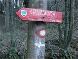 2
2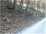 3
3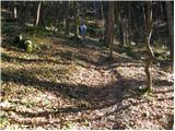 4
4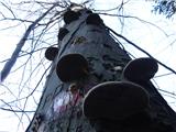 5
5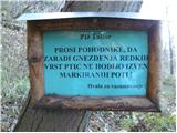 6
6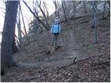 7
7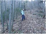 8
8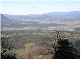 9
9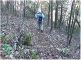 10
10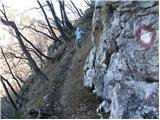 11
11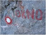 12
12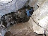 13
13 14
14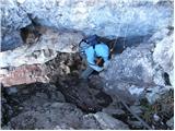 15
15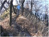 16
16 17
17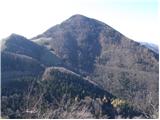 18
18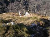 19
19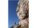 20
20 21
21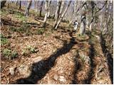 22
22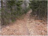 23
23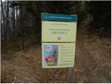 24
24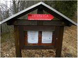 25
25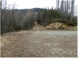 26
26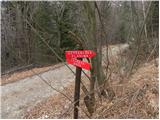 27
27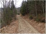 28
28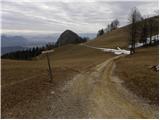 29
29 30
30 31
31 32
32 33
33 34
34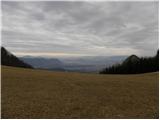 35
35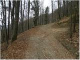 36
36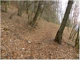 37
37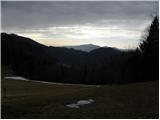 38
38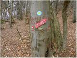 39
39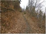 40
40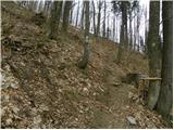 41
41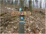 42
42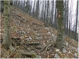 43
43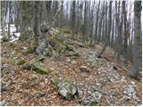 44
44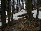 45
45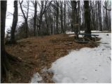 46
46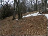 47
47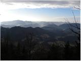 48
48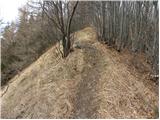 49
49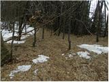 50
50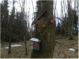 51
51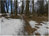 52
52 53
53 54
54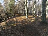 55
55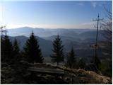 56
56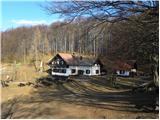 57
57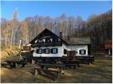 58
58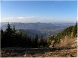 59
59
Discussion about the trail Loke - Koča na Čemšeniški planini (via Krvavica)