Lokavec - Veliki Modrasovec
Starting point: Lokavec (170 m)
| Lat/Lon: | 45,902°N 13,8813°E |
| |
Time of walking: 2 h 50 min
Difficulty: easy marked way
Altitude difference: 1183 m
Altitude difference po putu: 1200 m
Map: Goriška 1:50.000
Recommended equipment (summer):
Recommended equipment (winter): ice axe, crampons
Views: 7.488
 | 2 people like this post |
Access to the starting point:
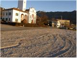
Take the expressway from Razdrteg to Nova Gorica or vice versa and take the Ajdovščina exit. Then turn left at the crossroads in the route Nova Gorica and drive to the village of Cesta, where the sign for Lokavec directs you to the right. Follow this road to the large parking area by the church in the village Lokavec, where there are also signs for Čaven.
Path description:
From the parking lot, continue along the road towards Čavna. The road climbs gently between the houses and soon leads to a small crossroads near a small stream. Here we continue along the left-hand road and the left-hand side of the stream, which leads us at the end of the village to cart track, which we then climb. Continue along cart track, which slowly turns into a footpath. The path crosses a worse forest road after a while and shortly afterwards leads to a crossroads, where we continue straight in the direction of Čavna. The path then leads to a small spring and then climbs steeply for a few dozen steps. The way forward leads us to uncultivated slopes from which we have a beautiful view of the Nanos, Vipava valley and the surrounding hills. A little further on, the path again crosses a porer forest road and climbs parallel to it for a short distance. Just a little further on we come to a wider road, which we follow to the right, but only for a few steps, and then the signs direct us up to the left. The path ahead starts to climb steeper and crosses a marked path a little higher up (crossing the Srednječavensko trail). Here continue straight up the path, which is getting very steep. A little further on, the path, which most of the time was through the forest, crosses again some scenic slopes. A little further on, the path leads us to a ridge where we have two options for continuing. The left one runs just below the ridge and is less scenic than the one along the ridge, but it is more forgiving in the event of a strong storm. After 10 minutes, the two paths merge and lead to the uncultivated grassy slopes to the east of Mala Gora.
Here the steepness eases and the route continues through beautiful meadows where, in spring and summer, many mountain flowers are seen. A little further on, the path from Stomaž joins us from the left. Here we continue straight along the path, which leads us in a few minutes to the hut at Čavno.
Behind the hut, the signs for Modrasovec and Golake direct us to the right to a meadow, across which we climb crosswise into the forest. Once in the forest, we quickly cross the undistinguished ridge of Maly Modrasovec (here an unmarked trail branches off to the right to Mali Modrasovec for 5 minutes), and we continue straight ahead along cart track, which descends slightly and turns slightly to the right. Just a little further on, we come to a marked crossroads where we continue straight on in the direction of Modrasovec (slightly to the right Golaki). We continue our ascent along a wider, but rather overgrown path which gradually changes to the right side of the ridge. From the wide path, or worse cart track, a marked footpath soon branches off to the left, and within a few minutes of further walking you will reach the top of Veliki Modrasovac. Lokavec - Koča na Čavnu 2:30, Koča na Čavnu - Veliki Modrasovec 20 minutes.

Pictures:
 1
1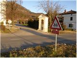 2
2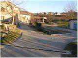 3
3 4
4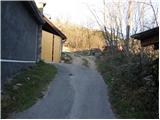 5
5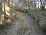 6
6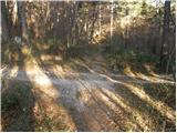 7
7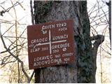 8
8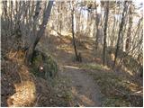 9
9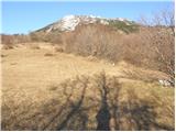 10
10 11
11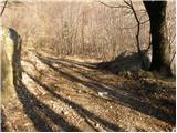 12
12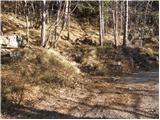 13
13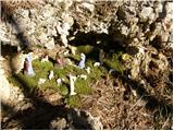 14
14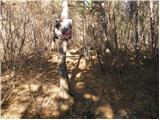 15
15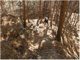 16
16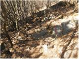 17
17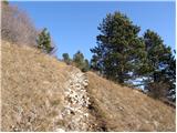 18
18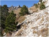 19
19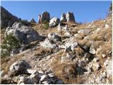 20
20 21
21 22
22 23
23 24
24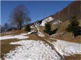 25
25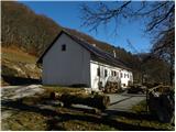 26
26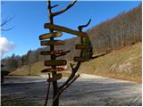 27
27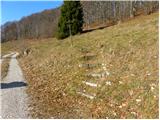 28
28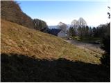 29
29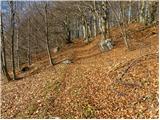 30
30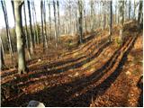 31
31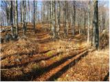 32
32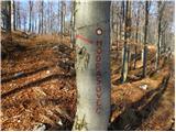 33
33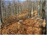 34
34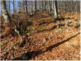 35
35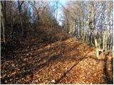 36
36 37
37 38
38
Discussion about the trail Lokavec - Veliki Modrasovec
|
| Kigeot15. 04. 2015 |
Pot do koče je zelo zelo lepa. In je tudi naporna, ker je strmo. Sam vrh Modrasovca pa je totalno nezanimiv. Za priti 1x, lih da si rečeš, da si bil... 
|
|
|
|
| darinka416. 04. 2015 |
Zakaj pa ne greste na Kucelj od koče je 40 minut.Je lep razgled daleč naokoli, na Modrasovcu ,pa nisem bila, bom pa zagotovo šla.
|
|
|