Starting point: Ljubelj (1058 m)
| Lat/Lon: | 46,4324°N 14,2602°E |
| |
Time of walking: 2 h 55 min
Difficulty: very difficult unmarked way
Altitude difference: 966 m
Altitude difference po putu: 966 m
Map: Karavanke - osrednji del 1:50.000
Recommended equipment (summer): helmet
Recommended equipment (winter): helmet, ice axe, crampons
Views: 38.022
 | 2 people like this post |
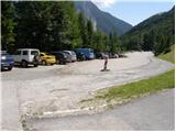
Access to the starting point:
From the Ljubljana - Jesenice motorway, take the Ljubelj exit and follow the road to the border crossing. Just a few metres before the border crossing, the signs for Zelenica direct us to the left and after a few 10 metres of further driving, the road leads to a parking lot under the Zelenica ski centre.
Path description:
From the parking lot, follow the footpath towards Zelenica, Vertatscha and Hochstuhla. The dirt track, which runs along the left-hand side of the ski slope, leads us after about 15 minutes of moderate ascent through the forest to the aforementioned slope along which we then climb. The path, which offers beautiful views of the extensive scree Begunjščica on the left and the ridge Ljubeljščica on the right, then leads us in a gentle ascent to the hut at Vrtača. From the hut, continue straight along the marked path, which slowly turns slightly to the left and, after a short cross-climb, leads us to lane of dwarf pines. The path then climbs steeply for a short time and then leads to cart track (transport-rescue road), which is then followed in a moderate ascent to the mountain home at Zelenica.
From the lodge at Zelenica, continue right towards Hochstuhla and Vertatscha (left Begunjščica) along the path, which turns left immediately after the lodge and climbs by the children's ski lift. Somewhere halfway up the lift you come to a less obvious crossroads, where you continue right and cross over the ski slope (straight ahead to the hut at the source of the Završnice River). Next, cross a short lane of forest and the path leads to the next lift which you cross in a slight downhill. On the other side of the ski slope, you will see a larger rock with a marker on it, which will direct you into the forest. The path then descends gently and after a few minutes of further walking leads us to the outlet of the valley of Suhego dwarf pines, where the unmarked path to Palec branches off to the right upwards.
Continue towards Palec (straight ahead Hochstuhl and Vertatscha) on the path which climbs through the lane of a forest and leads us higher up to the scree of Vertatscha and Palec. Here the steepness eases and the path then leads us along the valley of the dwarf pines. Higher up, the path turns slightly right and climbs steeply again. After a few minutes of further walking, we reach the border ridge (Žleb 1916m) from where we have a view of the Austrian side.
Continue left (right Palec) along the path which climbs crosswise over the scree below Pautz. After a few minutes of ascent, the path leads us to the next saddle, this time on the western side of Zelenjak. From here, continue to the right along a faintly visible path that climbs crosswise up the very steep top slope of the mountain. The path, which shows the route cairns, leads us along a steep slope which is dangerous for slipping. After about 10 minutes of difficult work, we reach the summit. Great care is needed when descending from the summit.
Ljubelj - Zelenica 1:20, Zelenica - Zelenjak 1:35.

We can extend the trip to the following destinations: Vrtača
Pictures:
 1
1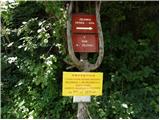 2
2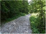 3
3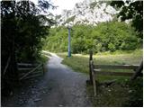 4
4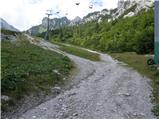 5
5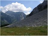 6
6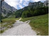 7
7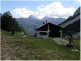 8
8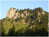 9
9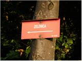 10
10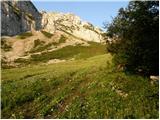 11
11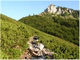 12
12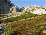 13
13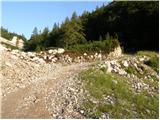 14
14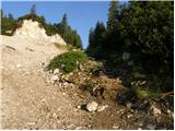 15
15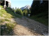 16
16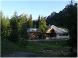 17
17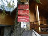 18
18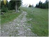 19
19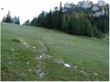 20
20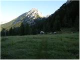 21
21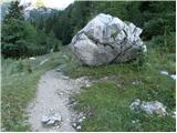 22
22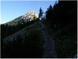 23
23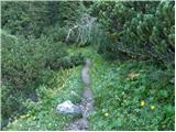 24
24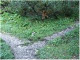 25
25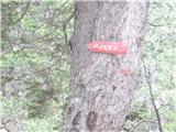 26
26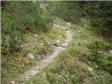 27
27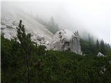 28
28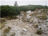 29
29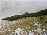 30
30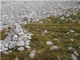 31
31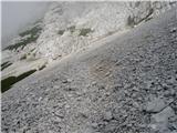 32
32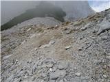 33
33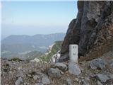 34
34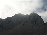 35
35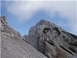 36
36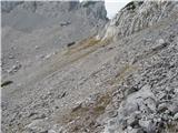 37
37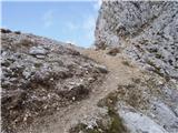 38
38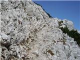 39
39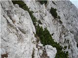 40
40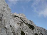 41
41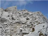 42
42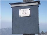 43
43
Discussion about the trail Ljubelj - Pautz/Zelenjak
|
| Guest15. 11. 2007 |
Ali je možno nealpinistično nadaljevanje iz vrha Zelenjaka proti Vrtači? Hvala za odgovor Frenk
|
|
|
|
| Guest15. 11. 2007 |
Po grapi Y je v snegu sorazmerno "lahek" dostop. Pod Zelenjakom se na levi strani (na pobočjih Vrtače) odpre grapa, ki je sprva lahko prehodna, višje pa postane strma do 45 stopinj naklona. Vsaj malo alpinističnega znanja pa mislim, da je potrebno. Najemi vodiča 
|
|
|
|
| anda27. 05. 2009 |
Ali kdo ve kako je s snegom na poti na Zelenjak?
|
|
|
|
| JUREE28. 05. 2009 |
Jaz sem bil danes popoldne na Palcu. Ruševje je ponekod še pod snegom,ki se ne predira,
tako da se hodi brez problema.
Melišče je kopno, na poti od mejnega grebena proti vrhu Palca je le še en "jezik" ostanka snega.
Na Zelenjak nisem šel, pod njim je
še nekaj snega, samo pobočje je bilo videti kopno.
|
|
|
|
| velkavrh14. 06. 2011 |
Danes je bil moj tudi Zelenjak. Od spodaj se zdi morda nezahteven, lahko ga pa popestriš kot sem ga jaz in si narediš mali alpinistični podvig. Nekje na sredini sem šel bolj v levo in plezal skoraj do vrha. Prehodi se dajo lepo najti.Treba pa je biti previden,da se pri plezanju ne zaplezaš. Res ta vrh ni za vsakogar. Sicer je skalovje kratko. Na vrhu je lep križ in vpisna knjiga. Paziti tudi pri sestopu. So pa čudovi razgledi, če je vreme lepo. Danes sem jih bolj slutil. Oba vrhova sta eden zraven drugega, mislim še Palec ali Zelenica kot piše na stari tabli na vrhu, tako da imaš dva dvatisočaka obenem prehojena.
|
|
|
|
| velkavrh14. 06. 2011 |
Ja Klin, večkrat naredim poldnevne ture pred šihtom dopoldne ali po šihtu popoldne. Sobote, nedelje ali prosti dnevi pa so rezervirani za celodnevne ture. V tej smeri bom v kratkem šel še na Vrtačo in Begunjščico. Na Stol mislim pa iti iz jeseniške strani. L.P.
|
|
|
|
| magroman26. 07. 2014 |
Danes s kolegom opravila jutranji skok na Zelenjak,z njega pa še na Palec.Večinoma oblačno,vendar brez dežja.Torej vroče ni bilo,zaradi nočnega deževja pa sva bila pri prebijanju skozi borovčke(ruševje)oba mokra kot cucka.Pri sestopu sva jo mahnila kar malo nad borovci po melišču.Meni zelo luštna turca,jo priporočam.
|
|
|
|
| Grenaleva19. 10. 2015 |
Čez ruševje gre ok, je res posekano, odcep pa ni več označen z možicem. Ga je treba kar poiskati, kakih 20 minut od koče na Zelenici.
|
|
|
|
| J.P.24. 10. 2021 21:38:44 |
Odcep za Suho rusevje je oznaceno z mozicem...krizisce prepoznamo tudi po kamnu na tleh ,ki ima oznako za smer na Vrtaco.Trenutno posebnosti ni, zaplate snega nas ne ovirajo.Varen korak, Lp
|
|
|
|
| Kalisan12. 05. 2022 09:27:32 |
Mene pa zanima, ce je ze kdo sel na Zelenjak ali Palec s psom? Hvala
|
|
|
|
| turbo12. 05. 2022 10:16:12 |
|
|
|
|
| ppegan12. 05. 2022 10:53:49 |
Jaz sem tudi bila, že večkrat, in to z dvema psičkama hkrati  Nobena ni imela težav, Palec sploh ni problematičen, Zelenjak je pa sam na začetku mal bl strm, ampak gre na vse štiri brez težav  Seveda pod pogojem, da je pes vsaj malo vajen hoje v visokogorje 
|
|
|