Lipovnik - Šteharski vrh (Šteharnikov vrh)
Starting point: Lipovnik (739 m)
| Lat/Lon: | 46,5677°N 14,9935°E |
| |
Time of walking: 45 min
Difficulty: easy marked way
Altitude difference: 279 m
Altitude difference po putu: 279 m
Map: Koroška 1:50.000
Recommended equipment (summer):
Recommended equipment (winter): crampons
Views: 1.980
 | 1 person likes this post |
Access to the starting point:
a) From the road Slovenj Gradec - Dravograd, take the exit towards Raven na Koroškem from the large roundabout, then drive towards the above-mentioned place, but only up to the crossroads, where the signs for Sv. Križ, Podklanc and Dobrovo direct you to the right through the underpass under the railway line. At Dobrova pri Dravogradu, turn left and then start climbing. The road then leads past the Church of St. Križ, and higher up at the crossroads follow the signs for Lipovik Farm. When you reach the farm, park in a suitable place.
b) From Črna na Koroškem or via Border crossing Holmec, take the road to Prevalje, from where you continue to Dravograd. When you arrive at Ravne na Koroškem, turn left after the Špar shop and the Petrol station onto the road in the direction of Tolste Vrho, Strojna and Zelen brega, which continues along the Zelenbreško brook. The road initially passes under the railway underpass and then climbs gently to moderately along the stream. A little further on, go slightly right, on the road in the direction of the farms Lipovnik, Anžnik and Šteharnik and in the direction of the settlements Strojna and Tolsti Vrh. The road then becomes steeper and more serpentine, and we follow it at the crossroads in the direction of Šteharnik and Lipovnik farms. When you reach the Lipovnik farm, park in a suitable place next to the farm.
Path description:
From the farm, continue eastwards, and at the part where the road turns into a forest, bear slightly left on cart track, which climbs gently to the right. After a few minutes, we arrive at a marked crossroads where we join the path from Dravograd, and we continue left in the direction of Šteharski vrh, and the path leads us a little further along the upper edge of the lookout hayfield, from which we have a beautiful view towards Uršlja gora, Kamnik Savinja Alps and Pec. Above the marked part, the path passes into the forest and continues to climb along and along the eastern to south-eastern ridge of Šteharski vrh. There is some climbing on the part that was badly damaged by a windstorm in December 2017, so in some places it is necessary to make some detours to the left or right of the marked trail. In the last part, the path is laid and, with a temporary view of Golica / Koralpe, leads us to the 1018 m high summit.
Description and pictures refer to the situation in 2018 (March).

Pictures:
 1
1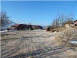 2
2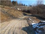 3
3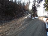 4
4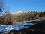 5
5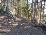 6
6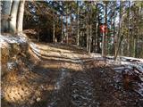 7
7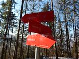 8
8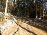 9
9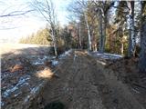 10
10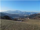 11
11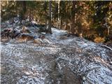 12
12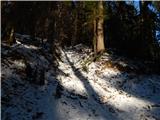 13
13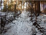 14
14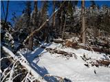 15
15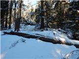 16
16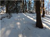 17
17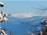 18
18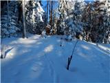 19
19 20
20
Discussion about the trail Lipovnik - Šteharski vrh (Šteharnikov vrh)