Leibnitzbachbrücke - Hoher Prijakt
Starting point: Leibnitzbachbrücke (1656 m)
| Lat/Lon: | 46,91503°N 12,66483°E |
| |
Time of walking: 4 h 15 min
Difficulty: difficult marked way
Altitude difference: 1408 m
Altitude difference po putu: 1430 m
Map:
Recommended equipment (summer): helmet
Recommended equipment (winter): helmet, ice axe, crampons
Views: 1.480
 | 5 people like this post |
Access to the starting point:
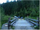
Drive through the Karavanke Tunnel into Austria, then continue to Spittal and on to Lienz (the motorway ends a little after Spittal). We continue along a relatively nice and wide road through the Drava Valley. In the centre of Lienz, at the roundabout, turn right towards Matrei. From the roundabout, continue along the valley of the Isel for about 8 km, then turn right towards Oberleibnig. Follow the signs for the Hochschoberhütte on the ascending road. The road climbs steep slopes and is quite narrow most of the time. At the last part, the asphalt ends and you continue on a dirt road for a few kilometres until you reach the parking area by the bridge over the Leibnitzbach stream.
Path description:
From the parking lot, continue along the macadam road for a few metres, which is then closed to traffic, and then signs direct you to the right onto a footpath. At first, you climb through the woods with the Leibnitzbach stream on your left. Later, a path called Eduard Jordan Weg leads to slightly flatter grassy terrain where you cross a bridge. Then the path climbs again a little steeper along the stream and leads to the mountain pasture Leibnitzalm.
At mountain pasture the path crosses the stream and then joins the mountain road. Continue along the dirt road along the stream for a while and then come to a crossroads where the dirt road turns left.
At the crossroads, we continue straight ahead, where we are directed by signs along the way. From the crossroads, initially follow the wide cart track, which soon becomes a track after crossing the stream. The path starts to climb a little steeper here again and leads through a short lane of woods. The path continues along the stream and is soon joined on the left by a track from the end of the road. The path then turns slightly to the right and the views of the surrounding peaks start to open up. The path then runs along grassy slopes past a cross, and there are a few benches along the way. When you reach the slightly steeper slopes, the path turns left and then ascends the slopes all the way to the Hochschoberhütte hut.
At the hut where there is a crossroads, turn right to follow the signs "Barrenlesee 1,5h" and continue along the relatively flat grassy terrain in a southerly direction. The scenic route then begins to climb slightly and continues towards the slopes of the Hoher and Niederer Prijakt. As you get a little closer to the walls of these peaks, the slope flattens out and the path leads to a marked crossroads.
At the crossroads, continue left towards the Hoher Prijakt peak and the Barrenlesee lake, and right towards the Mirschachscharte notch, over which the western path leads to the Niederer Prijakt peak. The terrain becomes increasingly rocky and the path follows the valley towards the east. The path then leads to the cirque called Kleiner Barren, where there is also a small unnamed lake. Shortly before the lake, the path leads to a marked crossroads.
Leave the trail here towards the Mirnitzscharte and head right towards Lake Barrenlesee and the summit of Hoher Prijakt. The path from the crossroads is slightly less beaten but well-marked and initially follows a rough scree uphill. The slope becomes steeper as you go up and in a few places you have to use your hands to help you up. Later, the slope becomes less steep again and the path through an undistinguished rocky valley soon leads to the high mountain lake Barrenlesee at 2727 metres.
At the lake, continue to the right and climb again on rough scree. We then climb for some time quite steeply up the eastern slopes of the Hoher Prijakt. The steepness then eases a shade and the path heads south to the Westliche Barreneckscharte, which offers a view to the south.
The slope here is strewn with rock slabs, so the path is less visible in this part. However, the path is sufficiently well marked so that the ascent is not difficult. Following this path, you will soon reach the summit, which is overlooked by a lookout point with a registration box.
You can descend by following the ascent route. From the summit, it is also possible to continue along a slightly more difficult path towards the summit of Niederer Prijakt.

Pictures:
 1
1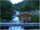 2
2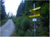 3
3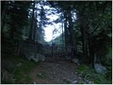 4
4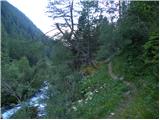 5
5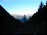 6
6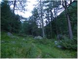 7
7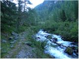 8
8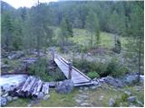 9
9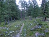 10
10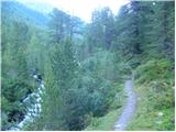 11
11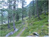 12
12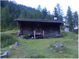 13
13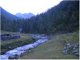 14
14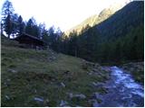 15
15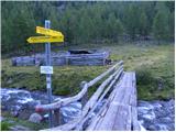 16
16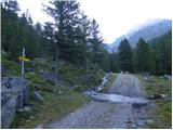 17
17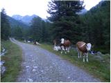 18
18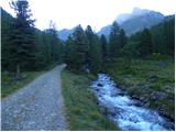 19
19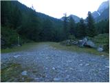 20
20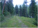 21
21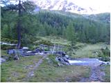 22
22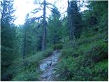 23
23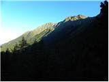 24
24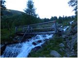 25
25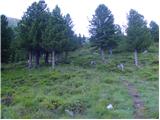 26
26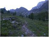 27
27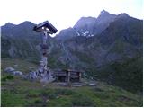 28
28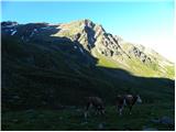 29
29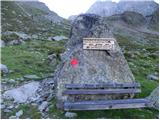 30
30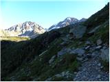 31
31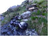 32
32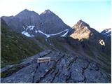 33
33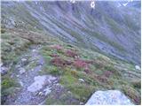 34
34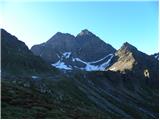 35
35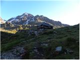 36
36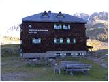 37
37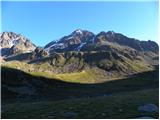 38
38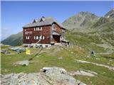 39
39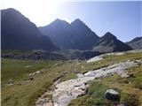 40
40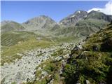 41
41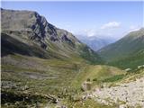 42
42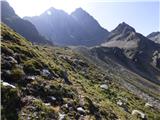 43
43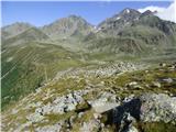 44
44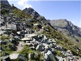 45
45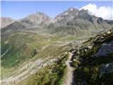 46
46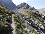 47
47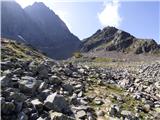 48
48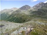 49
49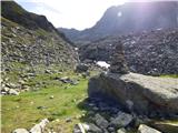 50
50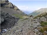 51
51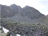 52
52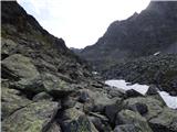 53
53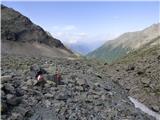 54
54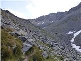 55
55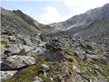 56
56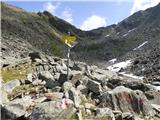 57
57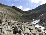 58
58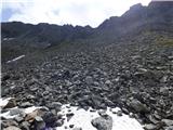 59
59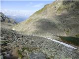 60
60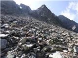 61
61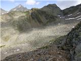 62
62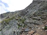 63
63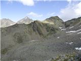 64
64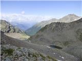 65
65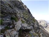 66
66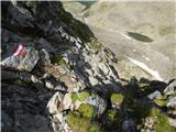 67
67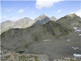 68
68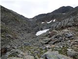 69
69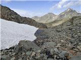 70
70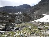 71
71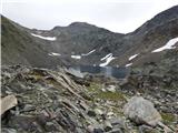 72
72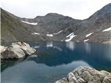 73
73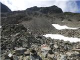 74
74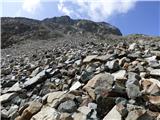 75
75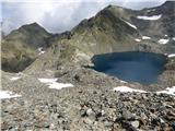 76
76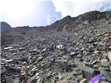 77
77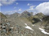 78
78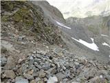 79
79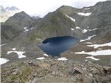 80
80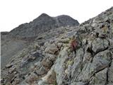 81
81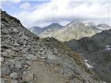 82
82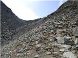 83
83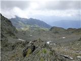 84
84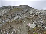 85
85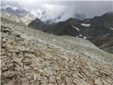 86
86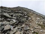 87
87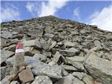 88
88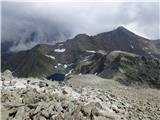 89
89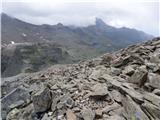 90
90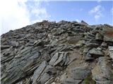 91
91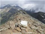 92
92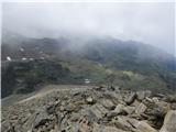 93
93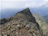 94
94
Discussion about the trail Leibnitzbachbrücke - Hoher Prijakt
|
| pohodnik3334. 09. 2023 18:04:45 |
Tura z tam 31.9.2023.
Dodal bi opis za pristop po nemarkirani poti z juga, jv z bližine Alkuser See(jezerce) do škrbine.
Shojena ni skor nič, večinoma brezpotje. Redko so na voljo možicelji. Včasih samo 1 bel kamen na temnejši skalni podlagi. Je bolj divja, kr je nekaj prebijanja skos grobo melišče, skalne plošče z luknjami vmes, tko da je treba bit previden. Ne glede na to ob normalnih pogojih ne predstavlja orientacijskih problemov, je dokaj naravnost. Pod škrbino je zoprno kratko strmo fino melišče. Najbolje je it mal v desno ter si pomagat z oprimki ob skali. Od škrbine naprej je avtor že opisal pot ter pristop z S smeri je markiran. Malo težji odsek je, če se nadaljuje z Hoher
Prijakt proti Niederer Prijakt, torej še en vrh, ki je malo manjši. Med tema dvema prek škrbine je napeljana jeklenica. Zahtevnost je na ravni Slovenske B zavarovane poti, en odsek je kr izpostavljen. Vse skupaj je kratko 20 - 25 min med dvema vrhovoma v 1 smer.
Lp,
|
|
|