Leibnitzbachbrücke - Hochschober (via Staniskascharte)
Starting point: Leibnitzbachbrücke (1656 m)
| Lat/Lon: | 46,91503°N 12,66483°E |
| |
Name of path: via Staniskascharte
Time of walking: 5 h
Difficulty: very difficult marked way
Altitude difference: 1584 m
Altitude difference po putu: 1610 m
Map:
Recommended equipment (summer): ice axe, crampons
Recommended equipment (winter): ice axe, crampons
Views: 4.707
 | 3 people like this post |
Access to the starting point:
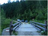
Drive through the Karavanke Tunnel into Austria, then continue to Spittal and on to Lienz (the motorway ends a little after Spittal). We continue along a relatively nice and wide road through the Drava Valley. In the centre of Lienz, at the roundabout, turn right towards Matrei. From the roundabout, continue along the valley of the Isel for about 8 km, then turn right towards Oberleibnig. Follow the signs for the Hochschoberhütte on the ascending road. The road climbs steep slopes and is quite narrow most of the time. At the last part, the asphalt ends and you continue on a dirt road for a few kilometres until you reach the parking area by the bridge over the Leibnitzbach stream.
Path description:
From the parking lot, continue along the macadam road for a few metres, which is then closed to traffic, and then signs direct you to the right onto a footpath. At first, you climb through the woods with the Leibnitzbach stream on your left. Later, a path called Eduard Jordan Weg leads to slightly flatter grassy terrain where you cross a bridge. Then the path climbs again a little steeper along the stream and leads to the mountain pasture Leibnitzalm.
At mountain pasture the path crosses the stream and then joins the mountain road. Continue along the dirt road along the stream for a while and then come to a crossroads where the dirt road turns left.
At the crossroads, we continue straight ahead, where we are directed by signs along the way. From the crossroads, initially follow the wide cart track, which soon becomes a track after crossing the stream. The path starts to climb a little steeper here again and leads through a short lane of woods. The path continues along the stream and is soon joined on the left by a track from the end of the road. The path then turns slightly to the right and the views of the surrounding peaks start to open up. The path then runs along grassy slopes past a cross, and there are a few benches along the way. When you reach the slightly steeper slopes, the path turns left and then ascends the slopes all the way to the Hochschoberhütte hut.
At the hut, continue slightly to the left (northwards) following the signs "Hochschober über Staniskascharte". The path initially descends slightly on a grassy slope and then crosses a stream. The path then starts to climb again and the views of the surrounding peaks get better and better. The trail continues to climb the southern slopes near the stream and leads to Lake Schoberlacke, which is located below the southern slopes of Hochschober.
From the lake the path continues northwards and climbs up the valley on the eastern side of the Kleines Schöberl and Langes Schöberl peaks. The path then climbs slightly steeper towards the Staniskascharte. Snowdrifts are still possible on this section even in late summer, so the use of snowshoes and snowshoes is necessary. At the notch where the signposts are, continue right and start climbing steeply along the rocky ridge. Higher up, the path becomes slightly less steep and bypasses the summit (3185m) on the south side. The path then leads along the ridge towards the main summit and is followed by another steep climb. In the shorter part, we are also helped by a cable car. In the last part, the path becomes less steep and the summit is soon reached along a scenic ridge.
The route described is particularly difficult because of the snowfields, which persist well into the summer, and it is essential to have crampons and an ice axe to cross the snowfields safely. In a few places, however, some easy climbing is also required (level 1).
Descend either by the ascent route or by the route along the east ridge of the mountain.

Pictures:
 1
1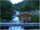 2
2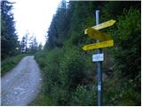 3
3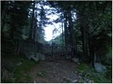 4
4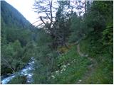 5
5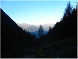 6
6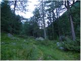 7
7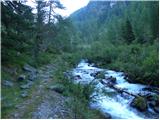 8
8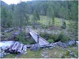 9
9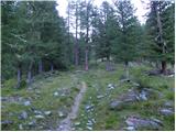 10
10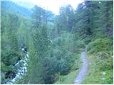 11
11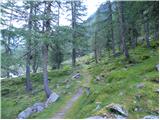 12
12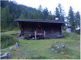 13
13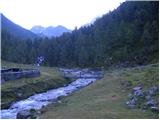 14
14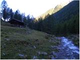 15
15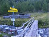 16
16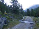 17
17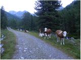 18
18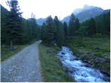 19
19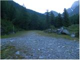 20
20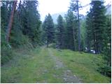 21
21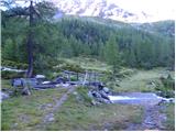 22
22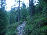 23
23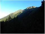 24
24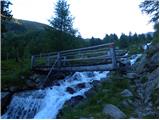 25
25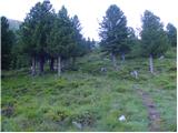 26
26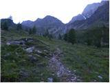 27
27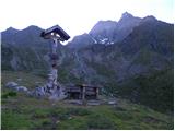 28
28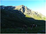 29
29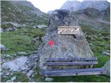 30
30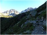 31
31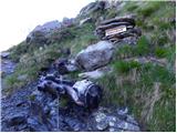 32
32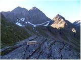 33
33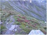 34
34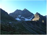 35
35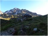 36
36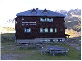 37
37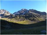 38
38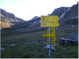 39
39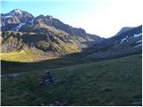 40
40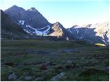 41
41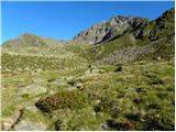 42
42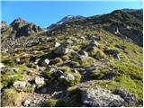 43
43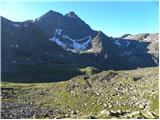 44
44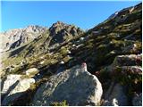 45
45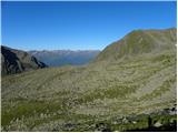 46
46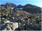 47
47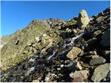 48
48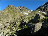 49
49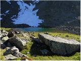 50
50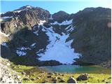 51
51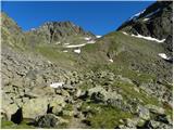 52
52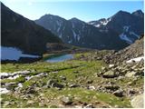 53
53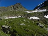 54
54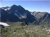 55
55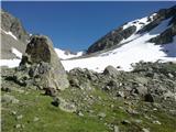 56
56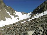 57
57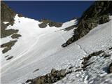 58
58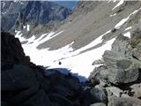 59
59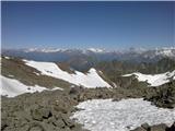 60
60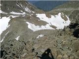 61
61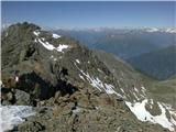 62
62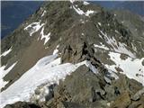 63
63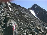 64
64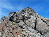 65
65
Discussion about the trail Leibnitzbachbrücke - Hochschober (via Staniskascharte)
|
| pohodnik3334. 09. 2023 16:26:05 |
 Tura z 1.9.2023. Tko kot je avtor opisal. Dodal bi še, 1 septembra je bilo nekaj snega nad 3050m naprej ter to samo na poti z zahoda, pot z vzhoda kopna. Pomoj ga je nekaj dni nazaj vrglo ob poslabšanju ter še ni skopnel. Derez ni bilo treba uporabit, sicer pa se lahk kočo pokliče ter vpraša. Samovarovalnega kompleta tle ni treba. Neki je treba rahlo poplezat 1 stopnja kot je avtor rekel. Pot z vzhoda je malo lažja ter manj problemov z snegom po moje. Ena zanka je pr sestopu prot vzhodu, na spodnjem delu pred meliščem. Markacije so po bolj strmem delu, marsikdo pa spregleda ter gre bolj v desno. Vendar je tud tam napeljana jeklenica, ki je ohlapna ter ni fiksirana v spodnjem delu. Enih par se jih ni drznilo it po zajli ter so se obrnil(nadaljeval tam k je markirana).Lepa gora, vredna obiska, pomoj po obiskanosti takoj za Glödisom v tej ožji grupi. Zame je najlepša varjanta it po levi smeri z koče, torej jugo-zahod it gor ter na vzhod sestopit. V primerjavi z nekaterimi okoliškimi vrhovi je pot tekoča, ni prebijanja skos nasute kamne, bloke. Cene v koči ok, velik pir 5 eur, kar je sprejemljivo. Lp
|
|
|
|
| Danijel Ž.17. 09. 2023 19:34:43 |
Res lepa tura. Ob poti proti koči še veliko malin in borovnic. Krožna varianta v smeri urinega kazalca je priporočljiva.
|
|
|