Laško - Storžič (on southwest ridge)
Starting point: Laško (740 m)
| Lat/Lon: | 46,3256°N 14,3969°E |
| |
Name of path: on southwest ridge
Time of walking: 3 h 30 min
Difficulty: difficult unmarked way
Altitude difference: 1392 m
Altitude difference po putu: 1392 m
Map: Karavanke - osrednji del 1:50.000
Recommended equipment (summer):
Recommended equipment (winter): ice axe, crampons
Views: 11.130
 | 1 person likes this post |
Access to the starting point:
a) From the motorway Ljubljana - Jesenice, take the exit Kranj - East, then continue driving towards Jezersko. When you reach Preddvor, leave the main road and turn left towards the centre of the town, and from there follow the signs for Bašelj. When we arrive in Bašelj, first at the beginning of the left turn in the direction of straight ahead there is a narrower road leading to the parking lot at the log cabin TD Bašelj (in the descriptions the starting point Bašelj), and from the mentioned crossroads we continue along the main road for another 100 m to the next crossroads, where we continue to the right along the road towards the Gamsovemu raje and the hamlet Laško (Laško hamlet). Only about 50 m further on, continue along the left-hand road, which gradually starts to climb moderately. At the hamlet of Laško, turn left again, then the asphalt ends and you continue along a steep macadam road, which you follow to a parking area, at a small crossroads. There are red mountain direction signs at the crossroads.
b) From the motorway Jesenice - Ljubljana, take the exit Kranj - West and continue left at the first junction. Continue through the underpass under the motorway and then to the roundabout, from where you continue in the direction of Golnik. The road continues through the village Mlaka pri Kranju, and at the end of the village we turn right in the direction of Srakovlje. Then drive through Srakovlje, Spodnja Bela, Srednja Bela, Zgornja Bela (in Zgornja Bela we join the road from Preddvor) to Bašlja, where the main road makes a long left turn, where a narrower road continues in a straight direction, leading to the parking area at the log cabin TD Bašelj (in the descriptions the starting point Bašelj), and from this junction we continue along the main road for another 100 m to the next junction, where we continue right along the road towards Gamsovem raje and the hamlet of Laško. Only about 50 m further on, continue on the left road, which gradually starts to climb moderately. At the hamlet of Laško, turn left again, then the asphalt ends and you continue along a steep macadam road, which you follow to a parking area, at a small crossroads. There are red mountain direction signs at the crossroads.
Path description:
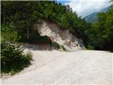
From the parking lot, take the steep cart track towards Lovrenec. After a short steep climb, the cart track leads to a crossroads where a footpath branches off to the right to the Church of St. Lawrence. We continue on the lower dirt track, which again starts to climb steeply and after a 15-minute walk from the starting point leads us to Dom na Lovrencu.
At the house we continue along the path towards Storžič and after a few steps the path leads us out of the woods and onto the meadows below the church. The Church of St. Lovrenec can be reached in a few minutes on foot through the meadow.
Continue along the meadow past the church and the path soon leads into the woods. Further on, the broad path descends gently to an undistinguished saddle, where we join the path from a slightly higher starting point. Continue in the direction of Storžič along the wide path, which climbs slightly. The path soon becomes narrower and then climbs steeply through the forest for some time. Higher up, the path just leads us out of the forest and beautiful views of the southern slopes of Storžič open up. The steepness continues unabated all the way to the bench at the crossroads.
To the left is a marked path towards Javornik and Poljana, to the right towards Kišče. At the crossroads, we continue neither left nor right, but onto an unmarked path that leads straight ahead. The slightly less well-trodden path can be seen to the left of the tree with the signposts. From the crossroads, the path climbs up a grassy slope, which becomes steeper and soon leads us into the vicinity of an undistinguished ravine. Here we continue slightly to the left and then to the left of the aforementioned ravine we climb towards the south-western ridge of Storžič. The slope on this side is also slightly more tree-covered. The path is less well trodden, but can be followed without major problems. As you approach the ridge, the path turns to the right and crosses grassy slopes. There is a short steep climb to the ridge. The grassy slopes are quite steep for most of the way and are very dangerous to slip on when wet. Even in the dry, however, some caution is needed.
When you reach the ridge, continue to the right and then climb up the mostly grassy and relatively steep ridge. In the steeper parts the path leaves the ridge a few times to the left or right. Follow Grebenc until it joins the marked trail from mountain pasture Javornik. The marked path then turns slightly to the right and soon we join the paths from Dom pod Storžičem and Kališča. It is then only a short climb to the summit, which can already be seen ahead.
You can descend via mountain pasture Javornik or towards Kišče.
Description and pictures refer to the situation in 2015 (June).

Pictures:
 1
1 2
2 3
3 4
4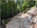 5
5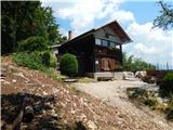 6
6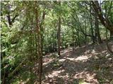 7
7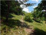 8
8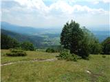 9
9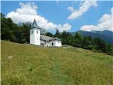 10
10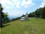 11
11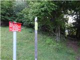 12
12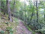 13
13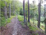 14
14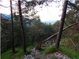 15
15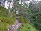 16
16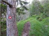 17
17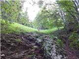 18
18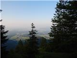 19
19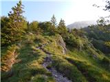 20
20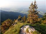 21
21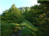 22
22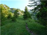 23
23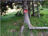 24
24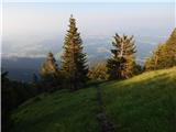 25
25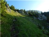 26
26 27
27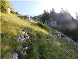 28
28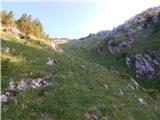 29
29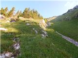 30
30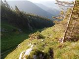 31
31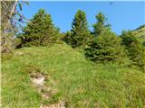 32
32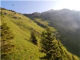 33
33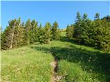 34
34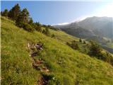 35
35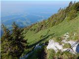 36
36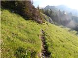 37
37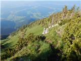 38
38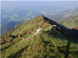 39
39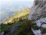 40
40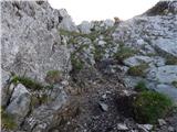 41
41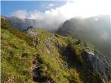 42
42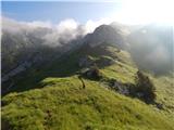 43
43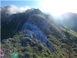 44
44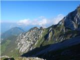 45
45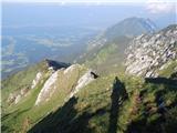 46
46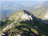 47
47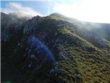 48
48 49
49 50
50 51
51 52
52 53
53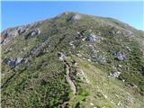 54
54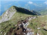 55
55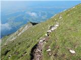 56
56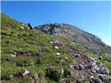 57
57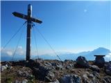 58
58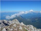 59
59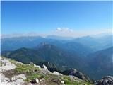 60
60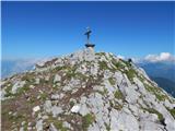 61
61
Discussion about the trail Laško - Storžič (on southwest ridge)
|
| zamudu22. 07. 2016 |
Turo sva prehodila vceraj (pristop, sestop cez Kalisce). Zelo prijetno. Ze lep cas nisva videla tako velikih, svezih sopov planik, ko so vceraj v zgornjem delu grebena. Le ob sestopu sem pogresal kazipote za Lasko, povsod je le Baselj  . Zvone
|
|
|
|
| Romancha25. 10. 2019 |
24.10.cesta do parkirišča je obupna za običajne (relativno nizke) avte. Boljše pustiti spodaj, ne na makedamski cesti. Jaz sem ga pustila na prvem ovinku (od kmetije cca 200m), ker v rikverc po luknjah nisem upala. Naprej gor je samo še hujše.
|
|
|
|
| tango12. 11. 2021 14:55:51 |
Pot brez posebnosti, megla tja do višine 1200m , naprej pa sončno in toplo. Vračala sva se na Javornik in prvi del je bil prava blatna avantura, tako da je bil prevoz po melišču še toliko večji užitek. Od Karničarjeve koče na Javorniku sva jo mahnila proti Kališču, a samo do klopce na razpotju(slika 24) potem pa navzdol proti izhodišču.
Lep jesenski poptep, spustu proti Javorniku se bova drugič raje izognila in ubrala kakšno drugo varianto, saj jih je na pretek
|
|
|
|
| mamaricka11. 07. 2023 20:12:51 |
Danes po tej poti na Storžič. Čudovito razgledna pot. Samo priporočam. Cesta do parkirišča res ni v najboljšem stanju zato je mogoče smiselno parkirati na parkirišču pod kmetijo. Dan je bil sicer vroč, a je po grebenu prijetno pihalo. Vračali smo se čez Kališče.
|
|
|
|
| Loni12. 07. 2023 09:10:30 |
Cesta je v takšnem stanju, ker jo vsak dež "uredi", potem pa svoje naredijo traktorji in avtomobili in imaš na koncu varianto pump steze.
|
|
|