Kućište/Viganj - Sveti Ilija (Pelješac)
Starting point: Kućište/Viganj (61 m)
| Lat/Lon: | 42,98332°N 17,11029°E |
| |
Time of walking: 2 h 30 min
Difficulty: easy marked way
Altitude difference: 900 m
Altitude difference po putu: 910 m
Map:
Recommended equipment (summer): lamp
Recommended equipment (winter):
Views: 929
 | 3 people like this post |
Access to the starting point:
The starting point is the cemetery (with St Luke's Church), which is situated high above the village of Kućište. You can get there by car from Orebić (see below under a). If you are staying in Vignje or Kućište, the most elegant and easy solution is to walk there (see b and c). It is very rare in life that you have the opportunity to start your climb directly from sea level! In this case, jumping into the sea after the tour is almost obligatory ;-)
a) By car: drive through Orebić; at its western end, at the "Y" junction, turn right in the route Kućište/Viganj/Lovište. Follow the main road for the next 10 minutes (5. 3 km). At the signs for the Antony Boy bivouac or the Čiringita bar, turn right up a steeper hill (0. 25 km). Park by the cemetery walls.
b) On foot from Vignjo: start the ascent from the sea about 200 m west of Cape St. Liberan, on the first distinct road west of this promontory (signs for Konobo Forte). Follow this road uphill, cross the main road, continue uphill to the mountain signposts. Before them, turn right and head east (a few metres of concrete road, then a nice path through the forest, finally passing a water reservoir) to reach the starting point in a few minutes.
c) On foot from Kućišto: from the Church of the Holy Trinity, which is by the sea in the western part of the village, go steeply uphill, first following the "S" curve, then crossing the main road and continuing uphill to the starting point.
Distances from the nearest tourist resorts to the starting point: Orebić (centre): 6 km; Viganj/Kućište: 0. 5 to 1. 5 km; Lovište: 12 km.
Path description:
On this approach, with a quite substantial difference in altitude, you are treated to a constant view of the Bay of Peljesac and the town of Korcula in the first part of the drive. Like most approaches, this one leads you through a beautiful pine forest in the middle part (at around 600 m). For a quick morning or evening "walk", the intermediate destinations are also attractive: the Church of St. Luncijata (around 170 m) and the first peak in the ridge (Vrh ljute, 311 m; up there is a cross).
In the high summer holiday season, it is best to start the tour in the dark (somewhere between 4 and 5 am) and finish it in the early morning, or to take advantage of a possible cooler day (the passage of the front). There is no water along the route. Both mountain huts - the new one (right next to the hunting hut; 5 minutes along the path towards Nakovana) and the better-known old one - are closed in summer (the Orebić PD has the keys).
Note: Most of the signs for Ilija have the east-facing sign (and some - unfortunately - have been removed). If you are coming from the west, you can see the back of the sign! In short, you can't see the sign for St Ilija.
You go north along the right-hand edge of the cemetery wall. After a few steps in the woods, you're soon on a hilly path (traces of the fire of 2019 are visible), where a comfortable mulatiera takes you quickly around a couple of bends to the church of St. Lunziata. Behind the church, you steeply bend your knees northwards; you walk between the maquis or on very rocky sections. As the steepness wears off, you progress along a flatter, more picturesque rock ridge, which gradually turns more and more to the east. The rock here is very sharp in places, so "slow and careful" (as Uroš Buh sings in a song by Mance Udovič); this applies especially to the descent! Past the cross, it goes downhill and even downhill a bit, then again in a moderate ascent in the NE direction (the markings are very rare or washed out in this part, they are solved by cairns) to a triple crossroads (the trail connection from the route of Bilopolje/Orebić). This part 1:10.
The continuation of the tour is much flatter. After a nice traverse, you cross the western slope of M. Kontija Peak (707 m), then over a few steel cables you soon reach the famous pine forest, and after a few steps you reach another triple crossroads (the trail connection from Nakovana). This part 0:20.
The last hour takes you further east, first through a beautiful pine forest, then a little more open again. Before you reach the old mountain hut, you bite your knees a little more steeply twice more. At the hut, the path from Orebić/Ruskovići joins. Above the hut, there are a few steps of steeper climbing through the forest (towards the NE), then a bare ridge to the top.
Times: starting point - first triple junction 1:10; first junction - second triple junction 0:20, second junction - summit 1:00. Total 2:30.
If you start from the sea, you have to add 10-15 minutes of walking, for a total of 2:45; and there is an additional climb of 60 m, for a total of 970 m.
The situation described above is valid for August 2022.

Pictures:
 1
1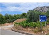 2
2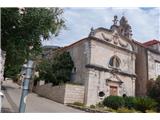 3
3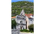 4
4 5
5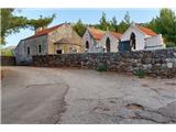 6
6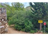 7
7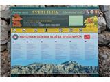 8
8 9
9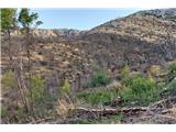 10
10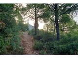 11
11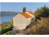 12
12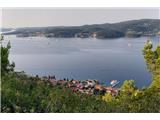 13
13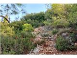 14
14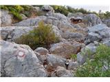 15
15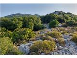 16
16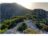 17
17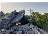 18
18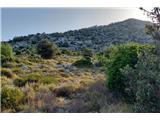 19
19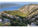 20
20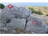 21
21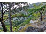 22
22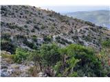 23
23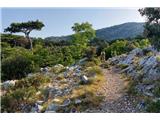 24
24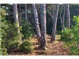 25
25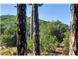 26
26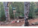 27
27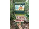 28
28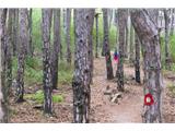 29
29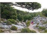 30
30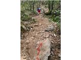 31
31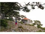 32
32 33
33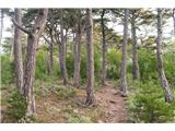 34
34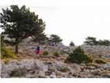 35
35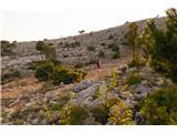 36
36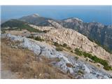 37
37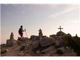 38
38
Discussion about the trail Kućište/Viganj - Sveti Ilija (Pelješac)