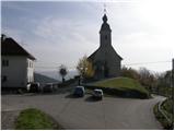
Starting point: Križevska vas (584 m)
| Lat/Lon: | 46,1091°N 14,7147°E |
| |
Time of walking: 45 min
Difficulty: easy marked way
Altitude difference: 159 m
Altitude difference po putu: 175 m
Map:
Recommended equipment (summer):
Recommended equipment (winter):
Views: 4.992
 | 1 person likes this post |
Access to the starting point:
a) From the Ljubljana - Celje motorway, take the Šentjakob exit and follow the road towards Litija. From the roundabout at Dolsko, take the exit towards Vinje, and at the next junction turn right towards Križevska vas. The road is slightly narrower and mostly ascending for about 5 km, and you follow it to the Church of St. Križ in Križevská vas. Park in a suitable place near the church.
b) First drive to Litija, then continue to Ljubljana. When you reach the crossroads at Senožeti, take the exit towards Senožeti. The road then immediately leads into the village, where you turn right at the junction and drive past the fire station, after which you reach the next junction, where you turn left. Continue straight ahead and follow the road until you reach Velika vas, where you turn left. Continue to Križevska vas, where you park in a small parking lot near the Church of the Holy Cross.
Path description:
From the starting point at the Church of the Holy Cross, continue northwards along the macadam road, which climbs crosswise. After a 10-minute walk from the starting point, you reach a small pass between two chapels.
Here, continue left (straight ahead Buven Farm, right Cicelj) and follow the road for another 100 m, then the signs lead you left into the forest, on an initially steep footpath. The path quickly lays down, then continues with a few short ascents and descents to a marked crossroads where the path from Dolsko joins us. Here, continue to the right and after 5 minutes of further walking, you will reach the forested summit of Murovica.
We can extend the trip to the following destinations: Cicelj
Pictures:
 1
1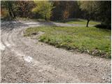 2
2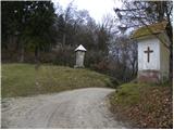 3
3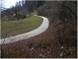 4
4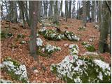 5
5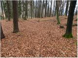 6
6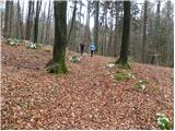 7
7 8
8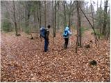 9
9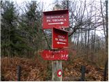 10
10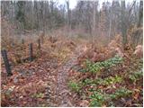 11
11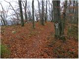 12
12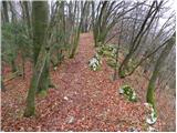 13
13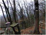 14
14 15
15
Discussion about the trail Križevska vas - Murovica
|
| balon15. 03. 2014 |
Pozdravljeni! Jutri bi se radi odpravili na izlet in nas zanima ali je pot skozi gozd zaradi žleda in ostalega očiščena/prehodna. Hvala in lep pozdrav, Balončki 
|
|
|
|
| PeterZ18. 06. 2016 |
Napaka pri opisu:
V Dolskem na krožišču se zavije proti Vinjam, potem pa po 200m desno za Križevsko vas. Senožeti so daleč naprej.
|
|
|