Koutschitz Alm/Kočiška planina - Poludnig/Poludnik
Starting point: Koutschitz Alm/Kočiška planina (1165 m)
| Lat/Lon: | 46,579°N 13,4481°E |
| |
Time of walking: 3 h
Difficulty: easy marked way
Altitude difference: 834 m
Altitude difference po putu: 834 m
Map: Tabacco 19
Recommended equipment (summer):
Recommended equipment (winter): ice axe, crampons
Views: 10.094
 | 2 people like this post |
Access to the starting point:
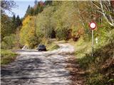
Access from Trbiz/Tarvisio: From Trbiz/Tarvisio, take the old road into Austria. After the village of Vrata/Thorl, the road turns left and crosses the railway with an underpass. Follow the road to the village of Bistrica/Feistritz, where in the centre of the village, at a sharp right turn, the road branches off towards the village of Blače/Vorderberg (continue straight ahead at the crossroads). At Blače/Vorderberg turn left towards the church and follow the road until the next crossroads where you turn right in the route mountain pasture Donice/Dolinza Alm. The tarmac road then takes us past the huts on Kočiška planina/Koutschitz Alm and leads us just a little further on to the next crossroads, where we continue on the upper road and drive for about 2km to the parking lot at the next crossroads. No further driving is allowed.
Access from Villach: Take the old road to Trbiz/Tarvisio and after the village of Megvarje/Maglern turn right under the railway. Follow the above description.
Access from Slovenia: Via the Rateče border crossing to Trbiz/Tarvisio, follow the above description.
Path description:
From the parking lot, turn right up the steep dirt road past the Dellacher Alm signs. The road runs alongside a torrent and leads to a crossroads. Turn left onto a road that crosses the torrent and passes through a forest. At the left turn, leave the road and continue right along the footpath, which leads to the hut at mountain pasture Dellacher Alm.
Here you come to an asphalted road on which you continue on the other side of mountain pasture to a crossroads at which there are also signposts. At the crossroads, bear left after the Poludnig Alm. At the first left turn, leave the road and turn right onto the footpath. The path continues through the forest and starts to climb moderately. In about half an hour's walk through the forest you will reach the hut at mountain pasture Poludnig Alm. Here we also have a beautiful view of the surrounding peaks.
At the hut, turn right to follow the Poludnig signs. The path continues over the grassy slopes below Poludnig and through a narrow lane larch forest. In between, cross an undistinguished ridge on the southern slopes of the mountain. Soon you reach a crossroads where you turn left towards the summit of Poludnig. The path from Egger Alm See joins from the right. Here the path starts to climb a little steeper and leads to the western ridge of the mountain. It is only a few minutes' walk along a scenic grassy ridge towards the summit.

Pictures:
 1
1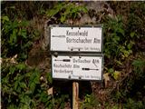 2
2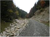 3
3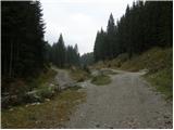 4
4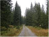 5
5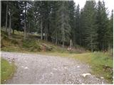 6
6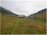 7
7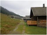 8
8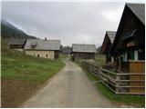 9
9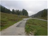 10
10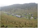 11
11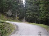 12
12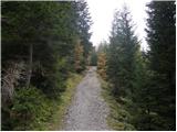 13
13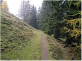 14
14 15
15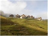 16
16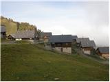 17
17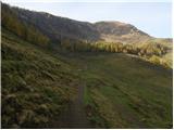 18
18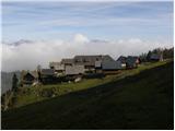 19
19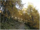 20
20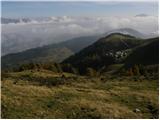 21
21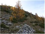 22
22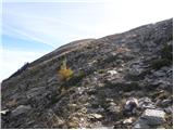 23
23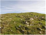 24
24 25
25
Discussion about the trail Koutschitz Alm/Kočiška planina - Poludnig/Poludnik
|
| martabojan30. 07. 2020 |
Želim izpeljati izlet s pohodniki na Poludnik. Na Egger alm bi se zapeljali z avtobusom in to 30 sedežnim. Ali kdo ve, če je to mogoče zaradi ozke in ovinkaste ceste, ali imate izkušnjo?
|
|
|