Koroška Bela (RC Kres) - Alničje (direct over the ridge)
Starting point: Koroška Bela (RC Kres) (630 m)
| Lat/Lon: | 46,4307°N 14,0982°E |
| |
Name of path: direct over the ridge
Time of walking: 1 h 30 min
Difficulty: partly demanding unmarked way
Altitude difference: 515 m
Altitude difference po putu: 515 m
Map: Karavanke - osrednji del 1 : 50.000
Recommended equipment (summer):
Recommended equipment (winter): ice axe, crampons
Views: 4.205
 | 4 people like this post |
Access to the starting point:
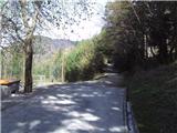
From the motorway Ljubljana - Jesenice take the exit Lipce and turn right towards Jesenice. At the first traffic lights (Slovenski Javornik), turn right towards Lj. At the second traffic-lighted junction, turn left and go under the railway underpass, and at the next smaller junction, turn right towards Koroška Bela. Go past the last bus stop (the shop on the left) into the village. Look for the crossroads in the centre of the village, where there is a church memorial. From here, follow the main road through the village, which leads uphill to the north. After about 100 m, you will see a bridge on the right, but go straight on for another 50 m, where you will come to a left fork in the road. Take this road, cross another (Koroška) street on the uphill slope and continue (the church is lower on the left) until you reach the area outside the village, where you come across the abandoned tennis courts (RC Kres).
Path description:
From the starting point, follow the right-hand path (kolovozu) uphill, where you will come across markings. Soon there will be a right turn followed by a left turn. On the right side of the latter you will see a path into the forest. Leave the marked path, follow it and start climbing. The path turns left onto the western slope of Alničje and continues to climb quite steeply northwards. Soon, when the steepness starts to ease a little, you will see the first sharp right fork (back). Not long afterwards, shortly before the path almost flattens out, we come across another, less obvious one, which leads steeply, right uphill, to the north. Take the latter and start climbing quite steeply. In a few roundabouts, the path leads to the SW edge of the ridge, where we leave it, as it ends after a few metres, and step onto the steep edge of the ridge mentioned above. Head left towards the summit, keeping to the forest edge on the left. Higher up, when you see the track, you can help yourself by holding on to trees (beware! dry trees). When you see some rocks on the path, you are at the top. Climb up to the ridge and follow it northwards. A steeper climb soon follows, in the middle of which the view back down into the valley starts to open up. Then we walk for a while along a moderately ascending, interesting ridge, with views on both sides. Higher up, the ridge widens and the path then climbs again a little steeper to the very highest point of the ridge, where it narrows again. Here the view opens up towards Potoški Stol and the Ljubljanska basin. The ridge continues down to the grassy saddle below Debeli Brdo, where there is a bench and a registration book under a spruce tree on the right. A view of the Julijce Mountains opens up if you climb a few 10 m up the grassy slope.

Pictures:
 1
1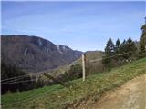 2
2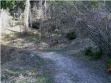 3
3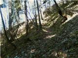 4
4 5
5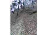 6
6 7
7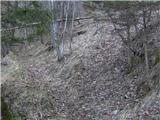 8
8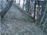 9
9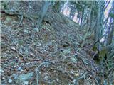 10
10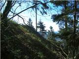 11
11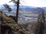 12
12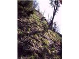 13
13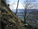 14
14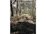 15
15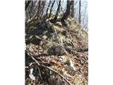 16
16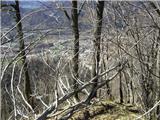 17
17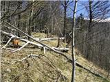 18
18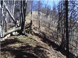 19
19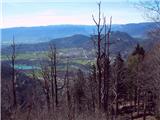 20
20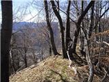 21
21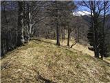 22
22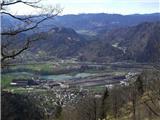 23
23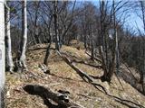 24
24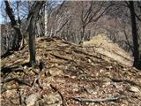 25
25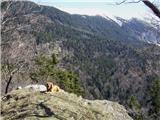 26
26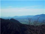 27
27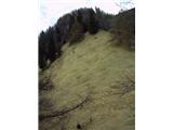 28
28 29
29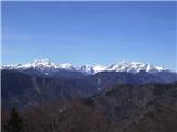 30
30
Discussion about the trail Koroška Bela (RC Kres) - Alničje (direct over the ridge)
|
| potočan3. 11. 2015 |
Danes prehodil to pot,vendar nisem zavil desno (slika 8) ampak sem šel naravnost in potem po zelo strmem gozdu prispel na polovico grebena in se usmeril proti najvišji točki.Nato 10 minut počitka in po grebenu do konca po strmih travah v dolino.Nikjer žive duše, vreme pa za vikat.
|
|
|
|
| heinz3. 11. 2015 |
Od slike 8 dalje poti kmalu zmanjka, in potem ti ne preostane drugega kot nadaljevanka v pobočje, po izjemno strmem terenu proti vrhu grebena.. Še sreča, da ni bilo ledeno, saj tla (zemlja) marsikje že krepko zmrzuje. Teren poznam, nadaljeval sem že ravnotako levo po poti, ki se pri sliki 11 konča. Na greben pa sem se že tudi povzpel z Gajškove.. Ni ravno fajn. Še hujša (nemogoča) pa je strmina zahodnega pobočja severneje. Tudi vzhodna pobočja nikakor niso od muh (vse preizkušeno). Greben Alničja je posebej ok, ker nikoli ne srečaš žive duše.. Vedno uživancija. 
|
|
|
|
| Jusk1. 02. 2020 |
Najprej fajn strma pot,potem pa prijeten sprehod po osamljenem grebenu  ni ravno obiskan vrh,zadnji vpis v knjigi je bil že kar nekaj dni nazaj. Povratek po poti proti Pristavi in po Gajškovi poti. Na poti ni posebnosti,Gajškova je občasno bolj blatna.
|
|
|
|
| Jusk21. 02. 2021 |
po dolgem času spet na to pot,vsako leto je bolj zaraščena..Po grebenu kopno,mirno,nikogar nisem srečal. Malo pred Debelim brdom se začne sneg po poti,ni ga veliko. V vpisni knjigi zadnji vpis prejšnji mesec,ni ravno obiskan ta del Karavank nazaj v dolino pa proti Pristavi in po cesti dol. Pot od Debelega brda do Pristave je še vsa pod snegom
|
|
|
|
| TrmaD9. 02. 2022 23:26:36 |
Danes na Alničje po grebenu. Pot se kmalu izgubi, tako, da je nadaljevanje po strmem terenu in suhi, drseči travi do grebena. V knjigi danes kar trije!!! vpisi. Nazaj po lovski, ki zaradi drseče suhe trave in listja tudi zahteva nekaj previdnosti. Snega ali ledu ni bilo nikjer.
Ob poti sem našel sončna očala. Če jih kdo pogreša jih lahko dobi pri meni.
|
|
|