Koprivna (Kumer) - Wackendorfer Spitze
Starting point: Koprivna (Kumer) (1172 m)
| Lat/Lon: | 46,4903°N 14,7284°E |
| |
Time of walking: 2 h 55 min
Difficulty: easy marked way
Altitude difference: 902 m
Altitude difference po putu: 915 m
Map: Kamniške in Savinjske Alpe 1:50.000
Recommended equipment (summer):
Recommended equipment (winter): ice axe, crampons
Views: 2.469
 | 2 people like this post |
Access to the starting point:
a) First, drive to Luce (to get here from Kamnik via the Volovjek Pass (Kranjski Rak) or from the Štajerska motorway and pass Mozirje and go through Ljubno ob Savinji), then continue driving in the direction of the Logarska dolina. When you reach Solčava, leave the main road and turn right towards Črna na Koroškem. Continue along the ascending road, following it at the junctions in the direction of Črna na Koroškem and the Spodnje Sleme pass. From the pass onwards the road starts to descend and we follow it to where it joins the Črna na Koroškem - Koprivna road. Here we continue left, then at the next crossroads about 1 km further on we turn right towards the mountain lodge on the Kumer farm. Continue along the Koprivna stream, following the road to a crossroads where the road to the aforementioned house branches off sharp left, the road continues straight on towards mountain pasture Luža, and the marked mountain trail to Peca branches off to the right (the latter also initially runs along the road). Park in a suitable place along the road. Continue along the road. Continue along the road.
b) From Koroška, first drive to Črna na Koroškem, then continue to Podpeca and Koprivna. At the junction where the road to Podpeca branches off to the right, continue slightly to the left, and also at the next junction where the road to the Tople valley branches off to the right. Continue along the Meži river for a while, and then first arrive at the junction where the road to the left branches off towards the Spodnje Sleme pass, and then onwards towards the Logarska dolina. Continue straight ahead here, and then at the next crossroads, about 1 km further on, turn right towards the mountain lodge on the Kumer farm. Continue along the Koprivna stream, following the road to a crossroads where the road to the aforementioned house branches off sharply to the left, the road continues straight on towards mountain pasture Luža, and the marked mountain path to Pec (which also initially runs along the road) branches off to the right. Park in a suitable place along the road. Continue along the road. Continue along the road until the road ends.
c) First drive to Šoštanj, then continue along the winding road to Črna na Koroškem. At Črna na Koroškem turn left towards Podpeca and Koprivna. At the junction where the road to Podpeca branches off to the right, continue slightly to the left, and also at the next junction where the road to the right branches off into the Tople valley. Continue along the Meži River for a while, then first arrive at the junction where the road to the left branches off towards the Spodnje Sleme pass and on towards the Logarska dolina. Continue straight ahead here, and then at the next crossroads, about 1 km further on, turn right towards the mountain lodge on the Kumer farm. Continue along the Koprivna stream, following the road to a crossroads where the road to the aforementioned house branches off sharply to the left, the road continues straight on towards mountain pasture Luža, and the marked mountain path to Pec (which also initially runs along the road) branches off to the right. Park in a suitable place along the road. Continue along the road. Continue along the road until the road ends.
Path description:
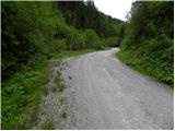
From the starting point, continue straight ahead, following the road as it climbs parallel to the nearby stream. The way forward takes us past the Blessed Well and, slightly higher up, the cart track turnoff to St Anne. Higher up, the road makes a sharp left turn, along which there are information boards, but we leave it just at this point and continue straight on the worse road, which only a little further on crosses the national border. Once in Austria, we continue along the minor road for a short distance before joining a wider dirt road, which takes us within a few minutes to the central part of the mountain pasture Luža.
From the shepherd's hut, walk to the second part of mountain pasture, and at the crossroads there, continue right in the direction of Pec (slightly left Železna Kapla / Bad Eisenkappel and Topitza / Topitza. The ascent continues on a dirt road which climbs gently to moderately along the edge of mountain pasture. After about 15 minutes of further walking, we will notice on the left side of the road the mountain signs for Peca, which direct us sharp left to the ascending cart track. The cart track cross-climb quickly leads us to a newly built forest road, which we follow to the left. After walking along the above-mentioned road for some 10 m, turn right onto the ascending cart track, which ascends through a spruce forest. After about 1 hour's walk from the starting point, rejoin the macadam road, which leads in a few steps to mountain pasture Zgornja Luža.
From mountain pasture continue along the marked path (originally still a road) in the direction of Pec. After some 10 steps the road turns right and we continue left on the footpath, which starts to climb moderately through the forest. The path gradually starts to climb steeper, and it leads us higher out of the forest to slopes covered with dwarf pines. Next, we climb the increasingly scenic slopes of Peć, following a path which leads us over time to the main ridge, where we also reach a crossroads.
Continue sharp left (right Feistritzer Spitze and Petzen) along the marked path in the direction of "Globasnitz". The way forward descends slightly, then leads us in a moderate ascent to an undistinguished peak, from which we open a wonderful view of the Drava Valley.

Pictures:
 1
1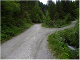 2
2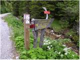 3
3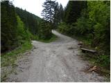 4
4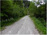 5
5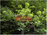 6
6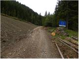 7
7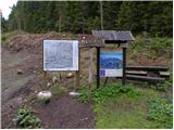 8
8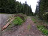 9
9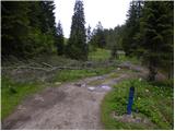 10
10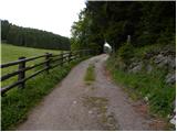 11
11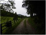 12
12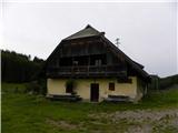 13
13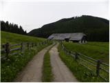 14
14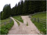 15
15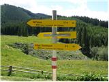 16
16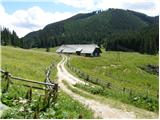 17
17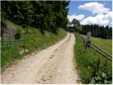 18
18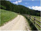 19
19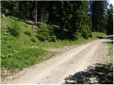 20
20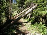 21
21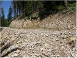 22
22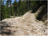 23
23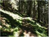 24
24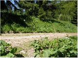 25
25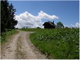 26
26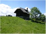 27
27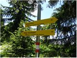 28
28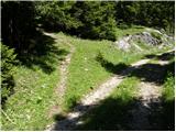 29
29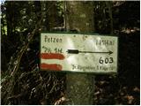 30
30 31
31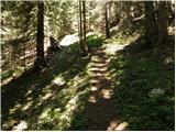 32
32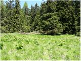 33
33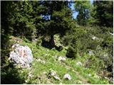 34
34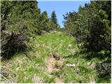 35
35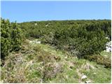 36
36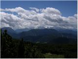 37
37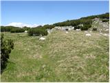 38
38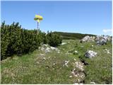 39
39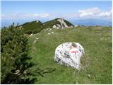 40
40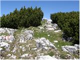 41
41 42
42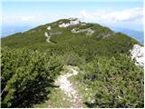 43
43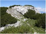 44
44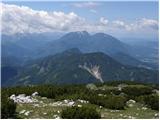 45
45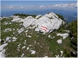 46
46 47
47
Discussion about the trail Koprivna (Kumer) - Wackendorfer Spitze