Kokra (Podlebelca) - Vrh Korena
Starting point: Kokra (Podlebelca) (559 m)
| Lat/Lon: | 46,319°N 14,4986°E |
| |
Time of walking: 3 h 50 min
Difficulty: partly demanding marked way
Altitude difference: 1440 m
Altitude difference po putu: 1440 m
Map: Kamniške in Savinjske Alpe 1:50.000
Recommended equipment (summer): helmet
Recommended equipment (winter): helmet, ice axe, crampons
Views: 8.515
 | 1 person likes this post |
Access to the starting point:
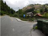
a) Drive to Preddvor or to the settlement Tupaliče, which is located on the main road Kranj - Zgornje Jezersko, and then continue driving in the direction of Jezersko. Once you reach Kokra, at the road sign between 8. 5 km and 8 km, turn right over the bridge into the hamlet of Podlebelca, where the route described above begins. There are no parking places at the starting point, so park in a suitable place nearby.
b) From Jezersko, drive towards Preddvor, and at the road sign between 8 km and 8. 5 km, turn left over the bridge into the hamlet of Podlebelca, where the described route begins. There are no parking places at the starting point, park in a suitable place nearby.
Path description:
Behind the bridge, you will see red mountain direction signs directing you to the road that climbs through the village of Podlebelca. Follow the signs past the houses, and the asphalt ends above the hamlet. After a short climb through the forest, you reach a large chapel, after which you go left on the marked cart track. Cart track immediately splits, and we take the right one, along which the markings continue. A little higher we reach an asphalt road leading to the farms Roblek, Pestotnik and Lovrin, and we follow it to the first right turn. After the bend, the footpath continues, climbing quickly to where you cross the road leading to Lovrin Farm. We continue through the wods, and the path gradually climbs up and along an undistinguished woded ridge. Higher up, we cross an asphalt road leading to the Roblek farm, and we climb steeply for a few more minutes before joining the cart track road leading from the Roblek farm.
Continue straight ahead, following the initially wide cart track, which you soon leave, as the signs direct you to the right onto a footpath. A further, not to steep path then leads us to a larger rock, where the next marked crossroads is this time. Continue straight ahead (right Krvavec) along the path, which gradually begins to climb steeper and leads us higher under a large rocky peak, which is already visible from the Kokra valley. The path retreats slightly to the left of the boulder, and then, when we are a little higher up, it turns to the right and comes quite close to the rocky cliffs on our right. The path ahead leads us in a moderate ascent to a short lane of dwarf pines after which we reach Lojtra. Lojtra is a slightly exposed passage on a wide and well protected shelf. After crossing this part, there is only a short scramble up the slopes (a ropeway), and then the steepness of the slopes eases. Continue along the path ascending through dwarf pines. After 15 minutes, dwarf pines ends and the path leads to the vast pastures of Dolga njiva, where you reach a crossroads. Continue straight on (right Krvavec) and after a few more steps the path leads to an old shepherd's hut at the above-mentioned mountain pasture. From the hut, continue along the left-hand side of mountain pasture along a less visible path which, after 5 minutes' further walking, leads to another, restored hut. Again, keep slightly left and the path, which is still poorly visible, soon leads into the dwarf pines zone, where it becomes more distinct. This is followed by crossing a short steep rubbly slope, and then, in a few minutes of pleasant walking through meadows covered with dwarf pines, the gently sloping path leads to the crossroads at Škrbini.
Here, continue to the right in the direction of Krvavec across Ježa on a path that climbs moderately up a slope covered with dwarf pines. After about 15 minutes of ascent, the path leads to a crossroads where we continue sharp left in the direction of Vrh Korena, which we reach after a minute of further walking.
Podlebelca - Dolga njiva 3:00, Dolga njiva - Škrbina 30 minutes, Škrbina -
Vrh Korena 20 minutes.

Pictures:
 1
1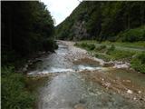 2
2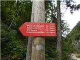 3
3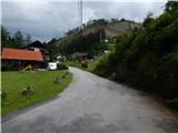 4
4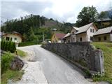 5
5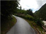 6
6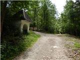 7
7 8
8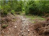 9
9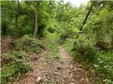 10
10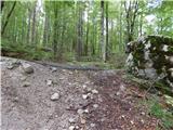 11
11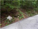 12
12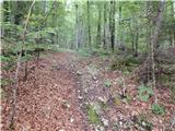 13
13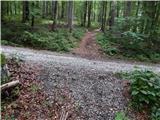 14
14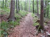 15
15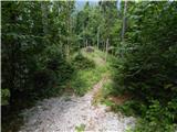 16
16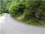 17
17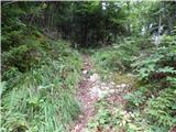 18
18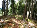 19
19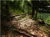 20
20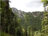 21
21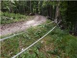 22
22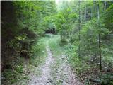 23
23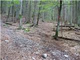 24
24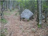 25
25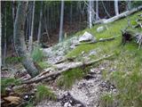 26
26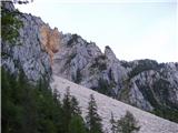 27
27 28
28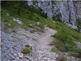 29
29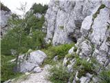 30
30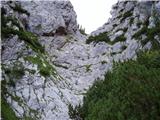 31
31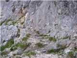 32
32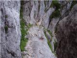 33
33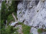 34
34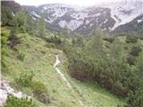 35
35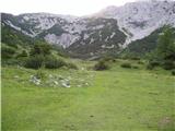 36
36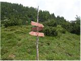 37
37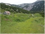 38
38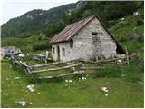 39
39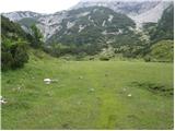 40
40 41
41 42
42 43
43 44
44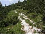 45
45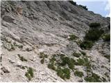 46
46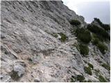 47
47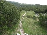 48
48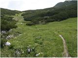 49
49 50
50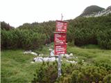 51
51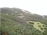 52
52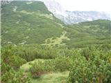 53
53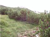 54
54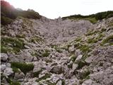 55
55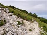 56
56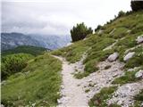 57
57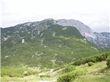 58
58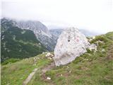 59
59 60
60 61
61 62
62 63
63
Discussion about the trail Kokra (Podlebelca) - Vrh Korena
|
| mic13. 08. 2013 |
V nedeljo 11.8.sem prvič šla po tej poti.Začetek poti od parkirišča ( na fotografiji)sem našla. Naprej v gozdu pa sem zašla.Je več kolovozev, nobeden pa ni uhojen.Tudi markacij nisem opazila.Vrnila sem se do avta in se odpeljala naprej do kmetije Roblek.Od tu brez problema po markacijah.
Pri kmetiji sem dobila dovoljenje za parkiranje, drugače pa je lepo parkirišče malo niže v gozdu,samo potrebno je označit pot do priključka kolovozne poti, ki vodi od te kmetije.LP
|
|
|