Koča pri Savici - Vrh Hribaric
Starting point: Koča pri Savici (653 m)
| Lat/Lon: | 46,2896°N 13,8022°E |
| |
Time of walking: 6 h
Difficulty: difficult marked way, easy pathless terrain
Altitude difference: 1735 m
Altitude difference po putu: 1800 m
Map: Triglav 1:25.000
Recommended equipment (summer): helmet
Recommended equipment (winter): helmet, self belay set, ice axe, crampons
Views: 4.625
 | 1 person likes this post |
Access to the starting point:
From the motorway Ljubljana - Jesenica, take the Lesce exit and follow the road towards Bled and on to Bohinjska Bistrica. Continue driving towards Bohinjsko jezero (Ribčev laz), at which you will come to a crossroads, where you will continue straight along the left (south) side of the lake in the direction of Ukanec and the Savica waterfall. Follow this increasingly narrow road to the large parking lot at the Savica cottage. There is a charge for parking.
Path description:
From the parking lot, turn right in the direction of Črno jezero, Koča pri Triglavskih jezerih and Hotel Zlatorog. The route initially leads along a dirt road, which crosses the Savica River via a bridge. Just after the bridge, the signs for Komarčo direct us left (straight ahead Hotel Zlatorog) onto what is at first still a fairly wide and relatively winding forest path. However, the path soon starts to climb steeper and leads us a little higher to a place where the path to the spring Savica branches off to the left, and we continue to the right on an increasingly steep path.
The well-maintained and relatively wide mountain trail, however, soon switches to the very steep and dangerous for slipping slopes of Komarče (there is also a high risk of falling rocks). The way forward climbs steeply on the mostly forested wall of Komarče, where we are helped in the more difficult places by the fixed safety gear (mainly by jeklenice).
Higher up, the route opens up some views towards Bohinj, and the path leads us to a short technically difficult place where we cross an otherwise not-so-exposed gully with the help of crampons and a rope. The way forward is still steeply climbing for some time and with the help of some fixed safety gear leads us to the top of Komarče, from where we get a nice view of our starting point. There is a short moderately steep climb, and then the path begins to descend gently towards Črno jezero, which is reached after less than 5 minutes of further walking.
Near the lake there is a marked crossroads where the path to mountain pasture Viševnik branches off to the right, and we continue slightly to the left and follow the marked path which bypasses the Black Lake on the right. On the other side of the lake, the path from Dom na Komni joins us from the left, and we continue along a relatively winding path that continues along the edge of the Lopučnička valley. Higher up, the path begins to climb moderately and leads us along the edge of overhanging cliffs to a small spring, which dries up in dry periods.
Continue on the marked path, which turns sharp right near Bela skala and climbs steeply. A few minutes of steep climbing follows, and then the path is laid and leads to a marked crossroads where the path with mountain pasture Blato joins us from the right. Continue left in the direction Koča pri Triglavskih jezerih and follow the relatively winding path, which will take you to the Double Lake within 10 minutes of further walking. The marked trail bypasses the lake on the right and before reaching the other side leads to a crossroads where the trail to Štapce branches off to the right. Continue straight ahead and within a few minutes of further walking you will reach the Hut by the Triglav Lakes.
From the hut, continue in the direction of Prehodavce and Hribarice and continue past the artificial lake Močivec. Just after the lake, the trail begins to climb moderately through a less and less vegetated valley. The pleasant and scenic route leads us further along the Valley of the Triglav Lakes, which quickly leads us to a marked crossroads where the path to Veliko or Lepo Špičje branches off to the left.
Continue in the direction of Prehodavce and follow the relatively folded path, which first crosses the lane of the rare larch forest, and then continues along the pleasant valley. The path continues to climb moderately and leads us to a small preval, from which we have a beautiful view of the lake in Ledvice.
The marked trail bypasses the lake on the right hand side, where it continues along the extensive scree fields at the foot of the two Zelnarice lakes. After the lake, the path returns from the scree to the Valley of the Triglav Lakes, after which it continues its relatively steep ascent. Already a completely high-mountain path, it climbs steeply for a short time higher up, then lays down completely and, after a few minutes of further walking, leads us to Zelená jezera.
Just after the lake, the signs for Hribaricee direct us right up (left Prehodavci). Continue climbing on the scree towards Hribariceam. After about half an hour's climb from the lake, the path from the Za Kopico valley joins us from the right. We continue in the direction of Hribarice on the path that leads us higher to a less visible crossroads, where the marked path to Kanjavec branches off to the left.
Continue straight on the marked path towards Dolič, and we walk along it for a few minutes, then we will see cairn along the way, which directs us to the right onto the pathless world between Hribarice and the Valley behind Debelim vrh. After an easier trackless climb to the saddle between Vrh Hribaric on the left and Vršaki on the right. From the indistinct saddle, continue slightly to the left, and our goal is now the ridge between Mišeljska dolina and Dolina za Debelim vrh. Without much difficulty, we climb the ridge, from where we continue to the right and take the less well-trodden path that leads along the right (west) side of the ridge. Soon you will see the summit of Hribaric Peak in front of you. The Cairns point us slightly right, avoiding the summit, which is only a short climb away. Once around the headland, there is only a final climb along a pathless ridge to the summit.

Pictures:
 1
1 2
2 3
3 4
4 5
5 6
6 7
7 8
8 9
9 10
10 11
11 12
12 13
13 14
14 15
15 16
16 17
17 18
18 19
19 20
20 21
21 22
22 23
23 24
24 25
25 26
26 27
27 28
28 29
29 30
30 31
31 32
32 33
33 34
34 35
35 36
36 37
37 38
38 39
39 40
40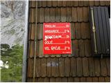 41
41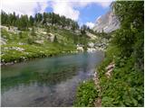 42
42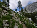 43
43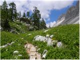 44
44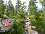 45
45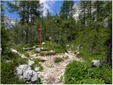 46
46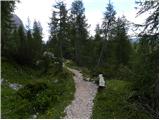 47
47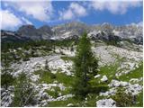 48
48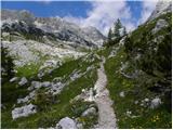 49
49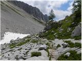 50
50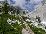 51
51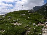 52
52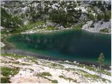 53
53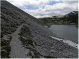 54
54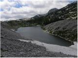 55
55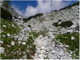 56
56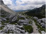 57
57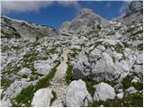 58
58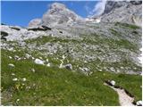 59
59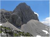 60
60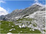 61
61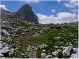 62
62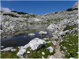 63
63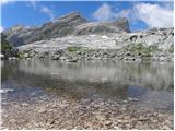 64
64 65
65 66
66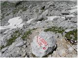 67
67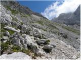 68
68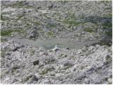 69
69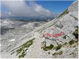 70
70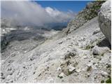 71
71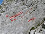 72
72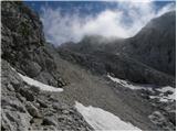 73
73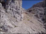 74
74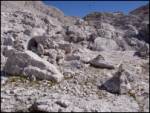 75
75 76
76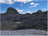 77
77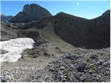 78
78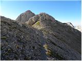 79
79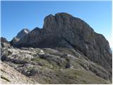 80
80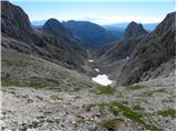 81
81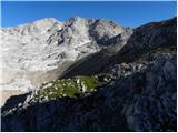 82
82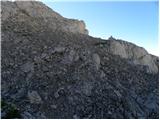 83
83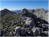 84
84 85
85 86
86 87
87 88
88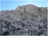 89
89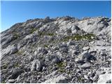 90
90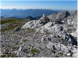 91
91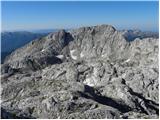 92
92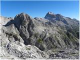 93
93
Discussion about the trail Koča pri Savici - Vrh Hribaric