Koča Porze - Porze / Cima Palombino
Starting point: Koča Porze (1942 m)
| Lat/Lon: | 46,6597°N 12,5824°E |
| |
Time of walking: 2 h 30 min
Difficulty: very difficult marked way
Altitude difference: 657 m
Altitude difference po putu: 657 m
Map: Austria On-line; Tabacco 01; BEV list 196; Freytag, Berndt und Artaria, list 182
Recommended equipment (summer): helmet, self belay set
Recommended equipment (winter): helmet, self belay set, ice axe, crampons
Views: 6.455
 | 2 people like this post |
Access to the starting point:
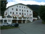
From Slovenia, the upper Zilj valley can be reached via the Karawanks tunnel, via Korensko sedlo or via Trbiz via Megvarje/Maglern. Passing Schmohor/Hermagor, continue along the valley to Kotschach-Mauthen and continue into the Leszno Valley/Lesachtal to Obertilliach. At the end of the village, at the signpost marking the name of the place, take the narrow asphalt road with the tiny sign Porzehutte southwards. After a kilometre the asphalt ends. A good dirt road leads along the Dorfbach stream to the Klapf(see) lake, and on Saturdays and Sundays to the hut. If the road is closed, it's about an hour's walk from the lake to the hut on a comfortable path that climbs in a couple of switchbacks over extensive pastures.
From Obertilliach, it is a 2½-hour walk along the road to the hut.
The Drava Valley is a kilometre longer, past Spittal, Lienz and Sillian, but the road is a little wider here.
Path description:
From the hut, a few detours along the path lead to the road and the Tilliacher Joch/Forcela Dignas saddle. Follow the signs along the old trade road, which was also used to supply the front line between Itali and Austria-Hungary in the First World War. Follow the road down to the Italian side, and at the first bend take the marked path over a short scree slope to enter the so-called Italian ferrata. The path, marked 172, is well marked and initially follows a wide ridge. It is secured by a rope, two short ladders, a few staples and a few rungs. It is not particularly exposed anywhere except in two places. It then follows the inlet of the ridge, where it makes skilful use of natural passages. The difficulties or the feratarian delights end when it reaches the main ridge. Here, at 2388 m, route 142 from the Italian mountains joins from the left. Continuing towards the summit is a combination of views of the steep northern precipices and admiring the diverse flora on the grassy slopes below the ridge. We walk along a former military supply route. Remnants of fortified positions and caverns can also be seen. At the last part below the summit, the path becomes narrower and passes over rocks. There are two crosses at the top. On the highest point there is a makeshift cross, and on the adjacent boulder a few metres lower, above the cavern, there is a huge memorial (peace) cross with inscriptions in several languages and a register. At the top, the Italian protected path meets the Austrian one, which leads over the Porzescharte notch. Both routes are part of the Carnic High Alpine Route. The view is suitable for the altitude and the neighbouring mountains.

Pictures:
 1
1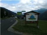 2
2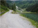 3
3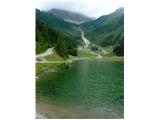 4
4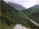 5
5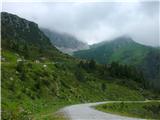 6
6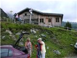 7
7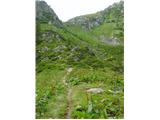 8
8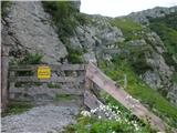 9
9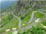 10
10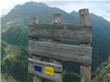 11
11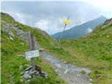 12
12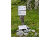 13
13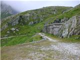 14
14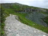 15
15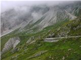 16
16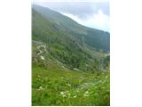 17
17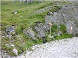 18
18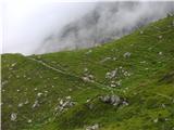 19
19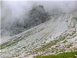 20
20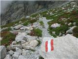 21
21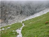 22
22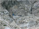 23
23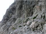 24
24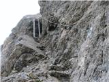 25
25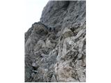 26
26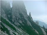 27
27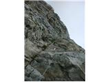 28
28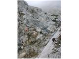 29
29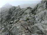 30
30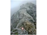 31
31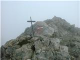 32
32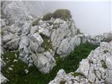 33
33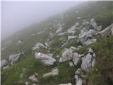 34
34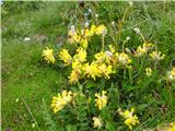 35
35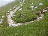 36
36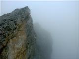 37
37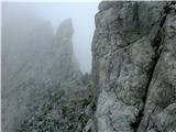 38
38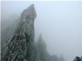 39
39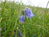 40
40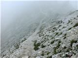 41
41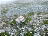 42
42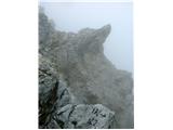 43
43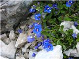 44
44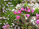 45
45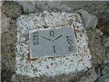 46
46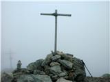 47
47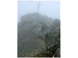 48
48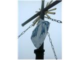 49
49
Discussion about the trail Koča Porze - Porze / Cima Palombino