Koča pod slapom Rinka - Kranjska Rinka (via Koroška Rinka)
Starting point: Koča pod slapom Rinka (1024 m)
| Lat/Lon: | 46,3696°N 14,5986°E |
| |
Name of path: via Koroška Rinka
Time of walking: 5 h 20 min
Difficulty: very difficult marked way
Altitude difference: 1429 m
Altitude difference po putu: 1504 m
Map: Kamniške in Savinjske Alpe 1:50.000
Recommended equipment (summer): helmet, self belay set
Recommended equipment (winter): helmet, self belay set, ice axe, crampons
Views: 15.508
 | 2 people like this post |
Access to the starting point:
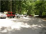
We drive to Luce (to get here from Mozirje or via Kranjski Rak) and onwards to the Logar valley. Shortly after the village Solčava, you will come to a crossroads where the road to Logarska dolina turns left. Turn left towards the Logar valley (pay the toll) and follow the road to the parking lot at the Cottage under the Rinka waterfall, where you park.
Path description:
From the parking lot, follow the wide tourist trail, which starts to climb gently. After a good ten-minute walk, you will emerge from the forest and reach a crossroads. Turn left (right Orlovo gnezdo 3 minutes) in the direction of the house at Okrešlju. The path crosses a small bridge and starts to climb steeply on the other side. After a short climb, the path leads us under the walls, from where we cross to the top of the waterfall. This part is exposed to falling rocks. The path then crosses the Savinja again and continues upwards along the river using steps. The ascent continues along the right-hand side (left bank) of Savinjek. Soon you reach the spring Savinjek, where you cross the water again. On the other side, the path goes into a dense forest and after a short climb leads to the winter shelter at Okrešlju. Continue to the left and in a few steps you will reach the house at Okrešlju.
At the home, take the path towards Kamnik and Savinja saddle. Soon you will come to the edge of a meadow where there is a crossroads. Continue straight across the meadow in the direction of Češka and Kranjska hut (Kamniško sedlo on the left). The path crosses a torrent and then climbs gently upwards along the rubble. Soon you will reach the next crossroads, where the path to Turški žleb (Turški žleb) and the memorial to the left branches off and is only a few dozen steps walk away. Continue straight ahead through the narrowing valley. The path starts to climb steeply and leads us under the walls of Mrzla Gora. The path continues along the left side of the torrent, on a moderately steep grassy slope partly covered with dwarf pines. The path then passes to the left side under the scree of the Štajerska Rinka. In a cross-climb the path leads us under the cliffs, where there is a danger of falling rocks. There is a short steep jump, and then the path veers slightly to the right onto grassy slopes, where we come to a crossroads. Continue straight ahead and the path to Mrzla Gora branches off to the right. Soon you reach the crossroads again, where you turn left onto a very difficult path marked Križ (straight ahead towards Savinjski sedlo). From the crossroads, the path climbs on scree and leads to the entrance to the climbing part of the route. The path then climbs up a slightly rubbly slope and then turns slightly to the right and crosses the steep slopes along a steel beam and with the help of a few scrambles in a slight ascent. The path then turns slightly to the left and climbs up a fine passage with the help of steel cables and pegs and then crosses very steep slopes a few more times along a steel cable. The path then leads to a steep ravine which is first climbed vertically by scrambling up the scrambles and then continued steeply upwards along the scrambles. The path then climbs steeply along the steep ravines a few more times, then leads us to the stumps, where we open a view towards Ledina. From the stubble, descend along the steel cable along the rough terrain and reach a crossroads. Bear left to follow the Rinka signs and right to follow the path towards Lediny. The path ascends past a natural window and then turns slightly to the right, crossing the steep western slopes as it ascends. The trail then turns left and climbs steeply along a steel cable. Soon the northern slopes of the mountain are reached and there is some easy climbing on broken rocks without fixed safety gear. Re-acquire the western slopes, where the route climbs very steeply again along the steel cable. From here there is also a very fine view of the precipitous cliffs of the Skute. There is a rather exposed traverse on the western side of the mountain, then the path turns left again and climbs almost vertically along the steel cable. The north slopes of the mountain are reached again and there is a short climb along the steel cable to the summit. From Križ, or Koroška Rinka, descend to the other side, along a path that descends steeply towards the valley between Kranjska and Koroška Rinka. The trail first follows a rugged ravine, then turns to scree, where it quickly reaches a crossroads, where it continues to the right (Turski žleb and Kamniška Bistrica on the left). The trail continues across the slopes of Koroška Rinka, then turns slightly to the left, where it climbs steeply. There is a short, very steep climb, and then the path leads to the main ridge, which is followed in a few steps to the top of Kranjska Rinka.
Hut under the Rinka waterfall - Dom na Okrešlju 1:15, Dom na Okrešlju - Koroška Rinka 3:45, Koroška Rinka - Kranjska Rinka 20 minutes.

Pictures:
 1
1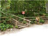 2
2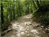 3
3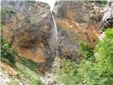 4
4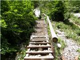 5
5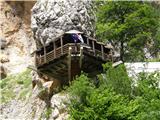 6
6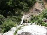 7
7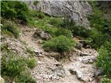 8
8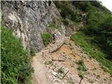 9
9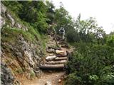 10
10 11
11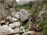 12
12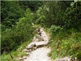 13
13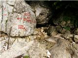 14
14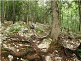 15
15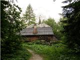 16
16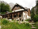 17
17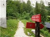 18
18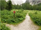 19
19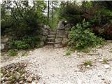 20
20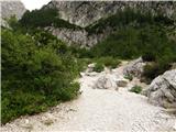 21
21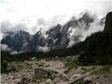 22
22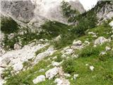 23
23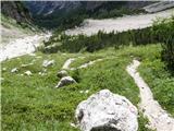 24
24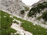 25
25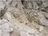 26
26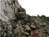 27
27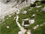 28
28 29
29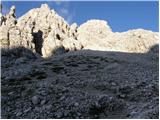 30
30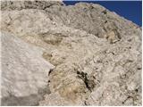 31
31 32
32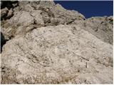 33
33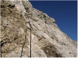 34
34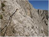 35
35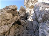 36
36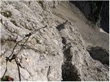 37
37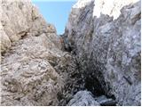 38
38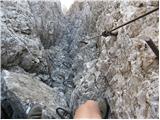 39
39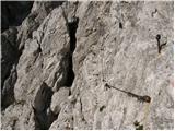 40
40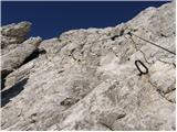 41
41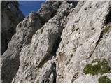 42
42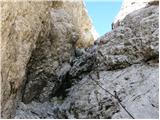 43
43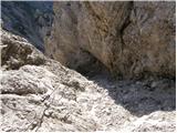 44
44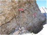 45
45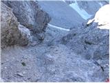 46
46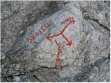 47
47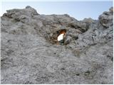 48
48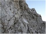 49
49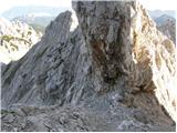 50
50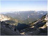 51
51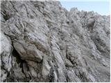 52
52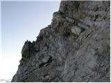 53
53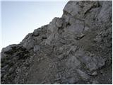 54
54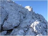 55
55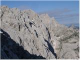 56
56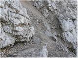 57
57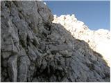 58
58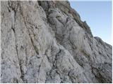 59
59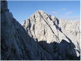 60
60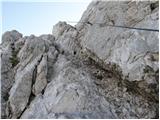 61
61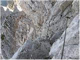 62
62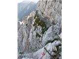 63
63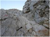 64
64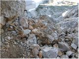 65
65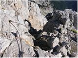 66
66 67
67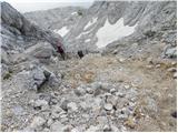 68
68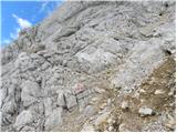 69
69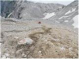 70
70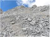 71
71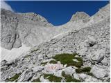 72
72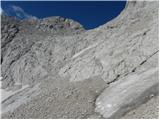 73
73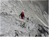 74
74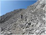 75
75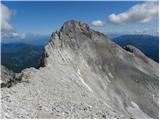 76
76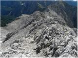 77
77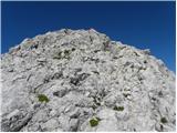 78
78 79
79
Discussion about the trail Koča pod slapom Rinka - Kranjska Rinka (via Koroška Rinka)
|
| azuri2. 07. 2010 |
Spoštovani;
zanima me, če se da združiti pot:
- koča pod slapom Rinka
- koča na Okrešlju
- Koroška Rinka
- Kranjska Rinka
- Skuta
- Turska gora
- nazaj čez Turski žleb v dolino.
Hvala vnaprej za odgovore in lep pozdrav.
|
|
|
|
| joža x3. 07. 2010 |
Z lahkoto,če imaš kaj hribovske kilometrine.
|
|
|
|
| soncyka25. 09. 2013 |
Zivjo. Vceraj (24.9.13) sem na vrhu Koroške Rinke(morda pa na Kranjski)izgubila sončna očala adidas - črna, bila so v sivem etuiju. Očitno so mi padla iz ruzaka, še sama ne vem. Če se najde najditelj bom zelo hvaležna.
|
|
|
|
| B.Smart25. 09. 2013 |
Pozdravljeni. Rad bi samo opozoril, da je pod sliko št.28 napačno navodilo za pot. Pri razpotju za Mrzlo goro (desno) se moramo usmeriti naravnost proti Savinjskemu sedlu in ne desno proti Mrzli gori. V samem opisu poti (zgoraj) pa so navodila pravilna. Lep pozdrav in varen korak. 
|
|
|