Klammbrückl - Große Gamswiesenspitze (Madonnen Klettersteig)
Starting point: Klammbrückl (1092 m)
| Lat/Lon: | 46,79024°N 12,76478°E |
| |
Name of path: Madonnen Klettersteig
Time of walking: 5 h
Difficulty: extremely difficult marked way
Ferata: C
Altitude difference: 1396 m
Altitude difference po putu: 1400 m
Map:
Recommended equipment (summer): helmet, self belay set
Recommended equipment (winter): helmet, self belay set, ice axe, crampons
Views: 3.315
 | 2 people like this post |
Access to the starting point:
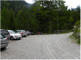
Drive through the Karavanke Tunnel into Austria, then continue to Spittal and on to Lienz (the motorway ends a little after Spittal). We continue along a relatively nice and wide road through the Drava Valley. In the centre of Lienz, at the main roundabout, turn left and continue towards Itali (exit from the roundabout in the direction of Leisach, Anras and Silian). Shortly after Leisach, you will see direction signs on the left-hand side of the road directing you to a narrow wooden bridge over the River Drava (direction Kerschbaumer Alm, ÖTK - Schutzhaus 1902 m). The road narrows just after the bridge and starts to climb steeply. Follow this road to the parking lot at Klammbrückl.
Path description:
From the parking lot, continue along the road, which is closed to traffic. After a few dozen metres, you reach a crossroads where you continue to the right, following the signs "ÖTK Schutzhaus". You can either follow the mountain road all the way or take the footpath through the forest and then join the mountain road a few more times for a short distance.
When the road ends, continue on the footpath, which begins to climb up the right side of the valley. The path leads through sparse wodland to a slightly steeper slope and then to a viewpoint with a good view of Klapffall Waterfall. The path then turns slightly to the left and approaches a mountain stream. The path climbs along the stream and then leads to the mountain pasture Kerschbaumer alm. The path here follows the left-hand side of the mountain pasture and there is only a short climb up a grassy slope past sparse trees to the Schutzhaus hut.
From the hut, continue left after the Kerschbaumer Törl marker. First cross a grassy slope and a stream bed and then reach a fork in the trail. At the crossroads, continue straight ahead through a larch forest and cross the slopes on the right side of the valley. The path then turns slightly to the left and crosses several small streams. Later the path turns left again and then follows the left side of the valley. Here you reach dwarf pines and start to climb a little steeper. The path climbs for some time through dwarf pines and then reaches a crossroads where it heads left after the markings "gr. Gamswiesenspitze'.
The path then climbs up a partly grassy slope and soon leads to another crossroads and thus to the entrance to the climbing part of the route.
Continue left on the extremely difficult "Madonnen Kletersteig". The path starts climbing along a steep slope at the beginning. The path crosses the slope slightly to the left a few times, but otherwise climbs steeply upwards towards the north. Later, the path turns left and crosses a steep exposed rock face, which leads to a suspension bridge. After crossing the bridge, the trail turns right up again and leads to a registration box by a small steel cable, which is located before entering the most challenging part of the trail. From the registration box, continue left up the hill and then climb almost vertically along the steel cableway several times. This will take you to the west side of the mountain. Here you will see an interesting rock in front of you, to which a "saintly glow" has been added so that from a distance it loks like a statue of the Virgin Mary. The path then turns slightly to the right, going around the rock, before turning left and climbing vertically along the cliff a few times. This part of the path is extremely difficult and is marked with difficulty level C. Towards the top, the path becomes less steep and after a short climb along the ridge, an easier path joins from the right. From here it is just a short climb along a scenic ridge to the summit.
The route described is extremely difficult and is suitable only for the most skilled mountaineers with sufficient strength in their arms and with compulsory self-guidance. The climb is particularly difficult because the whole route is protected only by a rope, which is often placed in such a way that it can only be used as a belay, but not as a climbing aid.
It is recommended to descend via the easier route (Normalweg) via the notch between Große Gamswiesenspitze and Kleine Gamswiesenspitze.

Pictures:
 1
1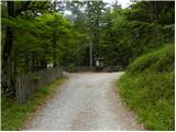 2
2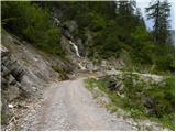 3
3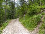 4
4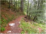 5
5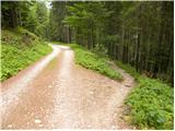 6
6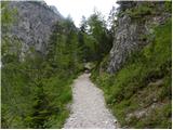 7
7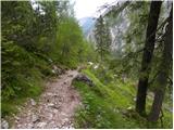 8
8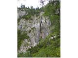 9
9 10
10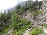 11
11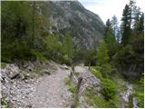 12
12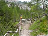 13
13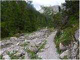 14
14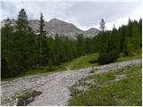 15
15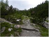 16
16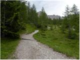 17
17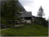 18
18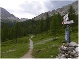 19
19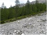 20
20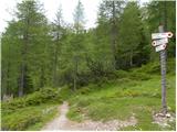 21
21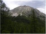 22
22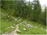 23
23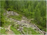 24
24 25
25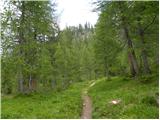 26
26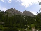 27
27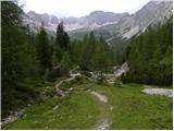 28
28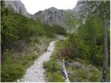 29
29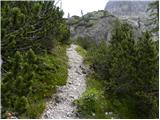 30
30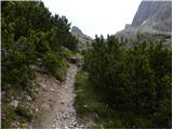 31
31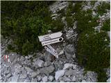 32
32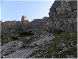 33
33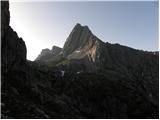 34
34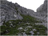 35
35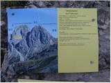 36
36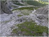 37
37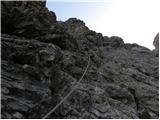 38
38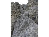 39
39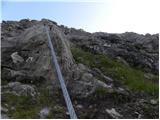 40
40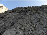 41
41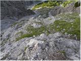 42
42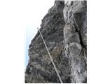 43
43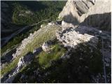 44
44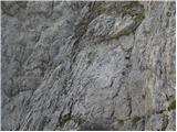 45
45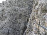 46
46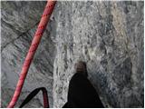 47
47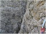 48
48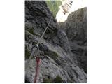 49
49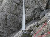 50
50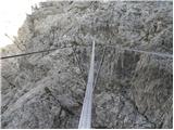 51
51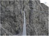 52
52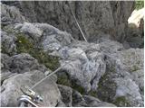 53
53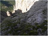 54
54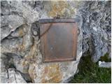 55
55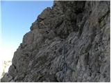 56
56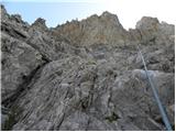 57
57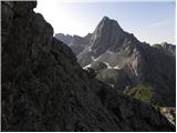 58
58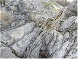 59
59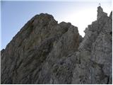 60
60 61
61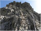 62
62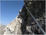 63
63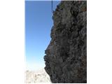 64
64 65
65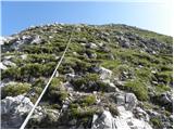 66
66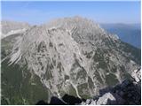 67
67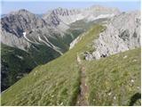 68
68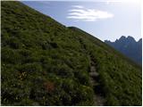 69
69 70
70 71
71
Discussion about the trail Klammbrückl - Große Gamswiesenspitze (Madonnen Klettersteig)