Starting point: Katarija (500 m)
| Lat/Lon: | 46,1189°N 14,7476°E |
| |
Time of walking: 2 h 15 min
Difficulty: easy marked way
Altitude difference: 326 m
Altitude difference po putu: 450 m
Map: Ljubljana - okolica 1:50.000
Recommended equipment (summer):
Recommended equipment (winter):
Views: 4.697
 | 1 person likes this post |
Access to the starting point:
From the motorway Ljubljana - Celje take the exit Krtina and Moravče. Follow the road towards Moravče, where you turn right towards the village of Ribče. The road to Ribče first ascends and then descends. When it starts to climb again, it leads into the forest, where after a while a macadam road branches off to the right. Park in the parking lot by the road near the crossroads. The parking lot is on the Moravian side.
From Litija drive towards Ljubljana but only as far as the village of Ribče. Turn right here and follow the road towards Moravče. The road then takes you over a 580m pass (you return to it on foot) after which the road starts to descend. After a short descent, we reach a crossroads where we park in a parking lot by the road.
Path description:
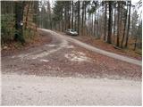
From the parking lot on the Moravian side of the road, follow the asphalted road up to the village Katarija, which is reached after a good five-minute walk. Here you will come to a crossroads where you turn left in the direction of Slivna (right Miklavž, right Ribče). The road becomes macadam shortly after the village. Follow the road, which climbs gently for the most part, to a large meadow across which a power line is laid. Just at the point where the road crosses the power line, leave it and turn left onto a footpath that climbs gently across the meadow. The path across the meadow, with beautiful views, leads us to the mountain home in two minutes.
From the home, continue in the direction of Zgornja Slivna (Pivkelj) along the path, which soon leads to a forest road. After a few minutes' walk from the house, the road leads to a crossroads, where we continue along the road below. Only a few tens of metres further on we come to the next crossroads, where we continue to the right in the direction of GEOSS. The road, which climbs moderately over time, leads us to Štance Laze (a small hamlet). Just a little further on, the signs for Slivna direct us to the right to cart track. Continue along cart track, which goes from the meadow into the forest. Cart track, which runs through the forest, has several forks, so follow the markings carefully. After a few descents and ascents, the path leads us to the next crossroads, where we continue to the right in the direction of Pivklja (Slivna). The path, which climbs a little more here, leads us within five minutes of the crossroads to a vegetated peak.
After a few minutes' walk along the cart track, we arrive at an asphalted road, where we continue to the right. The road you are walking on leads you in a few minutes to a house on Slivna.

Pictures:
 1
1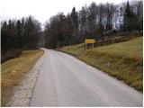 2
2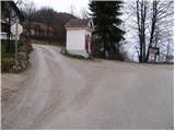 3
3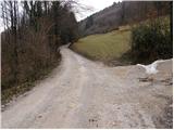 4
4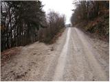 5
5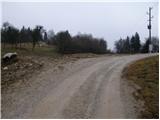 6
6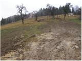 7
7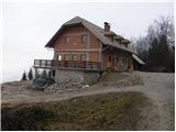 8
8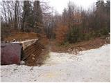 9
9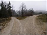 10
10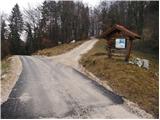 11
11 12
12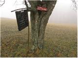 13
13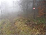 14
14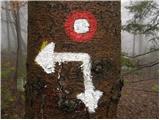 15
15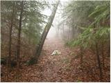 16
16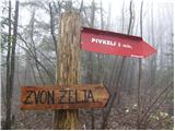 17
17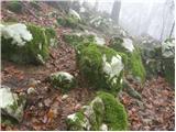 18
18 19
19 20
20 21
21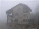 22
22
Discussion about the trail Katarija - Dom na Slivni