Kamnica pri Mariboru - Sveti Urban above Maribor (via Lucijin breg)
Starting point: Kamnica pri Mariboru (282 m)
| Lat/Lon: | 46,572°N 15,6136°E |
| |
Name of path: via Lucijin breg
Time of walking: 1 h 30 min
Difficulty: easy unmarked way
Altitude difference: 313 m
Altitude difference po putu: 313 m
Map: Štajerska 1:75 000
Recommended equipment (summer):
Recommended equipment (winter):
Views: 16.754
 | 4 people like this post |
Access to the starting point:
a) From Ljubljana, drive to the centre of Maribor, where you turn towards Tabor at the large crossroads on Tržaška cesta. Drive along Proleterskih Brigade Street, past the military barracks to the roundabout by the Qlandia shopping centre, turn right. Drive straight ahead until you reach the Koroška Bridge over the Drava, cross it and immediately turn right at the roundabout at the third exit. Continue in the direction of Dravograd and after about 3 km turn right at the crossroads (you have arrived in Kamnica at Maribor). Park in a suitable place.
b)From the direction of Dravograd, drive towards Maribor, where about 1 km after the Maribor island turn left at the crossroads. Park in a suitable place.
Path description:
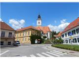
The trail starts in the centre of the town, near the post office opposite St Martin's Church. Go in the direction of the Road to Rošpoh. Walk straight ahead to the bus stop and the house number 43. A signpost points to the left onto a narrower road between the houses and climbs uphill. Higher up, it turns into a dirt road and becomes steeper. At the top of the rise, the road turns left and after a few minutes turns into a forest at cart track. After a few metres of flat ground, it turns slightly diagonally upwards and runs transversely. Exit the forest, climb up the overgrown slope. The first view of Maribor and Pohorje appears.
Follow the top of the hill across the meadow along the narrow strip of forest northwards past the Chapel of St Lucy. The path goes into the forest again, keeping to the left-hand path, and starts climbing up the hill again, crossing the steep slope on the south side. As the path regains the crest of the hill, you soon reach the highest point of Lucy's bank. The path then descends gently and emerges from the forest onto a meadow. The path continues along the fence and descends slightly to a fork, where you again keep to the left.
Turn sharp left up along the edge of the wood and after a while back into the wood. At the top of the hill, turn left and pass a house by the side of the wood, where you come out again. Cross the meadow and go up along the wooden fence to the woods, where you come out on a macadam road. After 10 minutes, near the farmhouse, step out of the woods and a view of St. Urban opens up. The dirt road turns into an asphalt road which descends quickly. We are back at the road junction, where we keep to the left. Walk steeply uphill past the houses to the sign on the electricity pole, which directs us off the road onto a footpath, which crosses the meadow and goes back into the forest, but only for a short time. Exit the woods onto the tarmac near the chapel, where you turn right. It is a steep 10-minute walk to the Church of St Urban, where the highest point is 597 m.

Pictures:
 1
1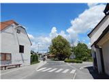 2
2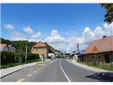 3
3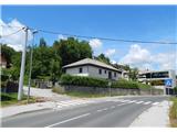 4
4 5
5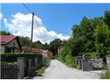 6
6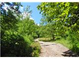 7
7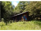 8
8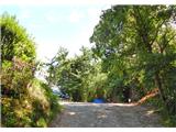 9
9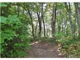 10
10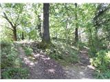 11
11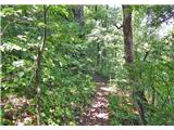 12
12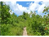 13
13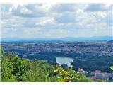 14
14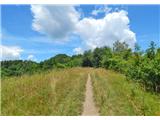 15
15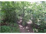 16
16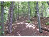 17
17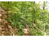 18
18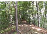 19
19 20
20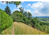 21
21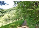 22
22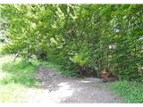 23
23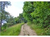 24
24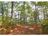 25
25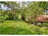 26
26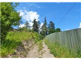 27
27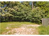 28
28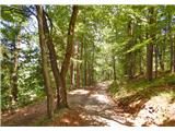 29
29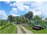 30
30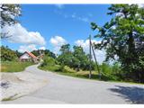 31
31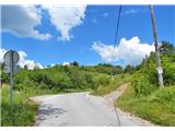 32
32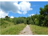 33
33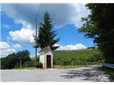 34
34 35
35
Discussion about the trail Kamnica pri Mariboru - Sveti Urban above Maribor (via Lucijin breg)
|
| dprapr28. 07. 2014 |
Prava grebenska na Štajerskem!
|
|
|