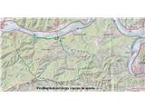
Jevnica - Janče (circular tour: Jevnica - Laze - Janče - Golišče)
Starting point: Jevnica (273 m)
Name of path: circular tour: Jevnica - Laze - Janče - Golišče
Time of walking: 2 h
Difficulty: no data
Altitude difference: 519 m
Altitude difference po putu: 600 m
Map: KartoGrafija, Ljubljana in okolica 1: 40.000
Recommended equipment (summer): helmet
Recommended equipment (winter): helmet
Views: 2.101
 | 3 people like this post |
Access to the starting point:
Jevnica, 20 km east of Ljubljana, is situated along the Sava River and the Lj-Litija railway line.
From Ljubljana, the starting point is usually reached by bicycle on the local road along the right bank of the Sava River, or by car on the main road from Ljubljana to Zasavje, along the left bank of the Sava River to Senožeti, where you take the right fork at the roundabout for Jevnica.
Path description:
For the described circular cycling trip (ascent and descent) from Jevnice, we choose the more northern paths of the Janče hills, which are more suitable for summer time, but it is not too hot in Janče, as there is a lot of forest and shade.
If you take Jevnica as your starting point and drive here, it is best to park at the railway station, and from there head west through the centre of the village, past the school and the shop, along the narrow local road that runs alongside the railway for another kilometre or two. After Jevnica and before Laze, the local road crosses the railway twice, and then shortly after the first two houses in Laze, above the railway, you see a side road and turn left and up, onto an initially quite steep asphalt road, which after about 2 km turns to macadam, and the steepness eases a little a few times. On the rather lonely forest road up, you stick to the main road throughout, and the only crossroads where you can make a mistake on the way to Janče are marked accordingly. Two of the three dirt slopes in the first half of the route are now also asphalted, but you will need to put a bit more effort and pedal power into the last part of the forest road below Janče.
We usually stop at Janče at the mountain lodge, which is the logical destination of the climb. From there, we then go back in the same direction for about 300 m and take the main road down through the village of Tuji Grm and on towards the village of Mala Štanga (direction Litija). From Mala Štanga, keep to the right at the crossroads (all left turns lead to the valley and Jevnica) and after a short climb and then a short descent on a worse road through the forest, head towards the village of Golišče until you reach a junction with a better and asphalted road. To return to Jevnica, turn left uphill a little (right for Kresniški vrh and Kresnice or Veliki Vrh and Litija), then through the picturesque village of Golisce, all along the asphalt and nice curves for another 5 km downhill to the starting point. All in all, about 30 km, 600 m of climbing and a good 2 hours of rugged riding. For this kind of trip, which is partly on tarmac but more on gravel, it is best to use a mountain bike with a good tyre profile to avoid slipping, because the climb is really steep and the descents, especially when wet, also require a safe and good grip on the tyres. The climb up to Janče along this path from Laz is not very popular because of the steepness, and it is not particularly scenic (with the exception of the extension of the world past three houses), and you will rarely meet anyone on the way through the forest, while the second part of the path and the descent over Golišče to Jevnica is more beautiful and interesting from the point of view of the views. If you ever miss a turn-off and turn down into the valley, don't panic, you'll almost always get to Jevnica, and this type of descent on the worse paths is especially favoured by downhillers.

Pictures:
 1
1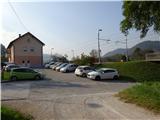 2
2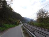 3
3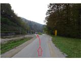 4
4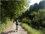 5
5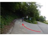 6
6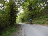 7
7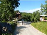 8
8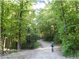 9
9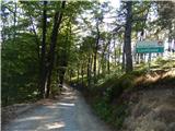 10
10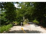 11
11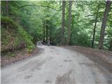 12
12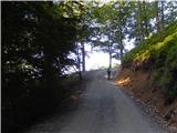 13
13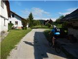 14
14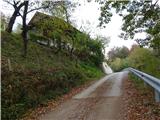 15
15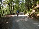 16
16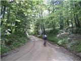 17
17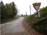 18
18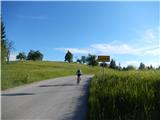 19
19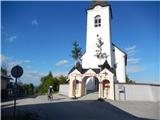 20
20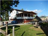 21
21 22
22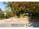 23
23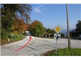 24
24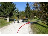 25
25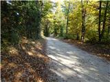 26
26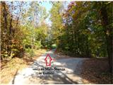 27
27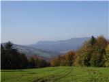 28
28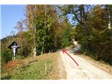 29
29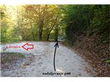 30
30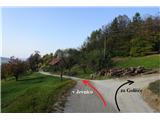 31
31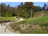 32
32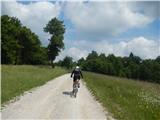 33
33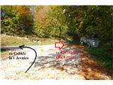 34
34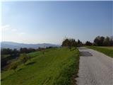 35
35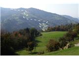 36
36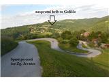 37
37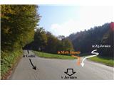 38
38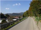 39
39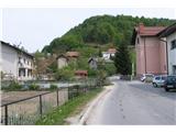 40
40
Discussion about the trail Jevnica - Janče (circular tour: Jevnica - Laze - Janče - Golišče)
|
| gams121. 04. 2020 |
gozdno cesto iz Laz so v zgornjem delu - slika 16 in 17 lani v jeseni "modernizirali", beri asfaltirali in razširili, tako, da je zadnje klance pod Jančami dosti lažje za zvozit 
|
|
|