Jesenice (Straža) - Kozjek
Starting point: Jesenice (Straža) (560 m)
| Lat/Lon: | 46,429°N 14,0825°E |
| |
Time of walking: 25 min
Difficulty: easy unmarked way
Altitude difference: 206 m
Altitude difference po putu: 206 m
Map: Karavanke - osrednji del 1 : 50.000
Recommended equipment (summer):
Recommended equipment (winter): ice axe, crampons
Views: 4.137
 | 2 people like this post |
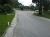
Access to the starting point:
From the motorway Ljubljana - Jesenice take the exit Lipce, where you turn right towards Jesenice. In the Slovenski Javornik settlement, at the junction with the traffic light, turn left towards the town centre. At the second traffic lights (by the gymnasium) turn right, back onto Tomšičeva cesta, passing the primary school on the left. Drive for another 2. 5 km to the end of Tomšičeva Street, or to where the last bus stop is located at the bottom of the incline by the railway line. Here is a large parking lot, or our starting point.
Path description:
From the parking lot, follow the tarmac road uphill, where just below the summit you will see a track on your left, which you can take and turn left, passing the gardens on your left. Immediately you come into the vicinity of the residential buildings on your left, where you cross the short cart track (leading to the nearby water reservoir on your right). The track now climbs slightly towards the power line, which you quickly reach. Here turn right uphill to the east along a dirt track.
Son reach another power line, where the path turns left into a short copse (in the summer time you come across a wire fence), after which you enter an east-west (hunting) track. Turn left (west) across the pasture, towards the end of which, on the left, you see a small bench, and here, at a crossroads, we continue right, steeper uphill. Son the steepness eases, and the path turns left towards an exposed rocky "baba", where we can enjoy the view.
Continue into the deciduous forest (heading west), where the path crossing the southern slope of Kozjek first descends a little and then leads to a forest levelling. Here we turn sharp right, onto a ridge, where we quickly come across a track. In a few minutes, we climb eastwards to the top point of the vegetated ridge, where we have a view of Slovenski Javornik, Lipce, Blejska Dobrava, Mežakla, Jelovica with Ratitovec and the Ljubljana basin.

We can extend the trip to the following destinations: Jelenkamen
Pictures:
 1
1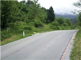 2
2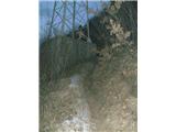 3
3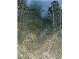 4
4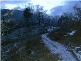 5
5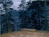 6
6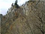 7
7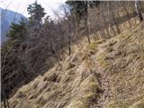 8
8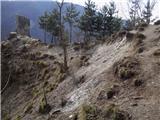 9
9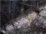 10
10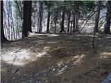 11
11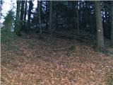 12
12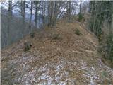 13
13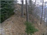 14
14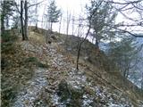 15
15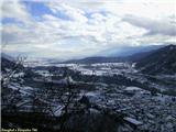 16
16
Discussion about the trail Jesenice (Straža) - Kozjek
|
| heinz16. 06. 2014 |
Klopce na sl. 6 ni več, pot je v sp. delu precej zaraščena.
|
|
|
|
| heinz22. 02. 2023 15:00:35 |
Priporočam ogled zemljevida, ki se nahaja na Španovem vrhu, kot dokaz da domačini vrh od nekdaj imenujejo KozjEk in ne napačno -KozjAk.
(fotografije žal ne morem prilepiti)
Lep dan, srečno in veselo na vseh poteh želim!
H.Blagne
|
|
|
|
| gamsek122. 02. 2023 16:40:37 |
Morda bi bilo priporočeno tudi, da se lokalci malo uskladite s TIC-om in ostalimi društvi, da ne bo takšne zmešnjave, ko pa na marsikateri (večini?) kart piše KozjAk, prav tako pa tudi v "novopečeni" knjižici jeseniške planinske poti in še celo na žigu samem. 
|
|
|
|
| heinz22. 02. 2023 23:29:05 |
Tisti, ki jih omenjaš so bili zavedeni od mojega prvotnega imena, ki sem ga objavil tukaj(Kozjak). Kasneje ko sem ugotovil, da sem ga polomil, sem administratorja naprosil, da je ime popravil, vendar je bilo že prepozno.. Pred mojo objavo poti in vrha kot cilja, nikjer na spletu nisi našel nikakršne omembe tega hriba, ki se nahaja nad Sl.Javornikom. Potem, ko sem objavil Kozjak, so nevedneži kot sem bil sam, začeli na raznih spletnih mestih (blogih, družabnih omrežjih, ipd) objavljati zgodbe o izletih na "Kozjak". Kot rečeno, ko je prišlo do popravka, je bilo prepozno. Za pravo ime kadar koli lahko vprašate Javorničane, ogledate pa si lahko tudi tisti velik zemljevid, ki se nahaja na Španovem vrhu. Vse dobro!
(podobno se je zgodilo z imenom Mali Jelenkamen, ki ima danes vpisno knjigo s tem imenom na povsem napačnem mestu. Objavil sem zgolj mnenje enega samega domačina, ki seveda še ni bilo dokončno, vendar očitno preveč za nekatere, ki so stvar vzeli "zdravo za gotovo")
|
|
|