Jablance - Skalica (Bohor) (via Travni laz)
Starting point: Jablance (500 m)
| Lat/Lon: | 46,0467°N 15,4454°E |
| |
Name of path: via Travni laz
Time of walking: 2 h
Difficulty: easy unmarked way
Altitude difference: 451 m
Altitude difference po putu: 550 m
Map: Posavsko hribovje Boč - Bohor 1:50.000
Recommended equipment (summer):
Recommended equipment (winter):
Views: 9.405
 | 2 people like this post |
Access to the starting point:
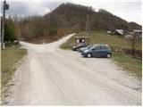
From Krško, drive to Sevnica or vice versa. Shortly after Krško, the road to Brestanica branches off to the right (from Sevnica, just before Krško, turn left). Follow this road towards Senovo, where you will see the first signs for Bohor (turn left at Senovo). The road then leads us up along the stream, taking us higher to a less well-marked junction, where we continue slightly to the left (the road going straight on along the stream leads us to the huts on Bohor. Our left road then makes two sharp bends and soon leads us out of the forest where, after a further 100m drive, we park in the parking lot by the information board.
Path description:
From the parking lot, continue along the unmarked road on the left, which after a 10-minute walk leads to a sharp left turn. In the middle of the bend, right up by the stream, the road branches off cart track in the direction of the Ubijavnik waterfall. Cart track soon turns into a footpath which crosses the stream a few times and leads us under the waterfall. Just a few metres before the waterfall, the path turns right and climbs steeply using the fixed safety gear. The ascent is not difficult in terrestrial conditions, but is exposed to falling rocks. At the top of this climb, step out onto the road and continue left. After a few more minutes of walking, the deteriorating road crosses a stream (before the bridge, the hut at Bohor on the right). Here, continue on the cart track, which climbs up alongside the stream. The increasingly steep cart track soon leads to the next crossroads, where we continue left in the direction of the hospital (right cottage on Bohorju). The path continues crossing the torrential stream and leads us in a short cross-climb to the partisan hospital on Travne lazu.
From the hospital, continue in the direction of Javornik, along a marked path that climbs moderately through the forest. After a short climb, you will come out on a forest road, which you follow to the left, further towards Javornik. After about 15 minutes of walking, the road leads to a crossroads where the path to Javornik - Bohor branches off to the right. We continue along the road in the direction of Lisce until the next crossroads, at which we leave the road and continue along the cart track in the direction of Lisce. The way forward initially climbs gently through the forest, then crosses a larger clearing in a slight downhill, after which you reach the undistinguished ridge of Bohorja. The dirt track then leads us past a cross to the next crossroads, where we continue down to the right in the direction of Skalice. After a short descent, cross the forest road and then climb to the top of Skalice in a moderate ascent in a few minutes.

Pictures:
 1
1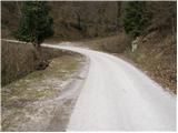 2
2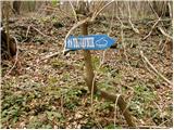 3
3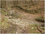 4
4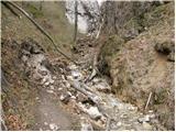 5
5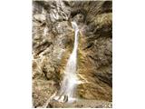 6
6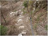 7
7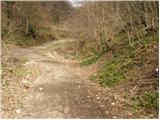 8
8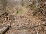 9
9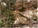 10
10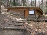 11
11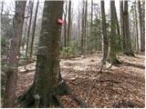 12
12 13
13 14
14 15
15 16
16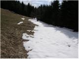 17
17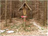 18
18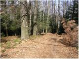 19
19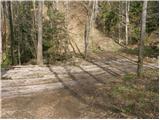 20
20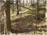 21
21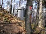 22
22 23
23
Discussion about the trail Jablance - Skalica (Bohor) (via Travni laz)
|
| Arafat7624. 01. 2010 |
Prosim moderatorja, da popravi opis poti takoj v začetku, ker Brestanica ni vas, pač pa kraj.  Pa tud Senovo in vas, mal bo treba pogledat v 4 razred OŠ. Katastrofa.
|
|
|