Jablance - Koprivnik (Bohor)
Starting point: Jablance (500 m)
| Lat/Lon: | 46,0467°N 15,4454°E |
| |
Time of walking: 1 h 20 min
Difficulty: easy marked way
Altitude difference: 484 m
Altitude difference po putu: 484 m
Map: Posavsko hribovje Boc - Bohor 1:50.000
Recommended equipment (summer):
Recommended equipment (winter):
Views: 8.678
 | 2 people like this post |
Access to the starting point:
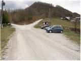
From Krško, drive to Sevnica or vice versa. Shortly after Krško, the road to Brestanica branches off to the right (from Sevnica, just before Krško, turn left). Follow this road towards Senovo, where you will see the first signs for Bohor (turn left at Senovo). The road then leads us up along the stream, taking us higher to a less well-marked crossroads, where we continue slightly to the left (the road going straight on along the stream leads us to the huts on Bohor. Our left road then makes two sharp bends and soon leads us out of the forest where, after a further 100m drive, we park in the parking lot by the information board.
Path description:
From the parking lot, continue along the right-hand road towards the hut on Bohor. After a few minutes of walking, signs direct you to the right on a wide footpath that climbs moderately through the forest. Once out of the forest, the path turns left and then crosses a grassy slope (porly marked). Follow this path, which climbs alongside fields, towards the houses in the village, which you can see ahead. In the village, step onto the road and walk along it for a few dozen steps to the chapel on the left-hand side of the road. After the chapel, continue your ascent along the marked footpath which climbs parallel to the road. The path, which is very well marked, leads us through the forest and some small meadows in a moderate ascent to the asphalted road, which we follow to the left. The road we are walking on then leads us in three minutes to a hut on Bohor.
From the hut, continue along the road towards Lisce, Javornik and Koprivnik. After a few minutes' walk from the hut, the path leads us to a crossroads where the path to the left branches off to the natural window and Petrova skala. Here we continue straight along the road which, after a few dozen steps of further walking, leads us to a place where the path to Koprivnik branches off to the right. Take this path, which climbs moderately on the cart track. After a short ascent, cart track descends gently and becomes a wide footpath, which is then followed in a gentle ascent to the top of Koprivnik.

Pictures:
 1
1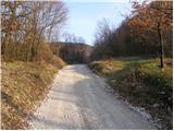 2
2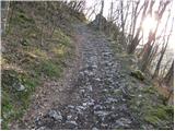 3
3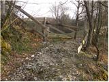 4
4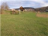 5
5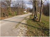 6
6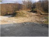 7
7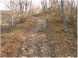 8
8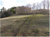 9
9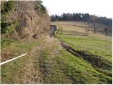 10
10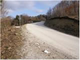 11
11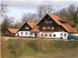 12
12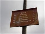 13
13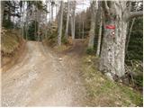 14
14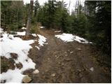 15
15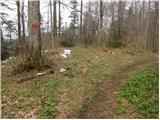 16
16 17
17
Discussion about the trail Jablance - Koprivnik (Bohor)
|
| Dayna10. 05. 2016 |
zelo slabo označena pot, sploh od Koče na Bohorju naprej 
|
|
|
|
| _d_10. 05. 2016 |
Označeno od koče naprej, odcept za Korpivnik označen, potem pa samo po eni in edini široki (potem malo ožji) uhojeni poti, ki ne pelje nikamor drugam kot na Koprivnik  Ali pa od koče po cesti do križišča za Veliki Javornik, se usmerimo desno (tudi označeno) na Koprivnik.  Sicer pa opis in slike lepo razložijo pot.
|
|
|