Starting point: Hrastovlje (165 m)
| Lat/Lon: | 45,5095°N 13,9006°E |
| |
Time of walking: 1 h 40 min
Difficulty: partly demanding marked way
Altitude difference: 284 m
Altitude difference po putu: 340 m
Map: Slovenska Istra - Čičarija, Brkini in Kras 1:50.000
Recommended equipment (summer): helmet
Recommended equipment (winter): helmet
Views: 8.003
 | 1 person likes this post |
Access to the starting point:
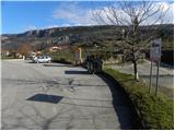
From the motorway Ljubljana - Koper take the exit Črni Kal. From Črni Kal, continue along the old road towards the sea, and we take it only as far as the next slightly larger crossroads, where we turn left towards Border crossing Sočerga. Continue towards the border crossing, but we follow the road for only a few km, as the signs for the village Hrastovlje then direct us left onto the local road. After a few km of further driving, we arrive in Hrastovlje, where we turn left at the crossroads by the small chapel and then park in the parking lot under the Holy Trinity Church in Hrastovlje, which is world famous for its frescoes of the Dance of the Dead.
Path description:
From the parking lot, continue along the narrow asphalt road as it climbs towards the nearby Church of the Holy Trinity. Just before you reach the church, the road splits in two. Continue along the lower left marked road (the right-hand road takes a few steps to reach the aforementioned church, famous for its frescoes of the Dance of the Dead), which begins to descend through the village. Follow the signs carefully through the village, so that you do not get off on the wrong track at a crossroads. After a few minutes of descending, the road gives way and we continue along the dirt road, which offers beautiful views of the Karst Edge. The road quickly leads us to a small crossroads under the power lines, where we continue straight ahead, or slightly left along the marked road. Continue along the valley flor for a while, and then the worse road crosses a small stream and turns slightly to the right and starts to climb moderately. A little higher up, the minor road splits in two, and we continue slightly left, following the wider cart track, which takes a few minutes of further walking to reach an underpass under the railway line.
On the other side of the railway line there is an unmarked crossroads where the marked path to Zanigrad branches off to the right, and we continue straight ahead on the initially unmarked dirt track, which takes us to the next crossroads in less than a minute's walk, where we rejoin the marked path. Here continue left (right viewpoint to Štrkljevica 5 minutes) and follow the gently sloping cart track, which crosses the slopes to the left. After a few minutes crossing the slope, get on the macadam road, which will take you to Podpeč in a few minutes. When we reach the asphalt road in Podpeč, we sit to the right of it, and we follow it almost to the end of the picturesque village, through which a narrow road winds. Just before the sign marking the end of Podpeč, signs point us left into the forest, through which we begin a steep climb. The steep path soon becomes a gentle slope and turns left, crossing quite steep and slippery slopes. At the end of the traverse, the path turns to the right and climbs steeply up a chain link fence towards an 11th century defensive tower. The tower, which is normally closed, is bypassed on the right and the ascent continues up a slightly less steep slope. After a few minutes' walk from the tower, the path flattens out and leads to vast karst meadows above the steep level of the Karst Edge. Here we continue to the left and climb along the edge of the cliffs to the undistinguished, but very scenic Zjat.

Pictures:
 1
1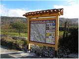 2
2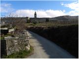 3
3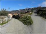 4
4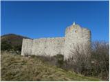 5
5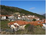 6
6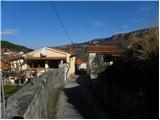 7
7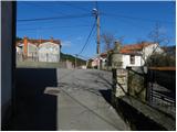 8
8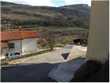 9
9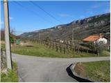 10
10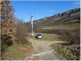 11
11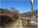 12
12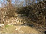 13
13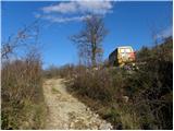 14
14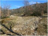 15
15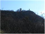 16
16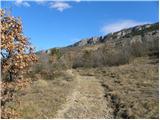 17
17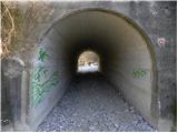 18
18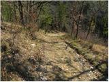 19
19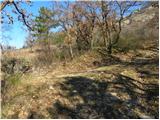 20
20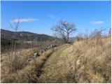 21
21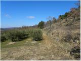 22
22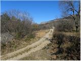 23
23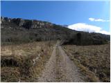 24
24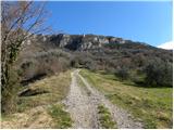 25
25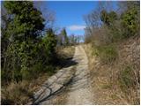 26
26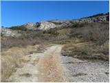 27
27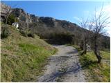 28
28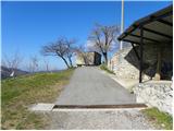 29
29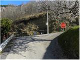 30
30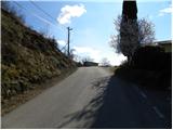 31
31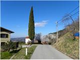 32
32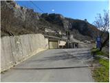 33
33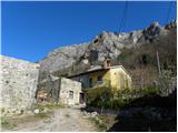 34
34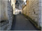 35
35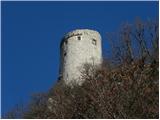 36
36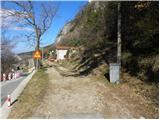 37
37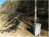 38
38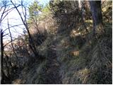 39
39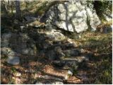 40
40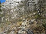 41
41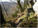 42
42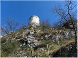 43
43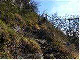 44
44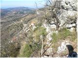 45
45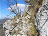 46
46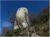 47
47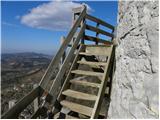 48
48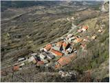 49
49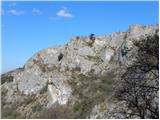 50
50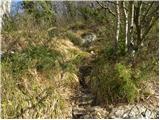 51
51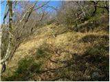 52
52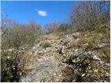 53
53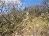 54
54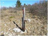 55
55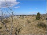 56
56 57
57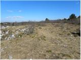 58
58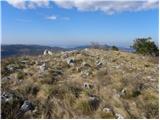 59
59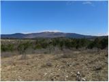 60
60
Discussion about the trail Hrastovlje - Zjat