Starting point: Grad (267 m)
| Lat/Lon: | 46,80119°N 16,09217°E |
| |
Time of walking: 25 min
Difficulty: easy unmarked way
Altitude difference: 119 m
Altitude difference po putu: 119 m
Map: Pomurje 1:40.000
Recommended equipment (summer):
Recommended equipment (winter):
Views: 172
 | 1 person likes this post |
Access to the starting point:
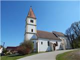
a) Drive to Radenci, then continue to Gederovci and Kuzma. From the roundabout in Gederovci, continue towards Kuzma, and after Pertoča, turn right towards Grad. When you arrive in Grad, continue straight ahead at the Spar shop and drive a little further to the parish church of St. Mary of the Assumption, where you park in the parking lot in front of the church.
b) From Murska Sobota, drive towards Gederovci, and in Černelavci, turn right towards Grad. Continue through a few more settlements, where you exit the crossroads in the direction of Grad. Once you arrive in Grad, drive past the Spar shop to the parish church in Grad, and park in the parking lot next to it.
Path description:
From the parking lot, walk to the church, which you pass on the bottom left, and then descend to the main road, which you follow to the right, and walk along it for only a few steps, because just after the Bežan - Žoeks inn, you continue to the right on a side road, next to which there is a sign that says that traffic is prohibited for goods vehicles. The way forward leads us along an ascending asphalt road, which initially leads us past a few houses and then into the forest. At a small crossroads, continue slightly left, then before the transmitters you see ahead, continue left on cart track. Cart track leads you out of the woods after a few steps, and then continue for a short distance between the woods on your left and the field on your right. When a grassy passage opens a little further on between two fields, we continue to the right and after some 10 steps of further walking we reach the highest point of the Ash Tree, where there is a trigonometric point and an old metal pole.
Description and pictures refer to the situation in April 2021.

Pictures:
 1
1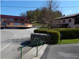 2
2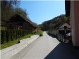 3
3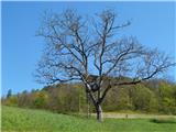 4
4 5
5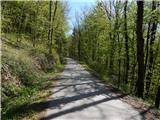 6
6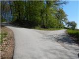 7
7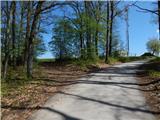 8
8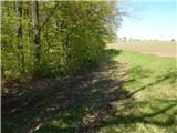 9
9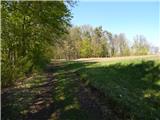 10
10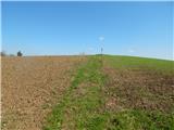 11
11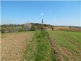 12
12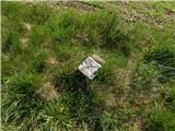 13
13
Discussion about the trail Grad - Pepelšček