Gozd - Vovar (northern path)
Starting point: Gozd (784 m)
| Lat/Lon: | 46,2578°N 14,6542°E |
| |
Name of path: northern path
Time of walking: 45 min
Difficulty: easy unmarked way
Altitude difference: 156 m
Altitude difference po putu: 175 m
Map:
Recommended equipment (summer):
Recommended equipment (winter): ice axe, crampons
Views: 734
 | 2 people like this post |
Access to the starting point:
a) Drive to Kamnik, then continue in the direction of the Črnivec Pass and Gornji Grad. After the settlement Krivčevo, drive along the main road towards the Črnivec Pass for a short distance and then turn right towards the settlement Gozd. When you arrive in Gozd, continue straight ahead from the first crossroads (St Anne's parish church in Gozd on the right), and turn right from the second crossroads after the two houses. From the next crossroads, go straight ahead (Laze on the left, the aforementioned church on the right), then immediately turn right again (the road to Brezje nad Kamnikom continues on the left) and pass a few houses to reach the parking lot near the mortuary.
b) Drive to the Volovljek or Črnivec pass, then start descending towards Kamnik. During the descent, leave the main road and continue driving to the left towards the village of Gozd. When you arrive in Gozd, go straight ahead from the first crossroads (St Anne's parish church in Gozd on the right) and turn right from the second crossroads after the two houses. From the next crossroads, go straight ahead (Laze on the left, the aforementioned church on the right), then immediately turn right again (the road to Brezje nad Kamnikom continues on the left) and pass a few houses to reach the parking lot near the mortuary.
Path description:
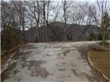
From the parking lot, go back a few steps and then take a sharp right, onto the path that leads between the older houses, where you will see a marker. There are no more markings, but the path leads past the chapel, then along the edge of the plateau to the houses on the other side of the meadow, where you step out onto the macadam road. When the road starts to climb, a slightly off-beaten path to the right leads to a nearby lookout point less than 5 minutes away, and we continue along the road, which quickly leads us to a crossroads, where we take a sharp right. There is some more ascent and the road leads us to a place where it starts to descend towards the settlement Brezje nad Kamnikom, and we leave it here and continue to the left on cart track in the direction of Vovar Peak.
Continue on cart track, which climbs the north to north-east ridge of Vovar, and higher up we cross a few trains, most of which were made after the 2008 windstorm. Higher up we continue on a well-trodden forest path, which we follow all the way to the summit, where there are a few benches, a registration box with a registration book and stamp, and a wishing bell.
Description and pictures refer to March 2020.

Pictures:
 1
1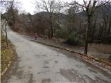 2
2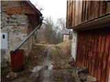 3
3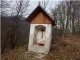 4
4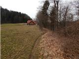 5
5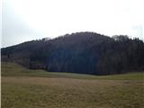 6
6 7
7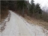 8
8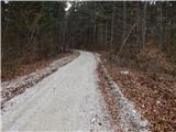 9
9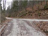 10
10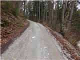 11
11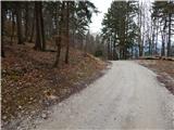 12
12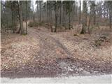 13
13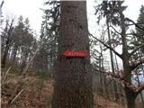 14
14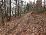 15
15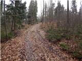 16
16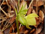 17
17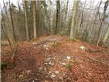 18
18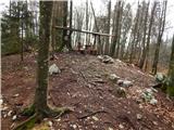 19
19 20
20
Discussion about the trail Gozd - Vovar (northern path)