Gozd Martuljek - Pri treh macesnih
Starting point: Gozd Martuljek (750 m)
| Lat/Lon: | 46,4821°N 13,8378°E |
| |
Time of walking: 3 h 40 min
Difficulty: very difficult unmarked way
Altitude difference: 1060 m
Altitude difference po putu: 1080 m
Map: Kranjska Gora 1:30.000
Recommended equipment (summer): helmet
Recommended equipment (winter): helmet, ice axe, crampons
Views: 13.347
 | 5 people like this post |
Access to the starting point:
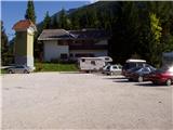
From Mojstrana drive to Kranjska Gora or vice versa, but only as far as the village of Gozd-Martuljek, where you park in the parking lot near the bridge over the Sava Dolinka river (the parking lot is located behind the bridge, or in front if you are coming from Kranjska Gora).
Path description:
From the parking lot, continue along the main road towards Kranjska Gora, but only to the point where the cycle path branches off to the left (there are also mountain signs at the start of the cycle path, which also direct you to the road). Follow the cycle path to the first crossroads, where you continue straight on to the dirt road (the cycle path turns right), which quickly leads you to the next crossroads.
Continue to the right and follow the road closed to traffic until you reach the TNP signpost. Further on, the path splits into two parts. Continue straight up the steep cart track, which climbs up the right-hand side of the Martuljška gorge. The cart track, which climbs mostly through the forest, leads us after 15 minutes to a beautiful viewpoint where a view of the valley opens up. The path then goes back into the forest and continues to climb. A little further on, the path from the waterfall joins us from the left, and a little further on, the path to the bivouac under Špikom branches off to the right. We continue in the direction of Ingot's hut. The way forward leads us to a crossroads, where we continue straight on, the path to the left leads to Ingot's hut to which is a two-minute walk.
The way forward is initially a steep climb but only for a while. The path then crosses a small well and climbs steeply on the other side. The steepness begins to give way to the path leads us to a crossroads, where we continue slightly right in the direction of the bivouac Za Akom (left Zgornji waterfall 10 minutes). The way forward is still some time steeply climbs, and then the path leads us to a more difficult part. First we cross a steep grassy slope with the help of a rope, and then, still using the fixed safety gear, we cross an exposed shelf (watch your head, slightly overhanging rock above us). The path continues to be guarded (the fixed safety gear is there mainly because of the wet terrain), and then it starts to climb more steeply, and after a few minutes of further walking, it leads us to the most difficult part. With the help of artificial steps and a rope, we cross a smooth and damp rock slab, and then cross a short, very steep wall, which is also well guarded (great care is needed because of the damp slope). The steepness of the slopes then eases and after a short climb, the still damp path leads us to the edge of the mighty gravels. Soon a marking on a rock directs us to the above-mentioned gravels, and right upwards leads the path towards the Za Akom bivouac, which is only a few minutes' steep climb away. When you reach the gravel, continue to the right where you are also directed by the numerous cairns. Keep to the right side of the stream as you walk along the wide channel of the torrent. Here we also have beautiful views of the northern walls of the Martulj Mountains where Široka Peč stands out. Below Široka Pečja, you can also see the landmark At the Three Larches. From the gravel paths, continue slightly to the left and climb briefly along the path through dwarf pines. The path leads to a slightly steeper torrent bed along which you then climb. The path here leads us up along the right side of the stream along an undistinguished ridge, past rare larch trees. This is followed by crossing a small stream and then climbing a scree slope, which leads us to steeper rocky slopes. From here, continue slightly to the right and cross the stream again on smooth rock slabs with a lot of sand. The slope here is quite steep and the sand on the rock slabs requires considerable caution. There is a short climb up a very crumbly steep slope, which is also dangerous for slipping, and then the path leads us to the lookout point Pri treh larchesnih.

Pictures:
 1
1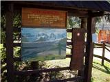 2
2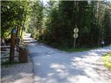 3
3 4
4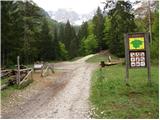 5
5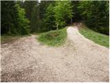 6
6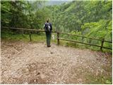 7
7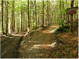 8
8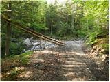 9
9 10
10 11
11 12
12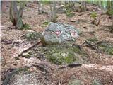 13
13 14
14 15
15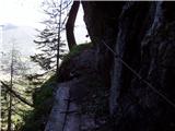 16
16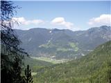 17
17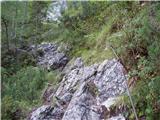 18
18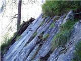 19
19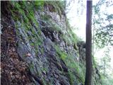 20
20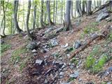 21
21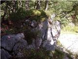 22
22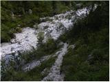 23
23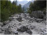 24
24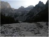 25
25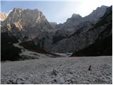 26
26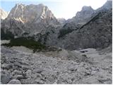 27
27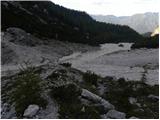 28
28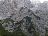 29
29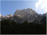 30
30 31
31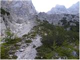 32
32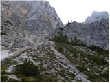 33
33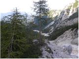 34
34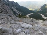 35
35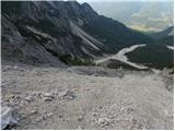 36
36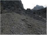 37
37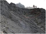 38
38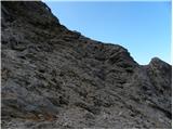 39
39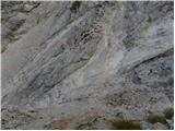 40
40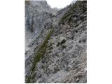 41
41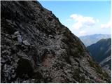 42
42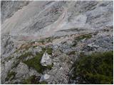 43
43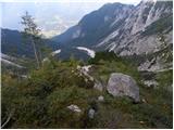 44
44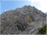 45
45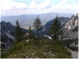 46
46
Discussion about the trail Gozd Martuljek - Pri treh macesnih
|
| andrejp6. 10. 2014 |
Pod macesni gre ena pot v desno. Mogoče kdo ve kam?
|
|
|
|
| ločanka6. 10. 2014 |
Mislim, da v kotle. Naj me kdo popravi!
|
|
|
|
| di23. 08. 2020 |
Tudi sam sem se spraševal za pot na sliki 33 in priloženo:
|
|
|