Gozd Martuljek - Na Pečeh (via Kotli)
Starting point: Gozd Martuljek (750 m)
| Lat/Lon: | 46,4821°N 13,8378°E |
| |
Name of path: via Kotli
Time of walking: 4 h 30 min
Difficulty: difficult unmarked way, easy pathless terrain
Altitude difference: 1289 m
Altitude difference po putu: 1300 m
Map: Kranjska Gora 1:30.000
Recommended equipment (summer): helmet
Recommended equipment (winter): helmet, ice axe, crampons
Views: 13.042
 | 3 people like this post |
Access to the starting point:
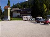
From Mojstrana drive to Kranjska Gora or vice versa, but only as far as the village of Gozd-Martuljek, where you park in the parking lot near the bridge over the Sava Dolinka river (the parking lot is located behind the bridge, or in front if you are coming from Kranjska Gora).
Path description:
From the parking lot, continue along the main road towards Kranjska Gora, but only to the point where the cycle path branches off to the left (there are also mountain signs at the start of the cycle path, which also direct you to the road). Follow the cycle path to the first crossroads, where you continue straight onto the dirt road (the cycle path turns right), which quickly leads you to the next crossroads.
Continue to the right and follow the road closed to traffic until you reach the TNP signpost. Further on, the path splits into two parts. Continue straight up the steep cart track, which climbs up the right-hand side of the Martuljška gorge. The cart track, which climbs mostly through the forest, leads us after 15 minutes to a beautiful viewpoint where a view of the valley opens up. The path then goes back into the forest and continues to climb. A little further on, the path from the waterfall joins us from the left, and a little further on, the path to the bivouac under Špikom branches off to the right.
Take this path, which initially climbs steeply along cart track. The wide path we are climbing then leads us past a rock with the inscription "pod Špik".
As the path approaches the torrent we come across an orientation loop. The path to the left leads to the torrent and then gets lost, we continue straight on past a small boulder on which there is a marker. After this, our path also approaches the torrent but does not cross it yet. It continues up the right-hand side and crosses it a little later. The crossing is not difficult, but the climb out of the torrent back to the path is a bit more difficult. This part is only three metres long, so it does not cause us any problems. The path continues gently climbing through the forest to the next torrent at which there is a boulder with a large marker. The way forward begins to climb steeply up a wooded slope. In the middle of this climb we come across a small spring and a pleasant bench a little further on. Further on, the forest becomes more and more sparse and the path leads us to the unspoilt slopes below Špik, where we encounter torrential layers of rocks. At this point we leave the marked path. The marked path turns right here and after a few minutes' climb through the forest reaches the bivouac below Špik.
Bear slightly left into the wide stream bed to the east. Continue towards the scree slope to the left of the precipitous walls of Na Pečeh Peak. A narrow path can be seen from a distance on this scree. When you reach the scree, the narrow path then leads up the steep valley to the right. The right side of the valley is mostly through dwarf pines steeply upwards. This path then leads to Spodnje Kotlo. Here the slope flattens out and the rocky terrain makes the path briefly disappear.
Most guidebooks describe the path as turning right at Spodnje Kotlo and then climbing up a very steep gully. An easier option is to follow the track in Spodnje Kotlo, which leads slightly left to the south-east. In this case, the path leads to a steep slope covered with dwarf pines. Enter dwarf pines a few metres before the end of the scree on the left-hand side. From the scree slope you have to climb down a few metres at first, and then a very narrow and somewhat overgrown path leads you through dwarf pines. After a short climb, the path turns to the right and then crosses the slopes in a gentle ascent to the south-west. Soon you emerge from dwarf pines and follow a climb up a partly grassy and partly rocky slope to reach Srednji Kotlo.
Continue up the valley, turning left towards the end of the valley. Here the views towards Ponce and Oltar begin to open up. Soon we reach a small saddle below the peak of Na Pečeh. Continue right here and soon reach the summit on a partly grassy slope. At the top, beautiful views open up on all sides.

Pictures:
 1
1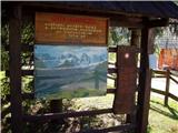 2
2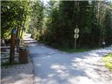 3
3 4
4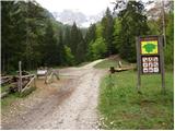 5
5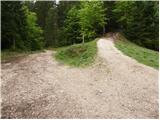 6
6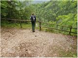 7
7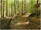 8
8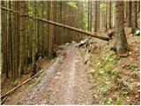 9
9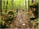 10
10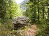 11
11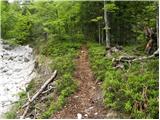 12
12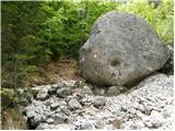 13
13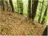 14
14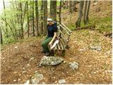 15
15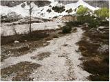 16
16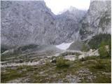 17
17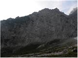 18
18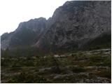 19
19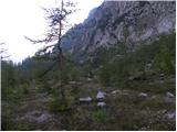 20
20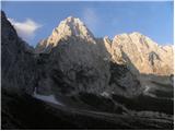 21
21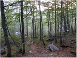 22
22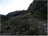 23
23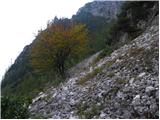 24
24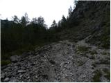 25
25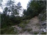 26
26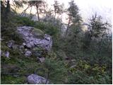 27
27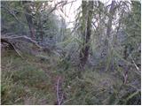 28
28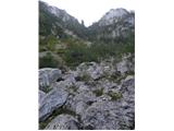 29
29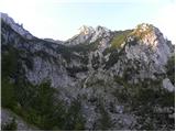 30
30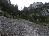 31
31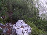 32
32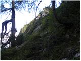 33
33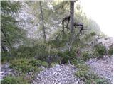 34
34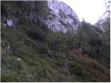 35
35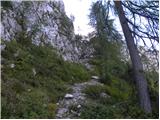 36
36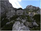 37
37 38
38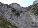 39
39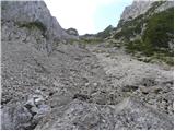 40
40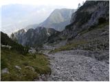 41
41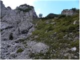 42
42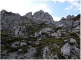 43
43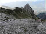 44
44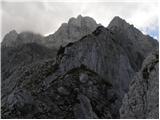 45
45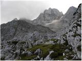 46
46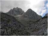 47
47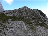 48
48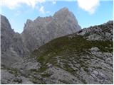 49
49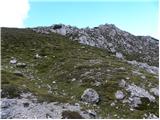 50
50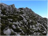 51
51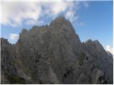 52
52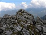 53
53
Discussion about the trail Gozd Martuljek - Na Pečeh (via Kotli)
|
| metod20. 08. 2014 |
17.8.2014: Stezico se da gor grede slediti brez problema. Za nazaj je pa treba biti precej zbran, da zadaneš prave vstope za prehod v nižje Kotle. Iz spodnjega v Srednji kotel je leva varianta čisto ok.
Če greš naprej na Malo Martuljško Ponco, se je treba izogniti zoprnemu grebenu na desno stran, kamor se steko večje melišče. Sestop je verjetno boljši mimo Treh macesnov.
|
|
|
|
| JusAvgustin20. 08. 2014 |
Veliko bolj prijeten je čez Kotle, saj Velikega melja ni in ni konec. Pa tudi sestop iz macesnov Za Ak zna biti za marsikoga težaven.
|
|
|
|
| ločanka20. 08. 2014 |
Če čez Kotle nikoli prej nisi šel gor, boš najbrž težko lovil varianto za dol. Pri sestopu mimo Treh macesnov, pa mislim, da je smer bolj jasna. Pa še lepši razgled imaš.
|
|
|
|
| djimuzl22. 09. 2019 |
Aplikacija ti je kazala tudi, da si v steni, tam bi težko stal  Tovrstne podatke je treba obvezno primerjati z dejanskim, "živim" stanjem v naravi. Prav gotovo si bil Na Pečeh.
|
|
|
|
| ljubitelj gora23. 09. 2019 |
Mislim da kar zadane, če nekaj časa pustiš telefon na miru. Problem je pri snemanju sledi, tam pa so odstopanja prevelika.
|
|
|
|
| djimuzl23. 09. 2019 |
Ja, tudi sam sem imel zanimiv pripetljaj s to aplikacijo  , ni ji dobro 100% zaupati.
|
|
|
|
| gregah26. 07. 2021 13:49:43 |
Danes, 26.7.21, na poti našel rdeč mobitel, apple. Ležal na desni, plezalni poti čez žleb, na srednjem kotlu. Info grega hočevar 041 226 886
|
|
|
|
| capraibex2. 10. 2021 15:41:39 |
Pot opravil danes,Del od Spodnjega kotla naprej komaj sledljiv oz. zaraščen,brez markacij.
|
|
|
|
| Kostja Jerovšek13. 11. 2022 14:09:18 |
Danes, 13.11.2022 izpod Špika čez Kotle na vrh na Pečeh. Pot je v redu, pred kratkim jo je nekdo presekal skozi rušje ne preveč, toliko kot je potrebno. Višje pobeljeno in pomrznjeno.
|
|
|