Gößgraben - Hochalmspitze (via Steinerne Mandln)
Starting point: Gößgraben (1600 m)
| Lat/Lon: | 46,9804°N 13,3351°E |
| |
Name of path: via Steinerne Mandln
Time of walking: 5 h 30 min
Difficulty: very difficult marked way
Altitude difference: 1760 m
Altitude difference po putu: 1780 m
Map:
Recommended equipment (summer): helmet, self belay set, ice axe, crampons
Recommended equipment (winter): helmet, self belay set, ice axe, crampons
Views: 6.746
 | 3 people like this post |
Access to the starting point:
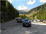
From the Karavanke Tunnel, follow the motorway towards Salzburg to the Gmünd exit. Then follow the signs for the Maltatal valley. Follow the road through the valley to Koschach. When you see the Fallbach waterfall (the highest waterfall in Carinthia) on your right, you will soon come to a crossroads where you turn left over a bridge that crosses the river Malta. Shortly afterwards, turn left again along the narrow road steeply up into the Gossgraben valley (signs for hut Gießener Hütte). Follow the road all the way to the large parking lot below the Goskarspeicher dam. The last few kilometres of the road are only open in the summer months when hut Gießener Hütte is open (from the beginning of July to the end of September).
Path description:
From the parking lot, continue along the asphalted road, which is closed to traffic. After a few minutes of climbing, you will come to a crossroads where you turn right onto a dirt road, where you will be directed by a sign with the inscription "Gießener Hütte". To the left is a short climb to the Gößkarspeicher lake.
At the crossroads, you also enter National Park High Tauern (Nationalpark Hohe Tauern). The road climbs steadily and the views towards the Reißeck mountain group start to get better and better. On the ascent, we also pass pasture fences a few times, as cattle also graze along the road in the summer months. You can continue walking along the road the whole way or take the marked shortcuts. The forest is getting thinner and thinner and in the last part of the way to the cottage you walk along rocky terrain. Here you will also have a beautiful view of the Hochalmspitze and the many streams that flow down the hillside. Continue along the road and you will soon reach the Gießener Hütte.
From the hut, continue along the footpath, which leads to a crossroads just above the hut. To the left, the path leads to the Mallnitzer Scharte and the Arthur von Schmid Haus, and we continue slightly to the right, following the 'Hochalmspitze' signs. A little further on, an easy path branches off to the right to the nearby Winterleitenkopf peak.
The trail continues along mostly rock slabs, which are at first still nicely stacked, so that the ascent is not difficult. Here you enter the central area of the High Tauern National Park and after a short climb you reach another crossroads.
To the left, the trail leads to the Lassacher Winklscharte ridge and the Hochalmspitze on the west ridge (Detmolder Grat). At the crossroads, we continue to the right along the 536 Rudolstädter Weg. On the slope where we climb there are more and more rock slabs so that the path is not very visible. Orientation is not particularly difficult, however, as there are many signs to help us. On the ascent you cross small streams several times, and higher up the trail you come to two lakes.
The trail continues mainly northwards and leads to the vicinity of the Trippkees glacier. Here, walk to the right of the main part of the glacier towards the part of the glacier below the cliff near the Steinerne Mandln towers. You will need winter gear to climb the glacier, and head towards the protected path that starts in the wall at the end of the glacier (also marked by a slightly larger marker). The glacier is very steep in the last part and should not be underestimated. In early summer, when there is still a bit more snow, the last few metres are even steeper. A possible steep crack at the end of the glacier can cause additional problems. In late summer, when rocks appear from under the snow, there is also a considerable risk of falling rocks.
From the edge of the glacier there is then a short almost vertical climb on scree, which leads to a ledge. Continue left and climb cross-climbing on a well-defended path. The path then turns right and climbs quite steeply up to the ridge by the famous Steinerne Mandln towers. The path is well protected at all times.
At the ridge where the view opens up towards the Hochalmkees glacier, continue left and there is a short, slightly exposed climb along the steel cable. The ridge then becomes slightly less difficult, but is no longer protected and therefore some caution is still needed. The ridge then becomes wider and the climb is not difficult. As we are walking on rock slabs, some care is needed as some of the larger rocks are not completely stable. Later, the ridge narrows again and there is another steep climb along the rocks. Then the ridge becomes wider again and the climb is no longer difficult. The route then continues in this way all the way to the Schneewinkelspitze. Towards the main summit, which is only a few dozen metres away, the ridge again becomes slightly steeper and slightly exposed.
You can descend either by the ascent route or by the west ridge where a protected path leads. The route to the west side is steeper than the one described above, but it is well protected. You will usually need winter gear on this route as well, but the snowfield is relatively short. In late summer it is possible that winter equipment will not be needed.

Pictures:
 1
1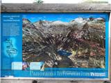 2
2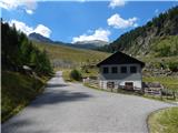 3
3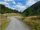 4
4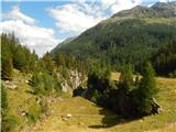 5
5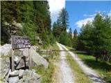 6
6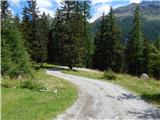 7
7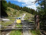 8
8 9
9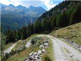 10
10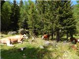 11
11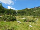 12
12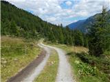 13
13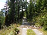 14
14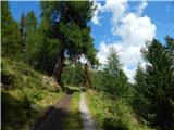 15
15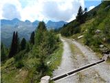 16
16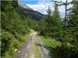 17
17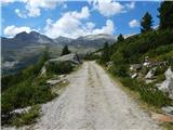 18
18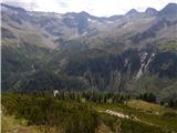 19
19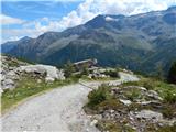 20
20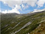 21
21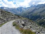 22
22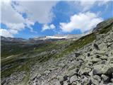 23
23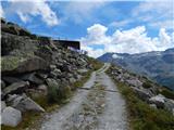 24
24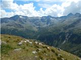 25
25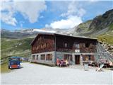 26
26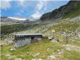 27
27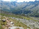 28
28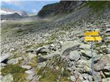 29
29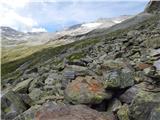 30
30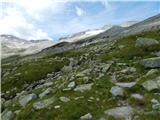 31
31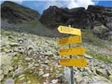 32
32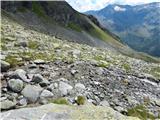 33
33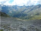 34
34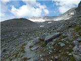 35
35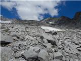 36
36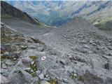 37
37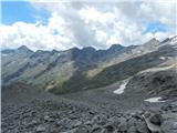 38
38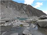 39
39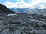 40
40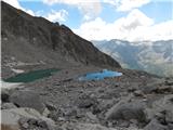 41
41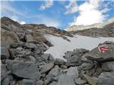 42
42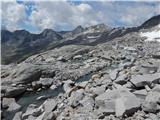 43
43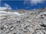 44
44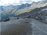 45
45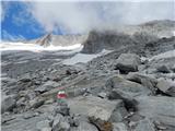 46
46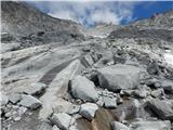 47
47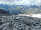 48
48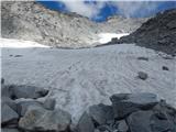 49
49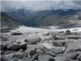 50
50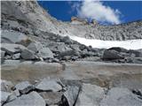 51
51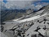 52
52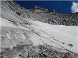 53
53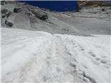 54
54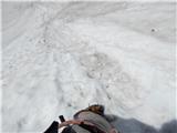 55
55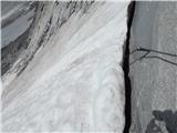 56
56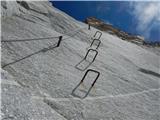 57
57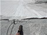 58
58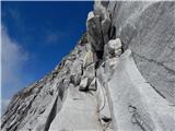 59
59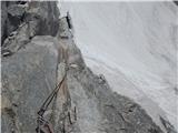 60
60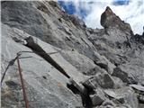 61
61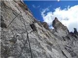 62
62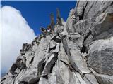 63
63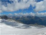 64
64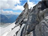 65
65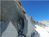 66
66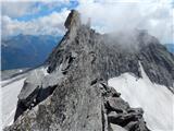 67
67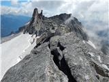 68
68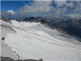 69
69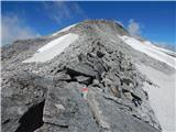 70
70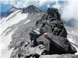 71
71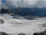 72
72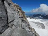 73
73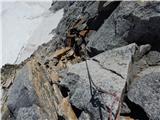 74
74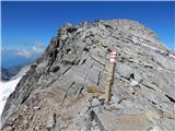 75
75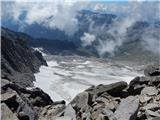 76
76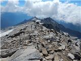 77
77 78
78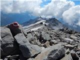 79
79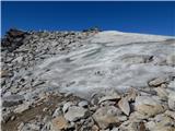 80
80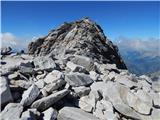 81
81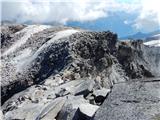 82
82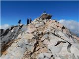 83
83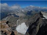 84
84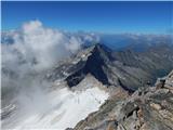 85
85 86
86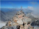 87
87
Discussion about the trail Gößgraben - Hochalmspitze (via Steinerne Mandln)
|
| J.P.11. 08. 2019 |
Pot je izjemno lepa in vredna truda. Izbrali smo za gor in dol pot mimo Steinerne Mandln. Posebnosti ni, razen potrebne zimske opreme za povzpenjanje po ledniku pred vstopom v zavarovano pot.Kot napisano: zadnji metri so precej strmi in poč na koncu ledenika ni mesto za iztop.Usmerite se na rdečo piko oziroma železo. Kdor zna,za nazaj lahko še abseil naredi in si priskrbi kar velik časa miganja po ledeniku. Planinci ,ki so šli po zahodni strani so z nami podelili, kako snega po poti niso imeli oziroma se ga je dalo zaobiti in je plezalna pot lepo zavarovana. Srečno. Lp
|
|
|
|
| planinec Maks28. 08. 2022 19:23:46 |
Vrh sem poskusil osvojiti 24.8. Pot je NEPREHODNA in NEVARNA zaradi podora. Snežišč ni bilo, del stene je podrt in varoval v steni prvih 50 metrov sploh ni. Viseč štrik je kazal na to, da je nekdo abzajlal pri sestopu. Oskrbnik koče je povedal, da je pot zaprta, kar me je čudilo glede na to da nikjer ni bilo tabel 
|
|
|
|
| mpp30. 08. 2022 08:04:56 |
Imaš kakšno fotografijo podora?
|
|
|