Gößgraben - Hochalmspitze (Detmolder Grat)
Starting point: Gößgraben (1600 m)
| Lat/Lon: | 46,9804°N 13,3351°E |
| |
Name of path: Detmolder Grat
Time of walking: 5 h 30 min
Difficulty: very difficult marked way
Altitude difference: 1760 m
Altitude difference po putu: 1770 m
Map:
Recommended equipment (summer): helmet, self belay set, ice axe, crampons
Recommended equipment (winter): helmet, self belay set, ice axe, crampons
Views: 15.546
 | 5 people like this post |
Access to the starting point:
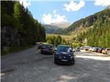
From the Karavanke Tunnel, follow the motorway towards Salzburg to the Gmünd exit. Then follow the signs for the Maltatal valley. Follow the road through the valley to Koschach. When you see the Fallbach waterfall (the highest waterfall in Carinthia) on your right, you will soon come to a crossroads where you turn left over a bridge that crosses the river Malta. Shortly afterwards, turn left again along the narrow road steeply up into the Gossgraben valley (signs for hut Gießener Hütte). Follow the road all the way to the large parking lot below the Goskarspeicher dam. The last few kilometres of the road are only open in the summer months when hut Gießener Hütte is open (from the beginning of July to the end of September).
Path description:
From the parking lot, continue along the asphalted road, which is closed to traffic. After a few minutes of climbing, you will come to a crossroads where you turn right onto a dirt road, where you will be directed by a sign with the inscription "Gießener Hütte". To the left is a short climb to the Gößkarspeicher lake.
At the crossroads, you also enter National Park High Tauern (Nationalpark Hohe Tauern). The road climbs steadily and the views towards the Reißeck mountain group start to get better and better. On the ascent, we also pass pasture fences a few times, as cattle also graze along the road in the summer months. You can continue walking along the road the whole way or take the marked shortcuts. The forest is getting thinner and thinner and in the last part of the way to the cottage you walk along rocky terrain. Here you will also have a beautiful view of the Hochalmspitze and the many streams that flow down the hillside. Continue along the road and you will soon reach the Gießener Hütte.
From the hut, continue along the footpath, which leads to a crossroads just above the hut. To the left, the path leads to the Mallnitzer Scharte and the Arthur von Schmid Haus, and we continue slightly to the right, following the 'Hochalmspitze' signs. A little further on, an easy path branches off to the right to the nearby Winterleitenkopf peak.
The trail continues along mostly rock slabs, which are at first still nicely stacked, so that the ascent is not difficult. Here you enter the central area of the High Tauern National Park and after a short climb you reach another crossroads.
To the right is the path along the eastern ridge to the Hochalmspitze, and we continue to the left along the 519 called the Schwarzenburger Weg. From the crossroads, the path crosses the slopes to the west for a while, crossing a few streams. Later it turns slightly to the right and starts to climb a little steeper. The path, which runs mainly on rock slabs, then leads to a marked crossroads.
To the left the path leads to the top of Schneewinkel Spitze and on to Säuleck, while we continue to the right towards the Lassacher Winklscharte. From the crossroads, the trail runs northwards, climbing over rocky terrain the whole way. Soon the view from the path opens up again towards the summit of the Hochalmspitze. The trail then turns slightly to the left and there is a final climb up to the Lassacher Winklscharte. On the way to the notch there may be a few snowfields, even in late summer, which are not too steep or can be avoided.
At the notch where the crossroads is, continue right after the signs "Hochalmspitze, Detmolder Grat". The path from the notch first crosses the slope to the right and then begins to climb steeply. Here you climb on granite slabs and the path is not visible. You should therefore pay a little more attention to the markings when walking and be careful as some of the slabs are not stable. The path here runs north-eastwards and leads to the edge of the glacier. The markings then point us slightly to the left away from the glacier and the climb up to the ridge follows. When you reach the ridge, continue to the right and then climb the ridge above the glacier. There is then a very short descent on the ridge, which leads to the small notch of the Obere Winkelscharte. Here you continue along the ridge for a short distance and then the trail turns right towards the edge of the glacier. There is a short traverse over the edge of the glacier where there may still be snow even in late summer. In this case you will need winter equipment. After a short traverse, you will reach a small glacier, which then leads you steeply left up towards the ridge. If the glacier is still under snow, continue crossing the glacier and join the ridge a little later where the slope is less steep. The first rappel from the edge of the glacier is very rarely wedged, so a little more caution is needed. The fall would be very long, even if the self-belaying system is used. As you get closer to the ridge, the route becomes better protected. The trail then crosses the exposed slope along the ridge, mostly in a gentle ascent, and then leads to the ridge where we have a view of the north side.
Leave the ridge quickly and continue again to the right. At first we descend even a little, then the path becomes more difficult and climbs very steeply along the steel cable towards the ridge a few times (difficulty up to C). The path then runs along a well protected ridge for some time, and in the last part of the route we withdraw again to the ridge on the right side. This route then goes all the way to the top, where a wonderful view opens up on all sides.
You can either descend along the ascent route or along the east ridge to the Steinerne Mandln towers and from there back to the Gießener Hütte via the Trippkees glacier. Winter equipment will be essential for the descent over the glacier. Before you decide to go down this route, it is a good idea to familiarise yourself with the current conditions on the glacier.

Pictures:
 1
1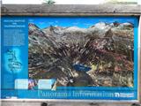 2
2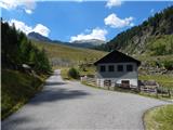 3
3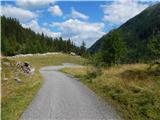 4
4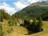 5
5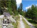 6
6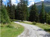 7
7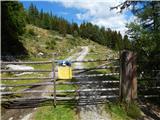 8
8 9
9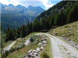 10
10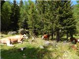 11
11 12
12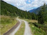 13
13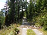 14
14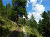 15
15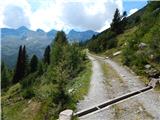 16
16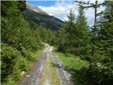 17
17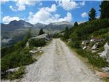 18
18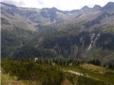 19
19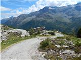 20
20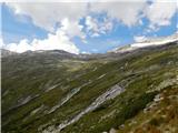 21
21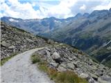 22
22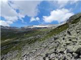 23
23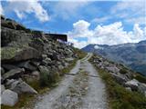 24
24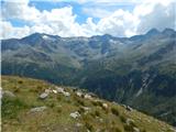 25
25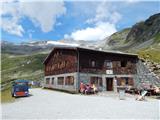 26
26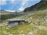 27
27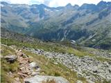 28
28 29
29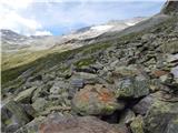 30
30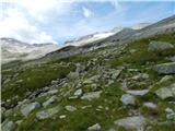 31
31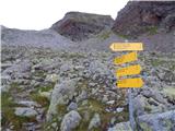 32
32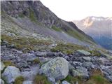 33
33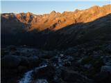 34
34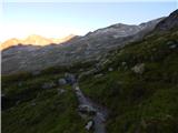 35
35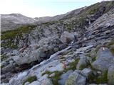 36
36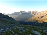 37
37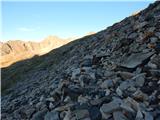 38
38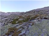 39
39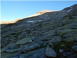 40
40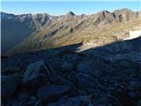 41
41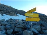 42
42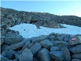 43
43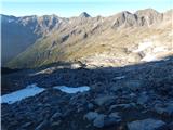 44
44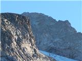 45
45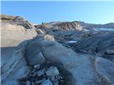 46
46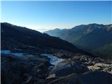 47
47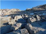 48
48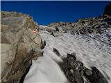 49
49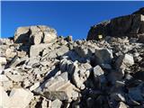 50
50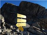 51
51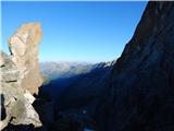 52
52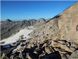 53
53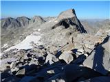 54
54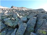 55
55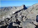 56
56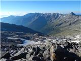 57
57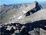 58
58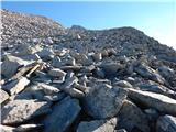 59
59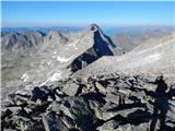 60
60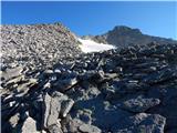 61
61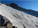 62
62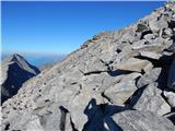 63
63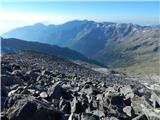 64
64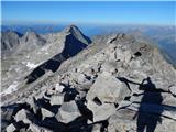 65
65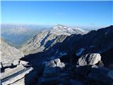 66
66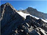 67
67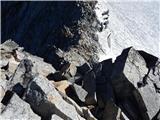 68
68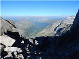 69
69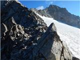 70
70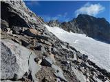 71
71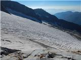 72
72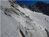 73
73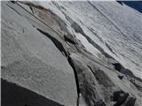 74
74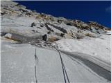 75
75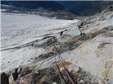 76
76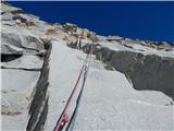 77
77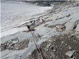 78
78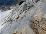 79
79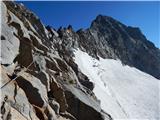 80
80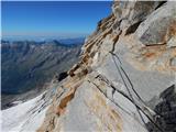 81
81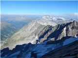 82
82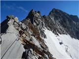 83
83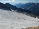 84
84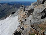 85
85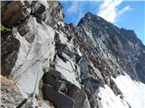 86
86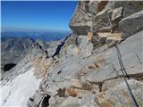 87
87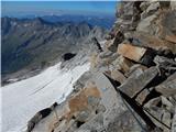 88
88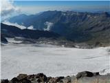 89
89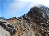 90
90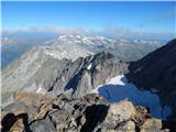 91
91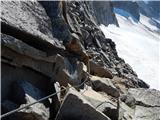 92
92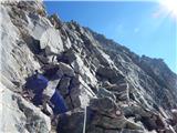 93
93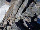 94
94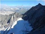 95
95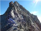 96
96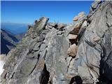 97
97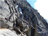 98
98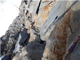 99
99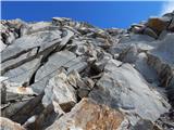 100
100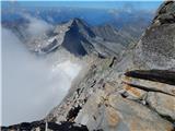 101
101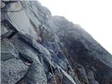 102
102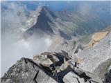 103
103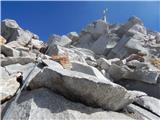 104
104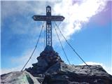 105
105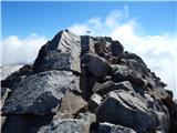 106
106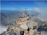 107
107 108
108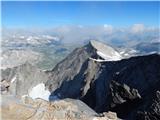 109
109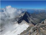 110
110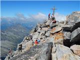 111
111
Discussion about the trail Gößgraben - Hochalmspitze (Detmolder Grat)
|
| mukica16. 08. 2015 |
Pred časom hodila po tej poti in moram reči da je zelo lepo speljano in vredno vsakega koraka.Pot te očara v lepem vremenu z razgledi na vse strani, tudi naše alpe so bile kot na dlani.Vračala sva se čez ledenik in takrat derez nisva potrebovala, cepin pa je nujen.
|
|
|
|
| ninooos16. 08. 2015 |
Ali je po omenjeni poti zimska oprema (letos) potrebna? (opis predvideva morebiten sneg pri prečenju nad robom ledenika)
Hvala, lp
|
|
|
|
| Rok16. 08. 2015 |
Po tej poti sem šel 6.8.2015. Prečiti je bilo potrebno le nekaj metrov snežišča (slika 73). Takrat se ga je dalo prečiti brez uporabe derez. Možno pa da sedaj tudi tistih nekaj metrov snega ni več.
|
|
|
|
| mpp16. 08. 2015 |
To je prava visokogorska tura in zimska oprema spada na nahrbtnik!
Za Detmolder Grat verjetno zimska oprema res ne bo uporabljena, a recimo v primeru sestopa čez Steinernen-Mandln bo nujna.
|
|
|
|
| felix11. 08. 2018 |
Katera pot se običajno uporablja za vzpon in katera za povratek? Lp
|
|
|
|
| lazo16. 05. 2019 |
Običajno je za vzpon Detmolder grat, a za povratek čez Steinerne Mandle.
|
|
|
|
| lzakelj30. 07. 2019 |
se da po emenjenen vzponu ter sestopu iti sam glede ledenika?
|
|
|
|
| Pi_is_exactly_330. 07. 2019 |
@lzakelj: Po tej poti ni ledenika. Opisana pot poteka nad ledenikom (od slike 73 naprej).
|
|
|
|
| lzakelj31. 07. 2019 |
Kaj pa po poti stainerne mandle?
|
|
|
|
| J.P.11. 08. 2019 |
Po poti stainerne mandle pa je lednik. Površina je trenutno zelo mehka vendar zimska oprema je potrebna, če ne drugega zaradi zadnjih par metrov pri vrhu in spusta za nazaj. Lp
|
|
|
|
| ssimon15. 08. 2020 |
Živjo , kero pot priporočate in me zanima če je čez ledenik potrebna ledeniška naveza. In za izhodišče me zanima, se je koča Gießener Hütte morda preimenovala v Giessener hutte.
Hvala za odgovor.
Lep pozdrav,
Simon
|
|
|
|
| Janiel7415. 08. 2020 |
Žal poti ne poznam, kar se pa tiče poimenovanja koče pa je to eno in isto.
|
|
|
|
| felix17. 08. 2020 |
Pot po grebenu Detmolder Grad je zelo zahtevna, potrebuješ veliko moči v rokah. Ledenik pod Steinere maindl ima naklon okrog 50 stopinj, obvezno cepin in dereze. Šli lani po grebenu gor in po ledeniku dol. Če bi še kdaj šel, bi izbral obratno smer predvsem zaradi ledenika. Lp
|
|
|