Göriach - Oberer Landawirsee
Starting point: Göriach (1443 m)
| Lat/Lon: | 47,2408°N 13,7453°E |
| |
Time of walking: 2 h 5 min
Difficulty: easy marked way
Altitude difference: 604 m
Altitude difference po putu: 604 m
Map:
Recommended equipment (summer):
Recommended equipment (winter):
Views: 2.759
 | 1 person likes this post |
Access to the starting point:
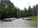
From the motorway Villach-Salzburg take the St. Michael exit (the exit is located between the two major tunnels) and follow the road towards St. Martin, Mariapharr and Göriach. Follow the ascending road through these villages to the parking lot located a few kilometres above the village of Göriach, where you park in a large parking lot.
Path description:
From the parking lot, continue along the road, which leads you to a large meadow in the middle of which you can see a large number of wooden houses within a 5-minute walk. One of the cottages is a mountain lodge, located on the right side of the path.
The way forward gradually begins to climb and leads us over two successive bridges to the point, from where we have a beautiful view of the waterfall. Behind the waterfall, the deteriorating road climbs a notch higher and, after half an hour's walk from the starting point, leads us to the hamlet of privat huts. The path continues along the road and, following the numerous streams, leads to a crossroads where the path to Hochgolling branches off to the right. We continue along the road, which turns to the left and, after a further 40 minutes of moderate ascent on an increasingly scenic slope, leads us to the mountain lodge.
From the hut, we continue slightly left towards the Scharnock peak and the path takes us past the cross to the lower (unterer) Landawirsee lake in 5 minutes. From the lake the path starts to climb a little more and after 15 minutes of moderate climbing, which takes place along a clear mountain stream, it leads us to the upper lake, which is covered with snow and ice long into the summer.

Pictures:
 1
1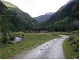 2
2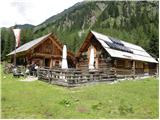 3
3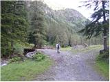 4
4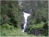 5
5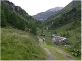 6
6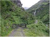 7
7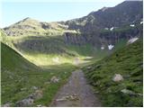 8
8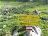 9
9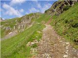 10
10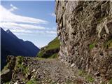 11
11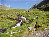 12
12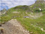 13
13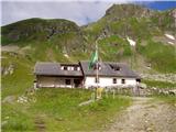 14
14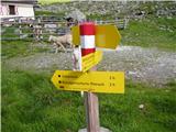 15
15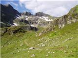 16
16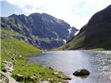 17
17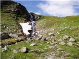 18
18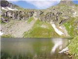 19
19
Discussion about the trail Göriach - Oberer Landawirsee