Gate (Belca) - Visoki vrh (by road)
Starting point: Gate (Belca) (1007 m)
| Lat/Lon: | 46,5041°N 13,9179°E |
| |
Name of path: by road
Time of walking: 2 h 55 min
Difficulty: easy unmarked way
Altitude difference: 821 m
Altitude difference po putu: 875 m
Map: Kranjska Gora 1:30.000
Recommended equipment (summer):
Recommended equipment (winter): ice axe, crampons
Views: 7.345
 | 3 people like this post |
Access to the starting point:
Due to the collapse, access to the described starting point is not possible until further notice (May 2018).
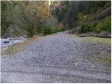
From the motorway Ljubljana - Jesenice take the exit Jesenice - West and then continue along the regional road towards Kranjska Gora. Follow the road to Belca and continue for a few 100 m, then you will see the beginning of a forest road on your right, leading into the Belka valley. Continue along the initially still wide, then narrower and sometimes quite precipitous forest road. Follow the picturesque road through the tunnel to a marked parking area by a small bridge at the confluence of the Suhego Grabno and Beli potok.
If you continue over the bridge, which has a green ramp behind it, you may find that it is locked when you leave.
Path description:
From the parking lot, continue along the road, which immediately crosses a bridge, followed by a green ramp. The road soon starts to climb steeply along the picturesque stream Suhi graben. Higher up, we climb over a beautiful waterfall, and the road leads us a little further to a crossroads where we continue along the road on the left (Kepa on the right).
The road continues to climb moderately, and we follow the "main" road at all junctions. A little higher up, the road leads past a forestry hut and a little higher still, past a water trough. The road, which has a few more small crossroads, continues to follow the 'main' road, which leads us around the last sharp right turn to a small crossroads at which there is usually a small cairn. Here, the path to Mojstrovica over the Bashinov Breg branches off to the left, and we continue straight on and follow the road to its end.
From the end of the road ascend to Sedlič, and at the fork at the fence continue left (right Kresišče and Trupejevo poldne). The path from Sedlič quickly switches to steep slopes, over which we climb to the forested ridge Mojstrovica. When the ridge is reached, the steep path descends, and the steep path even descends slightly further. A slight ascent follows and the path quickly leads out of the forest onto the vast grazing slopes. Here the track continues straight ahead, and we continue slightly to the right on the easier pathless ground, which takes us 5 minutes of further walking to reach the scenic summit.
From Mojstrovica, descend gently to the left, and then you will see a path leading into the forest. Once in the wods, begin a moderate descent, and then, as the path flattens out, another slightly beaten track joins the m on the left. Continue straight ahead, where you emerge from the forest onto a gentle grassy slope. Climb some 10 m, then on the right-hand side you will see a wide path which turns right and crosses a relatively steep slope. After crossing this part of the path, it turns to the left and continues to lead us over a scenic moderately steep grassy slope. The path then passes into a lane of sparse forest surrounded by dwarf pines. There is a short traverse, then the path climbs steeply and quickly leads to the summit. In fog, orientation in the upper part is relatively difficult.
Starting point - end of road 1:45, end of road - Mojstrovica 35 minutes, Mojstrovica - Visoki vrh 35 minutes.

Pictures:
 1
1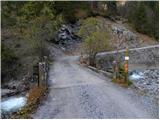 2
2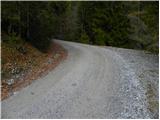 3
3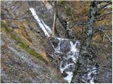 4
4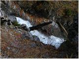 5
5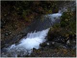 6
6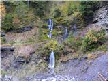 7
7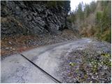 8
8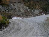 9
9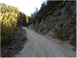 10
10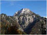 11
11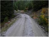 12
12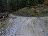 13
13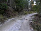 14
14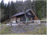 15
15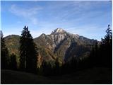 16
16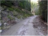 17
17 18
18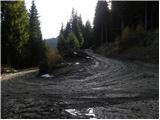 19
19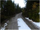 20
20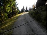 21
21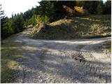 22
22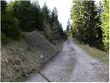 23
23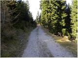 24
24115500.th.jpg) 25
25 26
26115500.th.jpg) 27
27115500.th.jpg) 28
28115500.th.jpg) 29
29 30
30115500.th.jpg) 31
31 32
32 33
33 34
34 35
35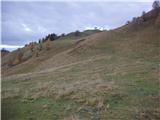 36
36177100.th.jpg) 37
37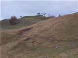 38
38177100.th.jpg) 39
39177100.th.jpg) 40
40400400.th.jpg) 41
41 42
42400400.th.jpg) 43
43 44
44 45
45 46
46400400.th.jpg) 47
47438900.th.jpg) 48
48438900.th.jpg) 49
49 50
50 51
51438900.th.jpg) 52
52 53
53438900.th.jpg) 54
54438900.th.jpg) 55
55438900.th.jpg) 56
56
Discussion about the trail Gate (Belca) - Visoki vrh (by road)