End of road on Pokljuka - Jezerski Stog
Starting point: End of road on Pokljuka (1340 m)
| Lat/Lon: | 46,3386°N 13,9045°E |
| |
Time of walking: 5 h
Difficulty: easy marked way, partly demanding unmarked way
Altitude difference: 700 m
Altitude difference po putu: 1100 m
Map: TNP 1:50.000
Recommended equipment (summer): helmet
Recommended equipment (winter): helmet, ice axe, crampons
Views: 3.820
 | 1 person likes this post |
Access to the starting point:
a) Leave the Gorenjska motorway at the exit for Lesce, then follow the signs for Bled and Pokljuka. Continue through Gorje and past the ski resort Zatrnik to Rudni Polje on Pokljuka, where there is a large pay parking lot and a military barracks and shooting range nearby. From here, continue straight along the macadam road, which leads us a little further to a crossroads, where we continue to the right (Uskovnica on the left). Follow this road to the former parking lot Za Ribnico, which is at the end of the road (there are mountain signs for mountain pasture Konjščico).
After the new parking at the end of the road is forbidden, so we park already at Rudne polje, which lengthens the route by about 40 minutes, but it is more convenient to choose the marked trail, which starts already at Rudne polje.
b) From Železniki or Podbrdo, take the road to Bohinjska Bistrica and then continue in the direction of Bled. Shortly after the Petrol station, which is located just after Bohinjska Bistrica, turn left in the direction of Pokljuka and Jereka. The road climbs steeply at first, then gradually flattens out behind Koriti, leading to a junction by the bus station, where you continue right in the direction of Pokljuka, Koprivnik and Jereka (straight ahead Srednja vas). Just after the crossroads we arrive at Jereka, and from the crossroads in front of the church we continue straight on towards Pokljuka (left Podjelje). After Jereka the road starts to climb steeply again, and higher up it levels off and continues along the Mrzle potok. When you join the road from Bled, go left and drive to Rudno Polje, where there is a large pay parking lot, and also a military barracks and a shooting range nearby. From here, continue straight along the macadam road, which leads us a little further to a crossroads, where we continue to the right (Uskovnica on the left). Follow this road to the former parking lot Za Ribnico, which is at the end of the road (there are mountain signs for mountain pasture Konjščico).
After the new parking at the end of the road is forbidden, so we park already at Rudne polje, which lengthens the route by about 40 minutes, but it is more convenient to choose the marked trail, which starts already at Rudne polje.
Path description:
From the former parking lot, continue right up cart track towards mountain pasture Konjščica. Cart track, which climbs steeply at first, soon becomes steep and turns into a footpath a little higher up. A moderate ascent follows, following the path which climbs along the Ribnica stream, which has a waterfall in its upper part, which can be seen from the path. Further on, the path crosses a small spring and enters the pasture area mountain pasture Konjščica. After a few dozen steps, the path crosses another small spring and ascends gently to the cheese-maker's hut at mountain pasture.
From mountain pasture, continue up the gently sloping meadow slightly to the other side of mountain pasture. There the path turns into dwarf pines and begins to climb, first gently and then steeply. In the last part of the ascent, the path from Rudno polje joins us from the right.
There is only a short climb along the torrent to the grassy plain of Jezerce, where the path turns left (right Srenjski preval, Blejska koča and Viševnik) and after a few steps of further walking leads us into the narrower area of the TNP.
We continue along the small spring towards Studorski Preval. A little higher, cross a torrent and the path heads slightly right, onto grassy slopes surrounded by dwarf pines. The path then ascends crosswise to Studorski preval, from which a fine view of the Bohinj side opens up.
The path continues, initially descending slightly, then crossing the slopes of Veliki Draški vrh and Tosc with some slight ascents and descents. After a while the path leads us to the grassy southern slope of Tosc, where the path to Tosc branches off to the right, and just a few metres further on we join the path from Uskovnice on the left.
Continue straight ahead, still crossing the slopes of Tosc. The path then crosses a short lane of sparse forest in a gentle descent, and then leads to steep slopes. A little further on, the path crosses the precipitous slopes of Tosc on an artificially created wide ledge in a gentle descent. As the path is quite wide it does not cause any problems (caution due to falling rocks, rock fall in 2008). The path then climbs slightly again and leads to a crossroads where we continue slightly left in the direction of Velo polje (sharp left to Voje, straight ahead to Vodnikov dom on Velo Polje). The way forward begins to descend crosswise to the right and quickly leads us to an unmarked crossroads.
Continue on the right marked path (left hunting lodge), which is soon laid, and then continues in crossing the slopes below Vodnikovi dom. After a few minutes the path turns slightly to the left and starts descending towards Maly and Velo Polje. After a short descent, a small pass is reached between Malo polje on the left and Velo polje on the right. Here continue left (Velo polje to the right) and follow the waymarked path which descends quickly to mountain pasture Little Field. A few minutes' walk along the above-mentioned mountain pasture, then the path turns slightly right and leads to an intermittent lake at mountain pasture below Mišelj vrh. Go around the lake on the right (slightly left Voje), then climb a slight incline to the ruined shepherd's huts at mountain pasture below Mišelj vrh.
At mountain pasture below Mišelj vrh, we reach a crossroads where the marked path to Mišeljski preval branches off to the right, and we continue straight ahead along the also marked path, which gradually starts to climb more steeply. The trail crosses a belt of larch forest higher up and then climbs steeply over first a rocky and then a grassy slope. After less than an hour's walk from the abandoned mountain pasture below Mišelj vrh, the path is laid, and within a few steps of further walking it leads us to Jezerski preval, where we leave the markings.
From the pass, continue left (straight down mountain pasture Jezerce) and follow the initially gently sloping path, which crosses increasingly steep grassy slopes to the south. Only a little further on, we reach a scenic and occasionally precipitous ridge, and the path quickly leads us to the top slope of Jezerski Stog, where it begins to climb steeply on a crumbly slope. Follow this rather steep and slippery path in the last part all the way to the summit, which is reached after 5 minutes of further walking.
Starting point - Planina Konjščica 30 minutes, mountain pasture Konjščica - Studorski preval 1:30, Studorski preval - mountain pasture below Mišelj vrh 1:45, mountain pasture below Mišelj vrh - Jezerski Stog 1:15.

Pictures:
 1
1 2
2 3
3 4
4 5
5 6
6 7
7 8
8 9
9 10
10 11
11 12
12 13
13 14
14 15
15 16
16 17
17 18
18 19
19 20
20 21
21 22
22 23
23 24
24 25
25 26
26 27
27 28
28 29
29 30
30 31
31 32
32 33
33 34
34 35
35 36
36 37
37 38
38 39
39 40
40 41
41 42
42 43
43 44
44 45
45 46
46 47
47 48
48 49
49 50
50 51
51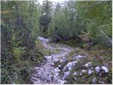 52
52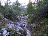 53
53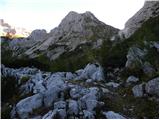 54
54 55
55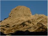 56
56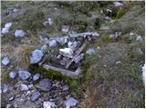 57
57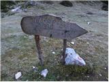 58
58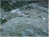 59
59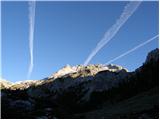 60
60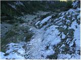 61
61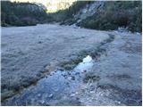 62
62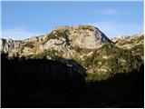 63
63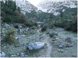 64
64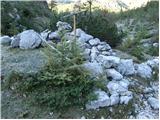 65
65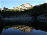 66
66 67
67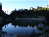 68
68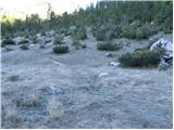 69
69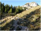 70
70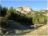 71
71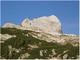 72
72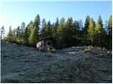 73
73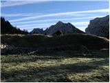 74
74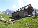 75
75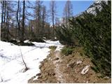 76
76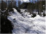 77
77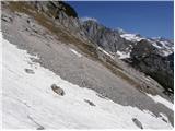 78
78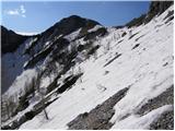 79
79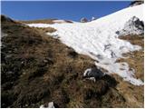 80
80 81
81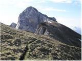 82
82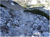 83
83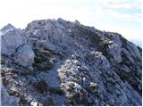 84
84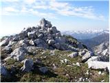 85
85
Discussion about the trail End of road on Pokljuka - Jezerski Stog