Dobje - Church of the Holy Cross at Brezje above Srednja vas
Starting point: Dobje (392 m)
| Lat/Lon: | 46,11828°N 14,17786°E |
| |
Time of walking: 25 min
Difficulty: easy unmarked way
Altitude difference: 119 m
Altitude difference po putu: 119 m
Map: Škofjeloško in Cerkljansko hribovje 1:50.000
Recommended equipment (summer):
Recommended equipment (winter):
Views: 224
 | 1 person likes this post |
Access to the starting point:
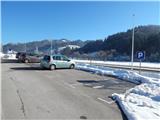
a) Drive to Škofja Loka, then continue driving towards Žire. After Poljany, just before Polycom, turn right in the direction of Dobje and then immediately right again into the marked parking area, where you park.
b) Drive to Gorenjska vas in the Poljanska valley, then continue driving towards Škofja Loka. Shortly after Srednja vas-Poljane, you will reach the Polycom company, after which the road to Dobje turns off to the left. Continue left, then immediately right to a marked parking area, where you park.
Path description:
From the parking lot, follow the side road parallel to the main road. Walk in the direction of Gorenjska vas, turn right after the chapel and continue walking between the houses. When the cart track fork off to the left between two houses, follow it, which initially leads through the lane of the forest, a little further along the edge of the view meadow, and then back into the forest, through which it starts to climb a little steeper. A few minutes of cross-country climbing follows, and after the chapel, which stands to the right of the path, it joins the footpath from the neighbouring Srednja vas.
Continue slightly right and quickly leave the woods, then along the edge of the meadow reach a small hamlet, where you go left to the next chapel. From the chapel, with a view of the forestry and the surrounding hills, you will quickly reach the Church of St. Križ.
Description and pictures refer to January 2021.
Pictures:
 1
1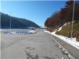 2
2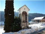 3
3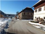 4
4 5
5 6
6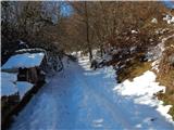 7
7 8
8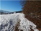 9
9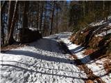 10
10 11
11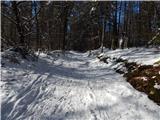 12
12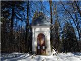 13
13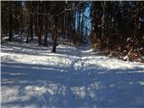 14
14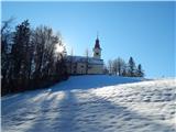 15
15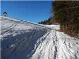 16
16 17
17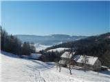 18
18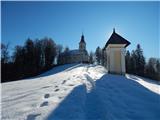 19
19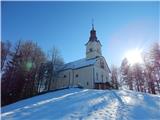 20
20
Discussion about the trail Dobje - Church of the Holy Cross at Brezje above Srednja vas