Starting point: Črnivec (902 m)
| Lat/Lon: | 46,2608°N 14,7024°E |
| |
Time of walking: 4 h 20 min
Difficulty: very difficult marked way
Altitude difference: 655 m
Altitude difference po putu: 1115 m
Map: Kamniške in Savinjske Alpe 1:50.000
Recommended equipment (summer): helmet
Recommended equipment (winter): helmet, ice axe, crampons
Views: 4.990
 | 1 person likes this post |
Access to the starting point:
From Kamnik, drive to Gornji Grad or vice versa. When you reach the Črnivec pass, park in the parking lot by the information boards. Parking in front of the nearby guest house is only allowed for guests.
Path description:
Opposite Gostišča GTC 902 Črnivec, by the water bottling plant 902, we see the mountain signs, and we set off on the trail in the direction of Velika Rogatec, Lepenatka and the top of Kašna planina (Kranjska reber). The best way to start the trail is along the macadam road, which branches off from the main road to the north, and after a few steps, we go left onto the trail, which begins to climb through the marshy area. The initially marshy path continues along an area that was the site of a severe windstorm a few years ago (13 July 2008), but today, after artificial replanting, the hillside is becoming overgrown again. As the trees are still low, the undergrowth and scrub grows heavily in the summer, so that the path is quite overgrown in this part in the semi-dark season. Follow the fairly overgrown path to where you cross the road, then on the other side continue along cart track, which is also still quite overgrown. After crossing the road for the second time, you reach the top of the slope where the wind is raging, so the path is less overgrown further on. At this point, the path also dips a little and turns slightly to the right, where it first crosses a small stream and then continues through a mainly spruce forest. A little further on, we cross another road, then climb crosswise through the forest, and the path leads us past a small spring to the prevala Na križu, where we are joined on the left by an unmarked path with Kališa.
Continue straight on the marked path, which climbs slightly steeper, then crosses the pasture fence and leads us out of the forest, where an unmarked path from the Volovljek Pass joins us almost imperceptibly from the left.
Here we continue straight ahead and, taking in the beautiful views, walk for a few minutes along the unmarked cart track, from which we soon turn right onto a mountain path, which we quickly climb up to a small watering place for animals. From the watering-hole there is a few minutes of moderate ascent and the increasingly scenic path leads to the top of Kranjska ribra, where there is a registration box.
After resting and enjoying the views, continue in the direction of Lepenatka. The way forward begins to descend moderately along the undistinguished north-eastern ridge of Kranjska Ribri, and then leads us past a few watering points to the hut at Kašna mountain pasture. From the hut, continue downhill along the nearby road or along a marked shortcut, which will take you to a junction with a wider macadam road in 5 minutes. Here, continue first to the right (Volovljek Pass on the left), then after a few steps to the left (straight back along the dirt road to the starting point at Črnivec Pass), both in the direction of Lepenatka. From the crossroads, follow the road as it gently descends, crossing the slopes of Kašný vrh on the eastern side. After a few minutes, we reach the ridge where the road ends at the Leška gmajna turnoff point, and we continue straight along the marked footpath, which turns into a forest through which it begins to descend, first moderately and then more steeply. At a lower level we reach a forest road, which we follow in a straight direction, and then, as the road turns slightly to the right from the ridge, we continue straight on the ascending cart track, along which there are also markings. cart track first climbs steeply up the ridge, then turns slightly to the left and down an unmarked cart track, which after a short cross-country descent joins the forest road, It is possible to continue along this road towards Bivak na Kalu, but we continue straight on, first a short way along cart track and then slightly right on a marked footpath. The path immediately starts to climb steeply, but soon turns slightly to the right, where it crosses over a steeper slope. The path continues to climb steeply, occasionally leading over a short exposed section, where greater care is needed, especially in wet and snowy conditions. Higher up, the slope gradually flattens out and the path turns right to lead to the ridge to the east of Kunšperski vrh (aka Brezovec).
On reaching the ridge, continue right (left Kunšperski vrh, 5 minutes of easier tracklessness) along the marked path, which continues along the occasionally scenic ridge. Continue climbing gently to moderately along or slightly to the left of the ridge. Higher up, the path leads over a grazing fence, beyond which you enter the top grassy slopes of Lepenatka. A few minutes of moderate climbing follows, along a path from which beautiful views open up from nearby Velika Rogatec, via Raduha and Olševa, to the highest peaks of Kamnik Savinja Alps and already reaching the grassy summit of Lepenatka. From the top of Lepenatka continue along the ridge for a few 10 steps, then at the marked crossroads left down towards the saddle of Kal and Velika Rogatec. There is a moderate descent of about 15 minutes on an initially quite scenic grassy slope, and then you arrive at the Kal saddle, where there is a marked crossroads.
From the crossroads, continue straight ahead in the direction of the climbing route to Rogatec (left Bivak na Kalu 1 minute, slightly right Rogatec past Zgornji Špeh, right St. Lenart). The route ahead turns slightly left and leads to the entrance to the climbing section. There is a steep climb up the slope, which is partly rocky and partly grassy, and then the path turns slightly right, where it continues to climb steeply, this time through a sparse forest. Higher up, the path leads us to a ridge from which we have a beautiful view of the Kamnik and Savinja Alps. Continue to the left, where we are initially helped by a few wedges, and then climb along an unprotected and partly precipitous ridge. After a few minutes, the ridge turns into a forest, through which it climbs steeply a few times. Higher up, the forest begins to thin out, and just below the summit, we step completely out of the forest, with only a few more 10 steps to the nearby summit, taking in the beautiful views.
The climbing part of the route is technically not too difficult, but it is not protected and is therefore very dangerous to slip on in the wet.
Črnivec - Kranjska reber 1:30, Kranjska reber - Kašna planina 15 minutes, Kašna planina - Lepenatka 1:45, Lepenatka - Bivak na Kalu 15 minutes, Bivak na Kalu - Rogatec 50 minutes.

Pictures:
 1
1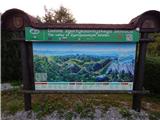 2
2 3
3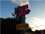 4
4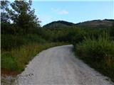 5
5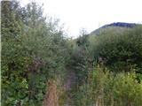 6
6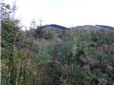 7
7 8
8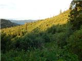 9
9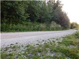 10
10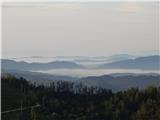 11
11 12
12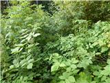 13
13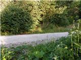 14
14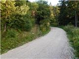 15
15 16
16 17
17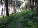 18
18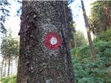 19
19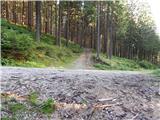 20
20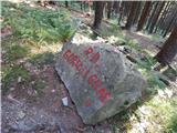 21
21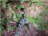 22
22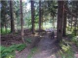 23
23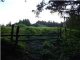 24
24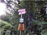 25
25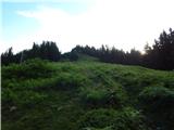 26
26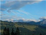 27
27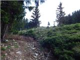 28
28 29
29 30
30 31
31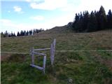 32
32 33
33 34
34 35
35 36
36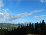 37
37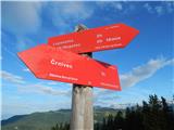 38
38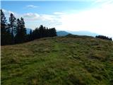 39
39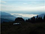 40
40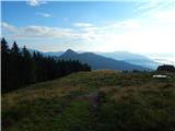 41
41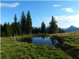 42
42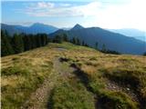 43
43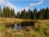 44
44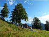 45
45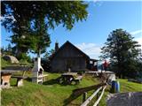 46
46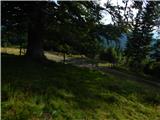 47
47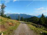 48
48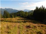 49
49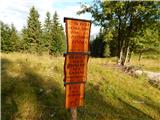 50
50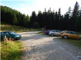 51
51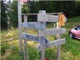 52
52 53
53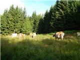 54
54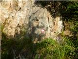 55
55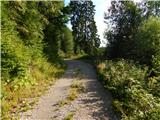 56
56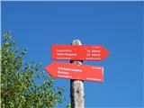 57
57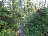 58
58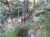 59
59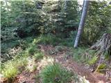 60
60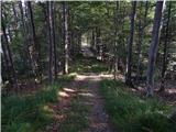 61
61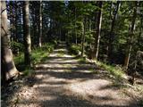 62
62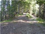 63
63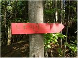 64
64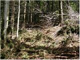 65
65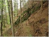 66
66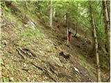 67
67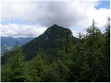 68
68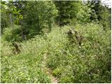 69
69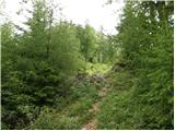 70
70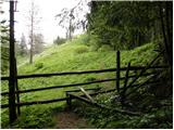 71
71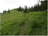 72
72 73
73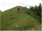 74
74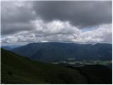 75
75 76
76 77
77 78
78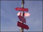 79
79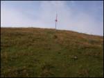 80
80 81
81 82
82 83
83 84
84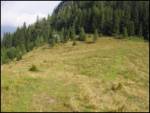 85
85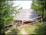 86
86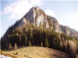 87
87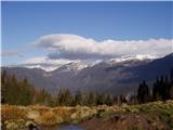 88
88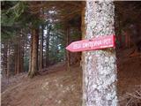 89
89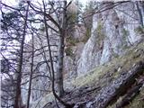 90
90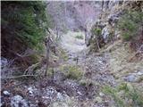 91
91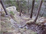 92
92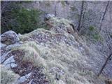 93
93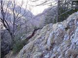 94
94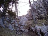 95
95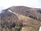 96
964424405.th.jpg) 97
97 98
98 99
994424406.th.jpg) 100
1004424407.th.jpg) 101
101 102
1024424407.th.jpg) 103
103 104
104 105
105 106
1064424408.th.jpg) 107
107
Discussion about the trail Črnivec - Rogatec
|
| anak11. 11. 2019 |
Danes smo prehodili omenjeno pot.Če si pozoren, se ves čas da slediti markacijam. Je pa veliko križišč z gozdnimi cestami in vlakami, kjer lahko zaideš. Pot na Roatec je precej strma, čelada bi bila priporočljiva pri večji skupini. Pot je zmogla tudi psička, skobe je obšla po strmih travah. Do Kala smo se vračali po isti poti, vrh Lepenatke smo nazaj grede izpustili, pod Kašno planino smo nadaljevali po gozdni cesti proti Črnivcu. Cesta se zelo vleče - verjetno ne bi porabili več časa, če bi šli še enkrat čez vrh Kranjske rebri.
|
|
|