Starting point: Črnivec (902 m)
| Lat/Lon: | 46,2608°N 14,7024°E |
| |
Time of walking: 1 h 30 min
Difficulty: easy marked way
Altitude difference: 533 m
Altitude difference po putu: 550 m
Map: Kamniške in Savinjske Alpe 1:50.000
Recommended equipment (summer):
Recommended equipment (winter): crampons
Views: 36.727
 | 1 person likes this post |
Access to the starting point:
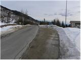
From Kamnik, drive to Gornji Grad or vice versa. When you reach the Črnivec pass, park in the parking lot by the information boards. Parking in front of the nearby guest house is only allowed for guests.
Path description:
At the pass, look for the mountain direction signs for Vrh Kašna planina, which direct you north on the macadam road. After a 10-step walk along the road, you will see a sign for the water catchment area and, right next to it, the start of the footpath. The path initially leads us over a scenic slope, as there has been no forest here since the windstorm of 13 July 2008 (more than 50 000 seedlings were planted in the area of Črnivac in 2009, about a third of them deciduous), along a newly surfaced path (the old one was completely destroyed), along which we can see a number of markings.
Cross the forest road at a higher level and then continue the ascent along the relatively steep cart track. The way ahead leads us for some time along the slopes of the windfall, and then, after crossing the forest road again, gradually turns into an old, mostly coniferous forest. Continue climbing moderately along cart track, cross a few small wells and rejoin the forest road. Higher up, the path lays completely flat for a short time and then gradually starts to climb steeper and steeper. After a good hour's walk from the starting point, you emerge from the forest onto the grassy slopes of Kranjska Ribra. The path, which is surrounded by ferns in the lower part of the grassy slope, climbs steeply higher up and leads to the main ridge of Kranjska ridge, where it lays down. From the point where we stepped on the ridge, it is only a short walk of 10 steps to the top.

Pictures:
 1
1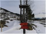 2
2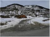 3
3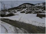 4
4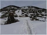 5
5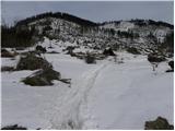 6
6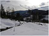 7
7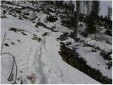 8
8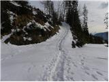 9
9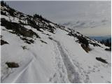 10
10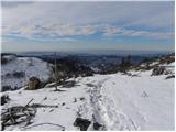 11
11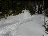 12
12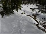 13
13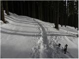 14
14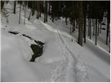 15
15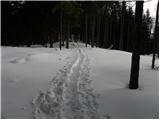 16
16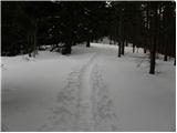 17
17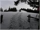 18
18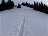 19
19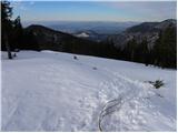 20
20 21
21 22
22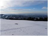 23
23 24
24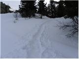 25
25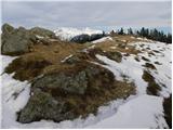 26
26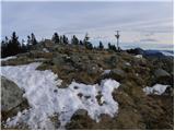 27
27 28
28
Discussion about the trail Črnivec - Kranjska reber
|
| U&Q3. 10. 2011 |
Pozdravljeni!
Zanima me, če se da izlet podaljšati do Lepenatke in kakšen je časovni okvir hoje do tja, če je to možno.
Hvala
|
|
|
|
| trilko22. 01. 2012 |
Nekoliko pred koncem vetroloma, preden markirana pot pripelje v gozd, je na cesti par podrtih smerek, ki jih je treba prečkati, če želimo ostati na markirani poti. Jaz sem namesto tega malo pred temi smerekami zavil levo po cesti in po nekaj serpentinah, koncu ceste in hoji v breg (neplanirano) pristal na vrhu bližnjega Plešivca. Torej, potrebno je splezati čez tiste smereke  Drugače pa lep izletek, fini razgledi, toplo sonce, le malo vetrovno.
|
|
|
|
| Sherlock16. 11. 2015 |
Super turca! edino kar je je uničen zig tako da ga bi bilo potrebno zamenjati 
|
|
|
|
| zivljenje je lepo30. 12. 2015 |
Pot iz Črnivca je zelo preprosta, primerna za vse otroke. Je pa zaradi velikega goloseka pozimi pot v spodnjem delu dolgočasna, občutek imaš, kot bi hodil po puščavi. Obenem pa se bojim, da je poleti, ko se razraste grmičevje, spodnji del poti precej težje prehoden. Z vrha se da pot podaljšati do Lepenatke. Mi tja nismo šli, je pa po mojem do tja še poldruga ura hoje.
|
|
|
|
| grega_p1. 02. 2021 |
Odličen razglednik, vsaj v današnjih pogojih. Od Kuma, Menine, Golt, Uršlje gore, Smrekovca, Komna, Travnika, Raduhe, dela Olševe, prek KS Alp (v bližini Velika planina, Lepenatka, Rogatec), pa Ratitovec, Blegoš, Trnovski Gozd, Javornik, Nanos, Javorniki, Snežnik...
Pod višino 900m je bila nizka oblačnost, tako da sem videl le višje vrhove, masive. Pa že vse to bi lahko gledal ves dan.
Drugače pa se mi spodaj pot ne zdi (več) dolgočasno, smreke so že kar zrasle. Sneg je utrjen, pot nadelana in se ne udira, je pa na trenutke malo poledenela.
|
|
|