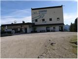
Starting point: Ciampac (2142 m)
| Lat/Lon: | 46,4575°N 11,7881°E |
| |
Time of walking: 1 h
Difficulty: easy marked way
Altitude difference: 344 m
Altitude difference po putu: 344 m
Map: Tabacco 06, 1:25.000
Recommended equipment (summer):
Recommended equipment (winter): ice axe, crampons
Views: 3.390
 | 1 person likes this post |
Access to the starting point:
a) From Kranjska Gora via the Koren saddle to Austria, where at the first major junction continue left towards Podkloštro / Arnoldstein and Trbiz / Tarvisio. At the end of Podklošter, signs for Šmohor / Hermagor direct you to the right on the regional road, which takes you past the town to the end of the Ziljska valley, or more precisely to Kötschach-Mauthen, where you turn right towards Oberdrauburg. The road continues over the Gailbergsattel Alpine pass (982 m), after which you descend into the above-mentioned town. After crossing a bridge over the River Drava, turn left towards Lienz. At the main roundabout in Lienz, turn left towards Sillian and Itali. Next, cross the national border between Austria and Itali and follow the main road to Dobbiaco/Toblach, where you turn left towards Cortina d'Ampezzo. Once in Cortina d'Ampezzo, follow the signs for the Passo Falzarego Alpine pass. At the Falzarego Pass (2105 m) there is a crossroads where you continue straight down towards Marmolada and the Passo Fedaia Pass. At the following junctions, follow the road towards Marmolada and the aforementioned pass. After the Fedaia Pass (2057 m), which is located by the artificial lake Lagho di Fedaia, the road starts to descend again and we follow it to the beginning of Alba, where we will see the Ciampac cable car (swing) on the left. Park in the large parking lot at the bottom station of the cable car. Then buy a ticket and drive to the top station of the Ciampac cable car. From Kranjska Gora to the starting point is about 280 km.
b) From Kranjska Gora via Border crossing Rateče to Trbiz / Tarvisio and then on the motorway to Udine. Leave the motorway at Tolmezzo, from where you continue driving towards Ampezzo and on to the Alpine pass Passo della Mauria (1298 m). The road then starts to descend and leads into the Cadore valley, where you continue to the right towards Auronzo di Cadore. At the next crossroads follow the signs for Cortina d'Ampezzo. When you arrive in Cortina d'Ampezzo, follow the signs for the Passo Falzarego Alpine pass. At the Falzarego Pass (2105 m) there is a crossroads where you continue straight down towards Marmolada and the Passo Fedaia Pass. At the following junctions, follow the road towards Marmolada and the aforementioned pass. After the Fedaia Pass (2057 m), which is located by the artificial lake Lagho di Fedaia, the road starts to descend again and we follow it to the beginning of Alba, where we will see the Ciampac cable car (swing) on the left. Park in the large parking lot at the bottom station of the cable car. Then buy a ticket and drive to the top station of the Ciampac cable car. From Kranjska Gora to the starting point is approximately 270 km.
c) From Nova Gorica, drive into Itali and continue on the motorway to Portogruaro, where you will take the motorway fork towards Belluno. Follow the motorway to the Belluno exit, and after Belluno follow the road towards Agordo and then Marmolada and the Passo Fedaia Alpine pass. After the Fedaia Pass (2057 m), which is situated by the artificial lake Lagho di Fedaia, the road starts to descend and we follow it until we reach the beginning of Alba, where we will see the Ciampac cable car (swing) on the left hand side. Park in the large parking lot at the bottom station of the cable car. Then buy a ticket and drive to the top station of the Ciampac cable car. From the Slovenian border to the starting point is about 245 km.
Path description:
From the upper station of the pendulum to Ciampac, continue along the dirt road, which splits into two parts after only a few metres. Continue straight ahead and after a few minutes of ascending steeply with views of the surrounding peaks, you will reach the Rifugio Tobia del Giagher hut.
From the hut, continue along the well-trodden path, which leads quickly across the meadow to the nearby macadam road, which is only just approached. The ascent continues along a mountain path that parallels the road.
Higher up, join the above-mentioned road, which has since turned into a steep and rocky cart track. Follow the cart track, or transport-rescue road, up to the Brunec saddle, and from there walk to the upper station of the four-seater.
From the top station of the chairlift, continue straight up the well-trodden path, which quickly ascends to a scenic ridge. On the ridge, continue to the right and within a minute's walk you will reach the top of Brunec.
Pictures:
 1
1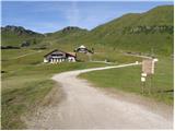 2
2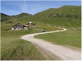 3
3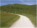 4
4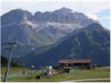 5
5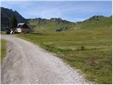 6
6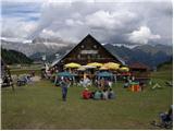 7
7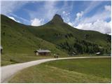 8
8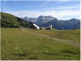 9
9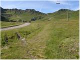 10
10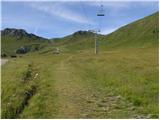 11
11 12
12 13
13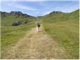 14
14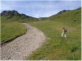 15
15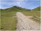 16
16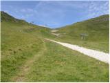 17
17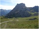 18
18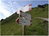 19
19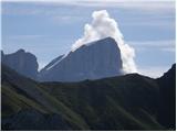 20
20 21
21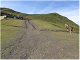 22
22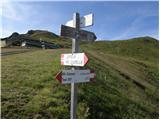 23
23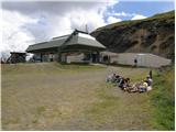 24
24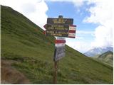 25
25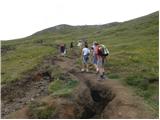 26
26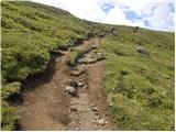 27
27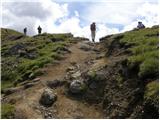 28
28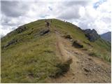 29
29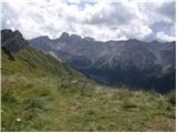 30
30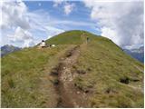 31
31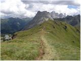 32
32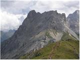 33
33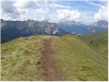 34
34 35
35 36
36
Discussion about the trail Ciampac - Brunec