Čepovan (Želinc) - Vrh Skopice
Starting point: Čepovan (Želinc) (607 m)
| Lat/Lon: | 46,087°N 13,7971°E |
| |
Time of walking: 50 min
Difficulty: easy unmarked way
Altitude difference: 256 m
Altitude difference po putu: 260 m
Map: Goriška 1:50.000
Recommended equipment (summer):
Recommended equipment (winter): ice axe, crampons
Views: 6.990
 | 2 people like this post |
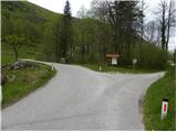
Access to the starting point:
a) First drive to Idrija, then continue to Tolmin. When you arrive in Dolenja Trebuša, leave the main road and drive left towards Čepovan. At the next crossroads, where the road to Oblakov Vrh branches off to the left, turn right and continue past the church to Dolenja Trebuša. A little higher up, the road splits in two again. This time continue slightly right (slightly left Gorenja Trebuša), cross the Trebuščica River and start climbing steeply towards the Drnulk Pass. After the pass, the dirt road starts to descend and after 2 km of further driving leads us to Čepovan down, where we continue to the right. Continue for another 3 km and then arrive at a small crossroads, where you park at an information sign. From the Podkorito Inn in Dolenja Trebuša to the starting point is about 13 km drive.
b) Take the Most na Soči or Podbrdo to Bača pri Modreju, then continue to the Station and on to Čepovan. The road, initially quite steep, climbs higher and leads down to Čepovan. Continue through the hamlet of Vrata, where the road to Lokovec branches off to the right. From this junction, follow the road for only 1 km, then park in a suitable space next to a small crossroads, next to which there is also an information board. From the station to the starting point is approximately 9. 5 km.
c) First drive to Nova Gorica or Solkan, then continue to Lokva, Grgarje, Čepovan and Sveta Gora. Just above the quarry, you will reach a crossroads, from where you continue to Grgar and Čepovan. The road then leads down to Čepovan, through which it continues to climb gently to moderately. A little further on we reach the centre of Čepovan, and we follow the road down through Čepovan to the next junction, where the road to Drnulk Pass branches off to the right. Continue straight ahead for another 3 km, then come to a small crossroads, where you park at an information sign. From Solkan to the starting point is about 22 km.
d) From Ajdovščina, first drive to Predmeja, then continue to Lokve and then Čepovan. From Lokvi the road starts to descend steeply towards Čepovan. At Čepovan turn right and then straight ahead at the next crossroads at the end of the built-up part of the town (Drnulk Pass and Dolenja Trebuša Pass on the right). Continue for another 3 km and then arrive at a small crossroads, where you park at an information sign. From Predmeja to the starting point is about 21 km.
Path description:
From the information board, take the lower road, which continues northwards. When you reach the house Čepovan 159, leave the road and continue to the right across the yard of this house, after which you will reach a well-traced but unmarked path. The path initially follows a small gully before receding to the left. Walk along the edge of the meadow for a short distance, then the path enters the woods, through which it begins to climb more steeply. Higher up, the path leads past a small lake (the lake is about 15 metres from the path), beyond which you quickly reach an abandoned house. At the house, the path turns right and climbs up to a nearby forest road, which we only cross. There is a relatively steep climb through the forest, and then cross the road again. The next time you step onto the road, continue along it. When the road is fully laid, the marked path from Drnulk Prevala almost imperceptibly joins us from the right, and we continue straight along the road, which immediately afterwards makes a left turn. The way forward leads us past a meadow with a hunting observation post, and after some 10 m of further walking we arrive at a small preval where the path to the right branches off to the top of Skopice. Continue along the mountain path, which leads to a scenic peak within 2 minutes of further walking.
From the top, you can descend along the ridge to a nearby lookout point, which offers a beautiful view of the valley.

Pictures:
 1
1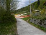 2
2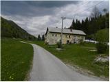 3
3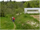 4
4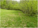 5
5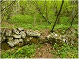 6
6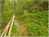 7
7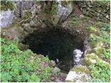 8
8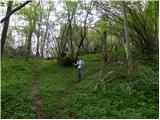 9
9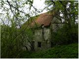 10
10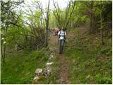 11
11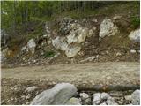 12
12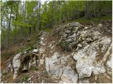 13
13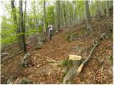 14
14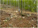 15
15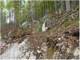 16
16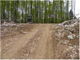 17
17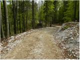 18
18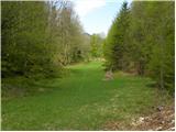 19
19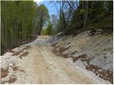 20
20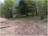 21
21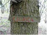 22
22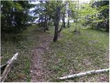 23
23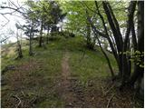 24
24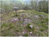 25
25 26
26
Discussion about the trail Čepovan (Želinc) - Vrh Skopice
|
| prevc3. 05. 2024 07:54:44 |
Opisana pot je povsem zaraščena in neuporabna.
Bolje je parkirati na križišču 1.5km severno in iti po kolovozni poti.
|
|
|