Capanna Alpina - Vallon Bianco
Starting point: Capanna Alpina (1720 m)
| Lat/Lon: | 46,55975°N 11,98145°E |
| |
Time of walking: 4 h 20 min
Difficulty: very difficult marked way
Altitude difference: 968 m
Altitude difference po putu: 1090 m
Map: Tabacco 03 1:25.000
Recommended equipment (summer): helmet
Recommended equipment (winter): helmet, ice axe, crampons
Views: 475
 | 2 people like this post |
Access to the starting point:
Access from Gorenjska: Via Border crossing Rateče or Predel to Trbiž / Tarvisio and then along the motorway towards Udine to the Tolmezzo exit. From Tolmezzo, follow the road towards Ampezzo and the Passo della Mauria mountain pass. The road then descends and leads to a crossroads where you turn left (possibly right) towards Cortina d'Ampezzo. At all subsequent junctions, follow the signs for Cortina d'Ampezzo.
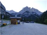
In Cortina d'Ampezzo, follow the signs for the Passo di Falzarego Alpine pass. Follow this ascending road to the pass and then turn right towards Passo Valparola. From the pass, descend towards the Val Badia valley. As the road levels out, you will see a large parking lot on the right, as well as a restaurant and a bivouac. We continue along the main road for a few 100 metres and then, just after the bridge crossing the Rü Sciare stream, turn right towards the Capanna Alpina restaurant. Follow the road to the end and park in the large parking lot in front of the restaurant. During the summer months, there is a charge for parking. The price for one day of parking is 5€ (July 2019).
From the coastal side. At Portogruaro, leave the motorway towards Venice and turn right on the motorway towards Pordenone. At the next motorway junction near Conegliano, turn right towards Belluno. The motorway ends near Belluno and we continue towards Cortina d'Ampezzo at the next junctions. Continue as described above.
Path description:
From the parking lot, continue past the Capanna Alpina restaurant on the macadam road, which is closed to traffic. The road then leads quickly to a plain where there is a crossroads. Route 20 to the right leads to the Ütia Scotoni hut, while we turn left onto route 11 and follow the signs for Col de Locia and Fanes.
From the crossroads, we walk for some time on a gravel path, which crosses a stream over a bridge in between. The path becomes a little narrower and leads into dwarf pines and then into a sparse forest. Here the path also starts to climb a little steeper. A little higher up, the path turns left and then climbs along a fence on a slightly steeper slope. The path here offers beautiful views to the west, where the Sella mountain group is clearly visible. The path then crosses a grazing fence and leads to flatter terrain along the undistinguished summit of Col de Locia, which is on our left alongside the path. There are also some benches at the top.
The path turns slightly to the right here and descends gently at first before crossing a small stream. The trail then follows a wide, gentle valley, mostly heading north. For a while the path continues along the dwarf pines and then leads to vast grassy slopes. This path then leads to a marked crossroads where a path branches off to the right towards Lake Lech de Legacio and on towards the Lagazuoi hut.
At the crossroads, we continue straight on across the vast meadows, which are also grazed by cattle in the summer months. The path begins to descend gently again and, with magnificent views, leads us to another marked crossroads.
This time, the path branches off to the left towards the peaks of Conturines and Lavarela. We continue along the wide path until we reach the mountain pasture of Malga Gran Fanes, where there is a marked crossroads.
Straight ahead, it is only a few minutes' walk to the Ütia de Gran Fanes hut, which we can already see ahead of us. At the crossroads, we turn right onto the Fridensweg / Via della pace (Path of Peace), which is number 17. From the crossroads, the path initially follows a grassy slope and then leads into a belt of very sparse larch and pine forest. The path is further marked with the number 17 and with the VB and FR markings, indicating the Vallon Bianco and Furcia Rossa peaks. The trail continues to climb gently and follows the old military causeway to the south-east. The path slowly curves slightly to the left and the view to the east of the Valle di Fanes begins to open up. The mulatiera here leads us onto more rocky terrain, which soon leads to a crossroads.
Route 17 leads to the right towards Monte Castello or bivouac Bivacco della Pace, and we continue left along the path towards the peaks of Furcia Rossa and Vallon Bianco. From the crossroads, the path then crosses the slopes a little more to the east for some time and leads to slightly steeper slopes. The ascent is mostly in switchbacks up a steep slope and the path leads to the next crossroads.
To the right, a protected climbing route branches off towards the Furcia Rossa III summit and on towards the Bivacco della Pace bivouac. At the crossroads, we continue left and climb for a while along the scenic route. The trail then turns slightly to the right and leads us along a wide shelf and then along the top edge of the scree again to a crossroads where a trail branches off to the right towards the Furcia Rossa III peak, next to which there is also a small bivouac called Bivacco Baccon Barborka. The bivouac is about a 10-minute walk away.
At the crossroads we continue left towards the Vallon Bianco peak and after a short crossing the path leads us to the northern slopes of the mountain. Further on, we cross the slopes to the east and the path becomes somewhat exposed, with a few small rocks to help us. Here we also enter the Parco Naturale delle Dolomites d'Ampezzo. The path then turns to the right, crosses a short bridge and soon leads to a saddle where you will see many ruins from the First World War.
At the saddle, continue left and the well-groomed military trail, which is carved into the steep hillside, then climbs in a few switchbacks. The path then crosses some more exposed slopes to the east and then crosses an interesting narrow bridge. The path then continues to cross exposed slopes to the east, mostly in a gentle ascent, with numerous ruins from the First World War along the way. Just below the summit, the path leads us to a small crossroads where we turn sharp right and climb steeper with the help of a few staples. It is then only a short climb to the top, along the mountain's scenic summit slope. From the top, where there is a registration box and a few small benches, you have an exceptional view over most of the Dolomites. The view of the nearby Tofane is particularly beautiful.
Let's go down the ascent route.

Pictures:
 1
1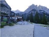 2
2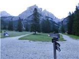 3
3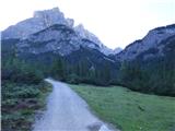 4
4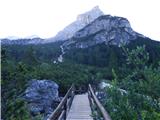 5
5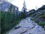 6
6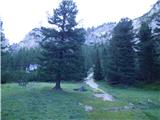 7
7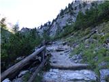 8
8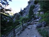 9
9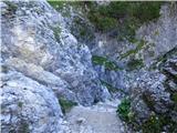 10
10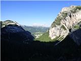 11
11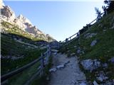 12
12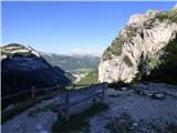 13
13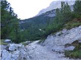 14
14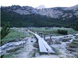 15
15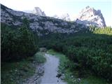 16
16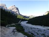 17
17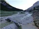 18
18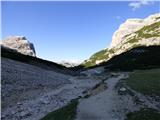 19
19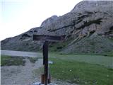 20
20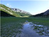 21
21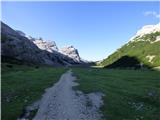 22
22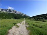 23
23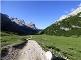 24
24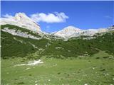 25
25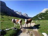 26
26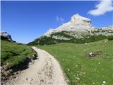 27
27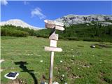 28
28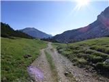 29
29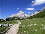 30
30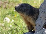 31
31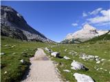 32
32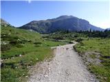 33
33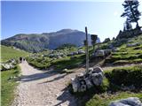 34
34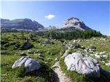 35
35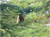 36
36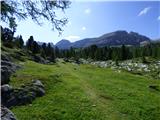 37
37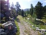 38
38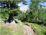 39
39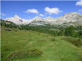 40
40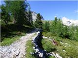 41
41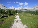 42
42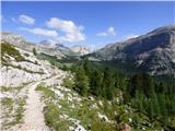 43
43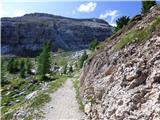 44
44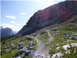 45
45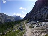 46
46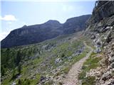 47
47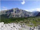 48
48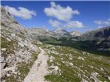 49
49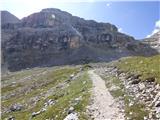 50
50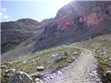 51
51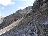 52
52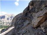 53
53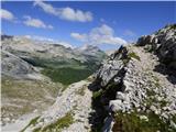 54
54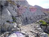 55
55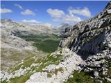 56
56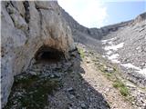 57
57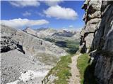 58
58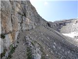 59
59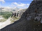 60
60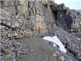 61
61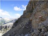 62
62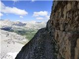 63
63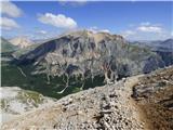 64
64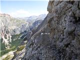 65
65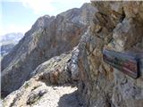 66
66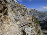 67
67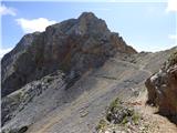 68
68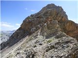 69
69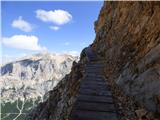 70
70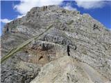 71
71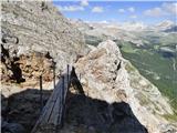 72
72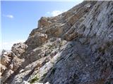 73
73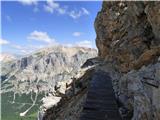 74
74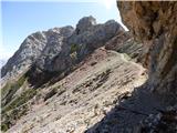 75
75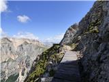 76
76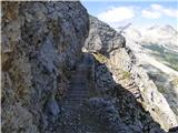 77
77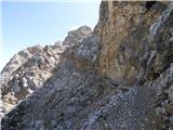 78
78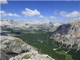 79
79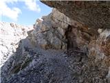 80
80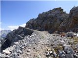 81
81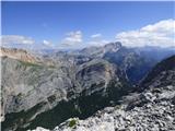 82
82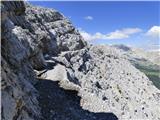 83
83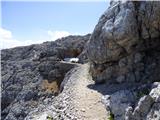 84
84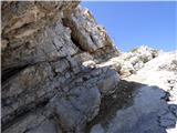 85
85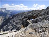 86
86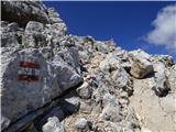 87
87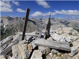 88
88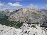 89
89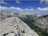 90
90 91
91
Discussion about the trail Capanna Alpina - Vallon Bianco