Starting point: Bukovo (710 m)
| Lat/Lon: | 46,1508°N 13,9019°E |
| |
Time of walking: 1 h 30 min
Difficulty: easy unmarked way
Altitude difference: 264 m
Altitude difference po putu: 375 m
Map:
Recommended equipment (summer):
Recommended equipment (winter):
Views: 1.770
 | 4 people like this post |
Access to the starting point:
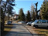
a) From the road Idrija - Most na Soči, at the settlement Reka turn slightly right (from the route Most na Soči sharp left) onto the road towards the villages Bukovo and Zakojca. Follow the ascending road, which at the crossroads is in the direction of Bukovo and Zakojca. In Bukovo, drive to the parish church of St. Lenart in front of which park in a suitable place.
b) From the Bača pri Modreju - Podbrdo road, in the Grahovo ob Bači settlement, turn in the direction of the Bukovo settlement. First, descend in two serpentines to the bridge over the river Bača, then start climbing towards Bukovo. At the next crossroads, take a sharp right in the direction of Cerkno (slightly left Zakojca). After a few 100 metres of driving, you will reach the centre of the village Bukovo, where you turn right and descend to the parking area of the church of St. Lenart.
c) First, drive to the centre of Cerkno (to get here from the road Idrija - Most na Soči, or from Gorenje village and Žiri via the pass Kladje, or from Zali Log via Davča. . . ), and then continue driving in the direction of Zakojca. Just a few metres after we head in the direction of Zakojca, the road to Zakriž branches off to the left, through which a steep shortcut leads, and we continue along the road that continues along the Zapoška stream. Higher up, the road leads us through the villages Trebenče, Gorje, and then, after crossing the slopes, we pass the village Zakriž on the upper side, where the aforementioned shortcut joins us. A little further on, the road turns further to the right, and after a few kilometres of crossing, we reach the beginning of the village Jesenica, from where we follow the signs for the village Bukovo. Then cross the slopes of Kojca, and when you arrive in Bukovo, drive to the parish church of St. Lenart in front of which you park.
Path description:
From the parking lot, go back a few 10 steps and then, just before the chapel, take a sharp left onto the road which descends to the west and after a few steps turns into cart track. Cart track widens into an asphalt road at the hamlet of a few houses, and then descends to the road leading to the Šentviška plateau, or Bukovo Vrh settlement. When you reach this road, continue left and descend for a few minutes, and along the way you will see some signs for Ponikve, which you should "stick to".
At a small pass, the descent ends and we start climbing towards the Šentviška plateau. After two serpentines we reach the first houses in the Bukovo Vrh settlement, and after a small sign we leave the asphalt road and continue slightly to the right on a steeper macadam road, which soon turns right and leads us to a garage.
At the garage, turn left onto cart track, which soon turns into a pleasant lane, and a slight incline leads back to the tarmac road. Follow the road to the right, and walk along it to a marked crossroads from which you continue to the right in the direction of Bukovo gaja. Just a little further on, go left again (straight towards the homestead at Pircu and Bukovo vrh), then continue on a moderate ascent along the macadam road to a small pass, where you go right in the direction of Bukovo gaja (straight towards Gorski Vrh).
Just after the crossroads we leave the dirt road, as cairn directs us to the left on a nicely trodden path, which after a few minutes returns to the dirt path, and we follow it to the left. After crossing the pasture fence, we can see Bukovo grove on the right, where there is a spring under Črvovi vrh.
From the Bukovo grove, continue along the lower cart track, which leads us towards Črvovo vrh. There is a few minutes of crossing with good views, and then a wide cart track ascends to the summit.
Description and pictures refer to December 2019.

Pictures:
 1
1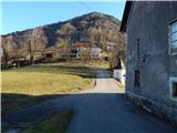 2
2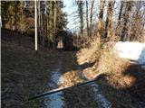 3
3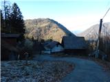 4
4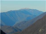 5
5 6
6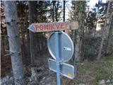 7
7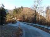 8
8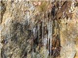 9
9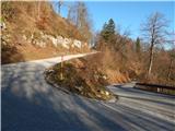 10
10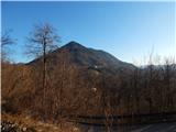 11
11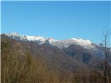 12
12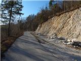 13
13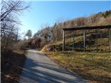 14
14 15
15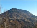 16
16 17
17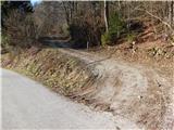 18
18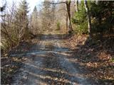 19
19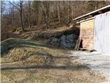 20
20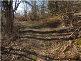 21
21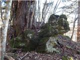 22
22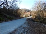 23
23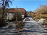 24
24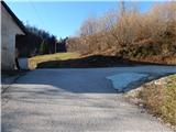 25
25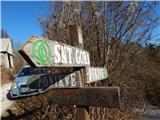 26
26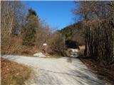 27
27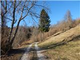 28
28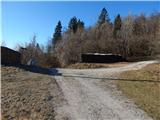 29
29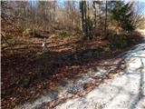 30
30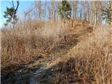 31
31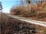 32
32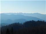 33
33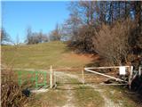 34
34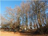 35
35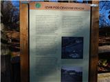 36
36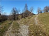 37
37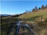 38
38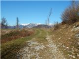 39
39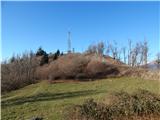 40
40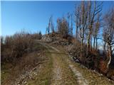 41
41 42
42 43
43 44
44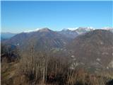 45
45 46
46
Discussion about the trail Bukovo - Črvov vrh
|
| valerija11230. 01. 2020 |
Tadej,hvala lepa za tale opis. Jaz se poti,ki niso prav markirane kar malo bojim. Ampak danes smo po tem opisu prišli na Črvov vrh z lahkoto in užitkom. Krasen dan je bil.Priporočam.
|
|
|
|
| Tadej31. 01. 2020 |
Hvala. Sem vesel, da so opisi uporabni 
|
|
|